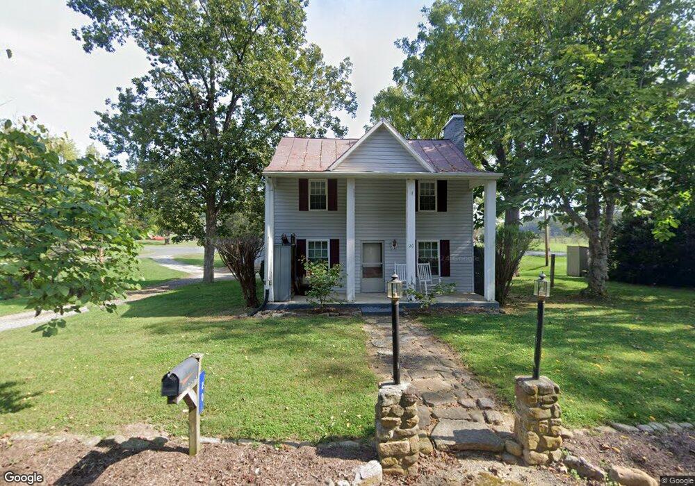
20 Rick Mast Loop Rockbridge Baths, VA 24473
Estimated Value: $240,503 - $363,000
3
Beds
1
Bath
1,400
Sq Ft
$230/Sq Ft
Est. Value
About This Home
This home is located at 20 Rick Mast Loop, Rockbridge Baths, VA 24473 and is currently estimated at $321,376, approximately $229 per square foot. 20 Rick Mast Loop is a home located in Rockbridge County with nearby schools including Rockbridge County High School.
Ownership History
Date
Name
Owned For
Owner Type
Purchase Details
Closed on
Jun 23, 2011
Sold by
Wilson Jerry Lee and Wilson Paula M
Bought by
Wilson Jerry Lee
Current Estimated Value
Home Financials for this Owner
Home Financials are based on the most recent Mortgage that was taken out on this home.
Original Mortgage
$108,000
Outstanding Balance
$74,278
Interest Rate
4.58%
Mortgage Type
New Conventional
Estimated Equity
$247,098
Create a Home Valuation Report for This Property
The Home Valuation Report is an in-depth analysis detailing your home's value as well as a comparison with similar homes in the area
Home Values in the Area
Average Home Value in this Area
Purchase History
| Date | Buyer | Sale Price | Title Company |
|---|---|---|---|
| Wilson Jerry Lee | $114,200 | None Available |
Source: Public Records
Mortgage History
| Date | Status | Borrower | Loan Amount |
|---|---|---|---|
| Open | Wilson Jerry Lee | $108,000 |
Source: Public Records
Tax History
| Year | Tax Paid | Tax Assessment Tax Assessment Total Assessment is a certain percentage of the fair market value that is determined by local assessors to be the total taxable value of land and additions on the property. | Land | Improvement |
|---|---|---|---|---|
| 2025 | $1,185 | $187,200 | $50,000 | $137,200 |
| 2024 | $11 | $185,200 | $50,000 | $135,200 |
| 2023 | $1,130 | $185,200 | $50,000 | $135,200 |
| 2022 | $1,178 | $159,200 | $40,000 | $119,200 |
| 2021 | $1,178 | $159,200 | $40,000 | $119,200 |
| 2020 | $1,178 | $159,200 | $40,000 | $119,200 |
| 2019 | $1,162 | $159,200 | $40,000 | $119,200 |
| 2018 | $1,114 | $159,200 | $40,000 | $119,200 |
| 2017 | $1,114 | $159,200 | $40,000 | $119,200 |
| 2016 | $839 | $114,200 | $30,000 | $84,200 |
| 2015 | -- | $0 | $0 | $0 |
| 2014 | -- | $0 | $0 | $0 |
| 2013 | -- | $0 | $0 | $0 |
Source: Public Records
Map
Nearby Homes
- 130 Walkers Creek Rd
- TBD Anderson Farm Rd
- 210 Anderson Farm Rd
- TBD Fredericksburg Rd
- 599 Lindsay Ln
- 1363 Fredericksburg Rd
- 2.02 Acres Smokey Row Rd
- 842 Adair Hill Dr
- TBD Mount Atlas Rd
- 261 Reid Rd
- 0 Saddle Ridge Rd Unit 11 Reid Rd
- 0 Reid Rd
- 4acs Reid Rd
- 71 Triple Crown Dr
- 65 Triple Crown Dr
- 370 Old Chapel Rd
- 4.12 Ac. Boundary Line Ln
- 0 Boundary Line Ln
- 29 Bonnie Brae Ln
- 11 Avalon Ln
- 29 Rick Mast Loop
- 37 Rick Mast Loop
- 46 Rick Mast Loop
- 46 Walkers Creek Rd
- 4934 Maury River Rd
- 3942 Turkey Hill Rd
- 59 Rick Mast Loop
- 4936 Maury River Rd
- 4840 Maury River Rd
- 4840 Maury River Rd Unit 39
- 3926 Turkey Hill Rd
- 3926 Turkey Hill Rd Unit 602
- 3948 Turkey Hill Rd
- 3914 Turkey Hill Rd
- 3958 Turkey Hill Rd
- 86 Rick Mast Loop
- 86 Rick Mast Loop
- 85 Walkers Creek Rd
- 95 Rick Mast Loop
- 51 Terrell Dr
Your Personal Tour Guide
Ask me questions while you tour the home.