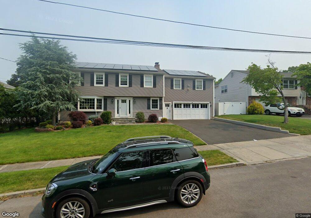
20 Rifle Rd Fairfield, CT 06824
University NeighborhoodEstimated Value: $1,203,000 - $1,384,000
4
Beds
4
Baths
2,596
Sq Ft
$508/Sq Ft
Est. Value
About This Home
This home is located at 20 Rifle Rd, Fairfield, CT 06824 and is currently estimated at $1,318,125, approximately $507 per square foot. 20 Rifle Rd is a home located in Fairfield County with nearby schools including Riverfield Elementary School, Roger Ludlowe Middle School, and Fairfield Ludlowe High School.
Ownership History
Date
Name
Owned For
Owner Type
Purchase Details
Closed on
Sep 30, 1999
Sold by
Forte Anthony and Forte Lynn M
Bought by
Ziegler Geza C and Ziegler Pamela G
Current Estimated Value
Home Financials for this Owner
Home Financials are based on the most recent Mortgage that was taken out on this home.
Original Mortgage
$320,000
Interest Rate
7.85%
Create a Home Valuation Report for This Property
The Home Valuation Report is an in-depth analysis detailing your home's value as well as a comparison with similar homes in the area
Home Values in the Area
Average Home Value in this Area
Purchase History
| Date | Buyer | Sale Price | Title Company |
|---|---|---|---|
| Ziegler Geza C | $400,000 | -- | |
| Ziegler Geza C | $400,000 | -- |
Source: Public Records
Mortgage History
| Date | Status | Borrower | Loan Amount |
|---|---|---|---|
| Open | Ziegler Geza C | $293,000 | |
| Closed | Ziegler Geza C | $325,000 | |
| Closed | Ziegler Geza C | $330,000 | |
| Closed | Ziegler Geza C | $320,000 |
Source: Public Records
Tax History
| Year | Tax Paid | Tax Assessment Tax Assessment Total Assessment is a certain percentage of the fair market value that is determined by local assessors to be the total taxable value of land and additions on the property. | Land | Improvement |
|---|---|---|---|---|
| 2025 | $14,040 | $494,550 | $259,350 | $235,200 |
| 2024 | $13,798 | $494,550 | $259,350 | $235,200 |
| 2023 | $13,605 | $494,550 | $259,350 | $235,200 |
| 2022 | $13,472 | $494,550 | $259,350 | $235,200 |
| 2021 | $13,343 | $494,550 | $259,350 | $235,200 |
| 2020 | $13,731 | $512,540 | $256,620 | $255,920 |
| 2019 | $13,332 | $497,630 | $256,620 | $241,010 |
| 2018 | $13,118 | $497,630 | $256,620 | $241,010 |
| 2017 | $12,849 | $497,630 | $256,620 | $241,010 |
| 2016 | $12,665 | $497,630 | $256,620 | $241,010 |
| 2015 | $12,430 | $501,410 | $272,020 | $229,390 |
| 2014 | $12,234 | $501,410 | $272,020 | $229,390 |
Source: Public Records
Map
Nearby Homes
- 360 Duck Farm Rd
- 1353 Mill Plain Rd
- 1091 Round Hill Rd
- 148 Millspaugh Dr
- 218 Lower Farm Rd
- 1478 Jennings Rd
- 42 Robin Cir
- 196 Robin Ln
- 359 Reid St
- 610 Unquowa Rd
- 68 Figlar Ave
- 647 Bronson Rd
- 20 Ermine St
- 54 Ridgedale Rd
- 15 Barton Rd
- 245 Reid St
- 164 Wakeman Rd
- 115 Mayfair Rd
- 158 Mayfair Rd
- 11 Tuckahoe Ln
Your Personal Tour Guide
Ask me questions while you tour the home.