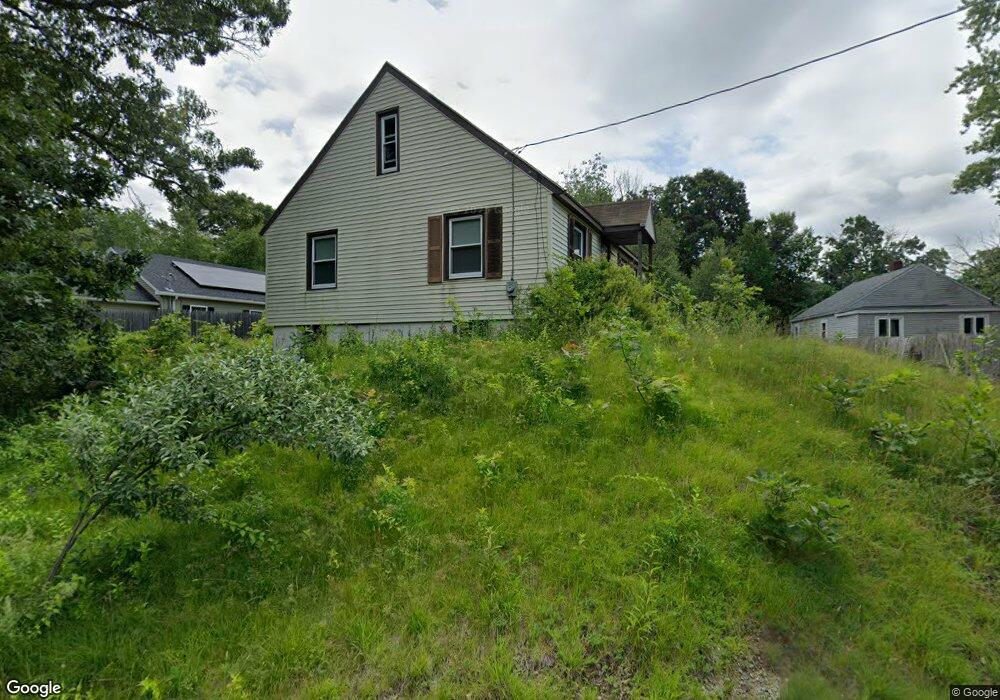
20 Rindge St Millbury, MA 01527
Estimated Value: $311,832 - $378,000
2
Beds
1
Bath
910
Sq Ft
$365/Sq Ft
Est. Value
About This Home
This home is located at 20 Rindge St, Millbury, MA 01527 and is currently estimated at $332,458, approximately $365 per square foot. 20 Rindge St is a home located in Worcester County with nearby schools including Elmwood Street Elementary School, Raymond E. Shaw Elementary School, and Millbury Junior/Senior High School.
Create a Home Valuation Report for This Property
The Home Valuation Report is an in-depth analysis detailing your home's value as well as a comparison with similar homes in the area
Home Values in the Area
Average Home Value in this Area
Tax History Compared to Growth
Tax History
| Year | Tax Paid | Tax Assessment Tax Assessment Total Assessment is a certain percentage of the fair market value that is determined by local assessors to be the total taxable value of land and additions on the property. | Land | Improvement |
|---|---|---|---|---|
| 2025 | $3,522 | $263,000 | $106,700 | $156,300 |
| 2024 | $3,229 | $244,100 | $98,800 | $145,300 |
| 2023 | $3,313 | $229,300 | $69,300 | $160,000 |
| 2022 | $3,257 | $217,100 | $69,300 | $147,800 |
| 2021 | $3,199 | $207,300 | $69,300 | $138,000 |
| 2020 | $3,103 | $202,400 | $69,300 | $133,100 |
| 2019 | $2,446 | $154,300 | $63,000 | $91,300 |
| 2018 | $2,420 | $148,100 | $63,000 | $85,100 |
| 2017 | $2,264 | $137,800 | $63,000 | $74,800 |
| 2016 | $2,082 | $126,500 | $63,000 | $63,500 |
Source: Public Records
Map
Nearby Homes
- 2 Diane St
- 3 May St
- 86 Wheelock Ave
- 11 Westview Ave
- 1 Pineland Ave
- 12 Irene Ct
- 1 Broadmeadow Ave
- 12 Alstead Path
- 90 Macarthur Dr
- 330 Millbury Ave
- 497 Massasoit Rd
- 27 A-B Grafton St
- 11 Maplewood Rd
- 3 Stidsen Way
- 232 Weatherstone Dr
- 76 Weatherstone Dr
- 52 Clearview Terrace Unit 39
- 46 John Dr Unit 46
- 1203 Grafton St Unit 38
- 5 Edward Dr