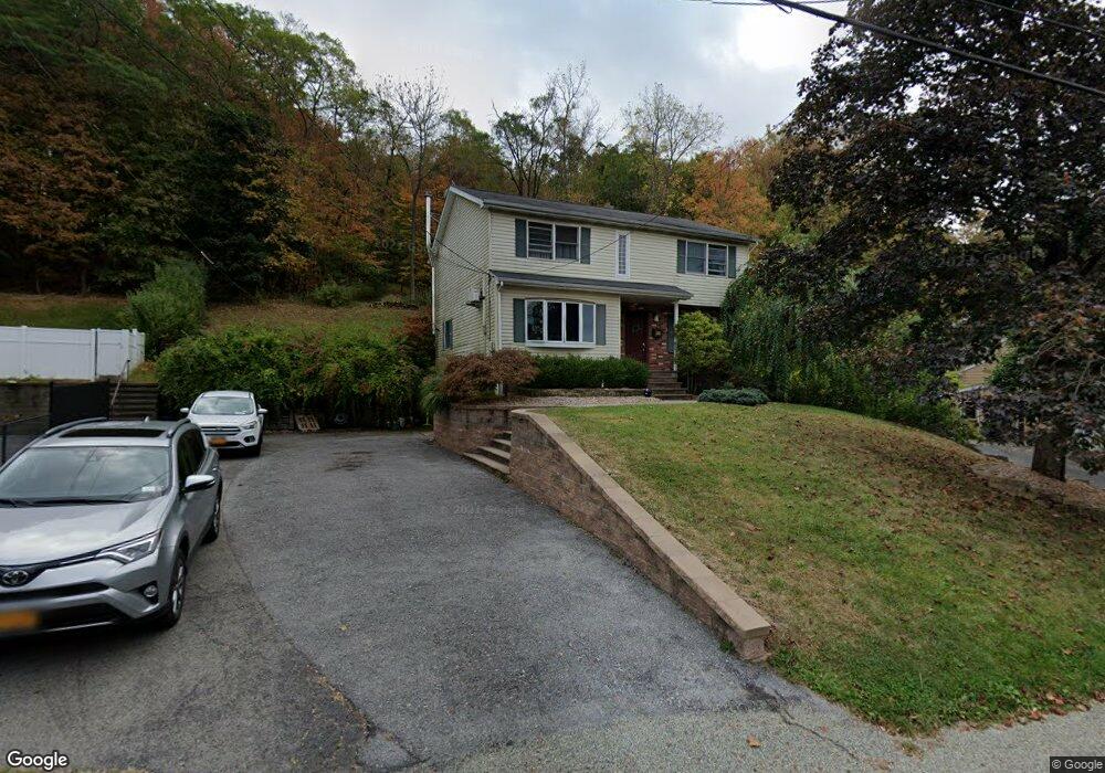
20 Robert Rd Cornwall, NY 12518
Estimated Value: $532,000 - $587,000
4
Beds
3
Baths
1,920
Sq Ft
$286/Sq Ft
Est. Value
About This Home
This home is located at 20 Robert Rd, Cornwall, NY 12518 and is currently estimated at $548,367, approximately $285 per square foot. 20 Robert Rd is a home located in Orange County with nearby schools including Cornwall Middle School and Congregation Mesifta Ohr Hatalmud.
Ownership History
Date
Name
Owned For
Owner Type
Purchase Details
Closed on
Nov 17, 2006
Sold by
Obrien Daniel D
Bought by
Ryabov Alexander
Current Estimated Value
Purchase Details
Closed on
Sep 28, 2001
Sold by
Ferrara Peter S and Ferrara Amy
Bought by
Cooney Jessica and Cooney Janis
Purchase Details
Closed on
Feb 12, 1999
Sold by
Mcgrath James P
Bought by
Obrien Daniel D and Sloan Janet E
Home Financials for this Owner
Home Financials are based on the most recent Mortgage that was taken out on this home.
Original Mortgage
$193,596
Interest Rate
6.35%
Mortgage Type
VA
Create a Home Valuation Report for This Property
The Home Valuation Report is an in-depth analysis detailing your home's value as well as a comparison with similar homes in the area
Home Values in the Area
Average Home Value in this Area
Purchase History
| Date | Buyer | Sale Price | Title Company |
|---|---|---|---|
| Ryabov Alexander | $363,000 | Jeffrey Otto | |
| Cooney Jessica | $580,000 | Chicago Title Insurance Co | |
| Obrien Daniel D | $189,800 | -- |
Source: Public Records
Mortgage History
| Date | Status | Borrower | Loan Amount |
|---|---|---|---|
| Previous Owner | Obrien Daniel D | $193,596 |
Source: Public Records
Tax History
| Year | Tax Paid | Tax Assessment Tax Assessment Total Assessment is a certain percentage of the fair market value that is determined by local assessors to be the total taxable value of land and additions on the property. | Land | Improvement |
|---|---|---|---|---|
| 2024 | $12,839 | $313,000 | $69,700 | $243,300 |
| 2023 | $12,839 | $313,000 | $69,700 | $243,300 |
| 2022 | $12,573 | $313,000 | $69,700 | $243,300 |
| 2021 | $11,929 | $313,000 | $69,700 | $243,300 |
| 2020 | $11,451 | $313,000 | $69,700 | $243,300 |
| 2019 | $11,109 | $313,000 | $69,700 | $243,300 |
| 2018 | $11,109 | $313,000 | $69,700 | $243,300 |
| 2017 | $10,897 | $313,000 | $69,700 | $243,300 |
| 2016 | $9,312 | $189,800 | $39,200 | $150,600 |
| 2015 | -- | $189,800 | $39,200 | $150,600 |
| 2014 | -- | $189,800 | $39,200 | $150,600 |
Source: Public Records
Map
Nearby Homes
Your Personal Tour Guide
Ask me questions while you tour the home.