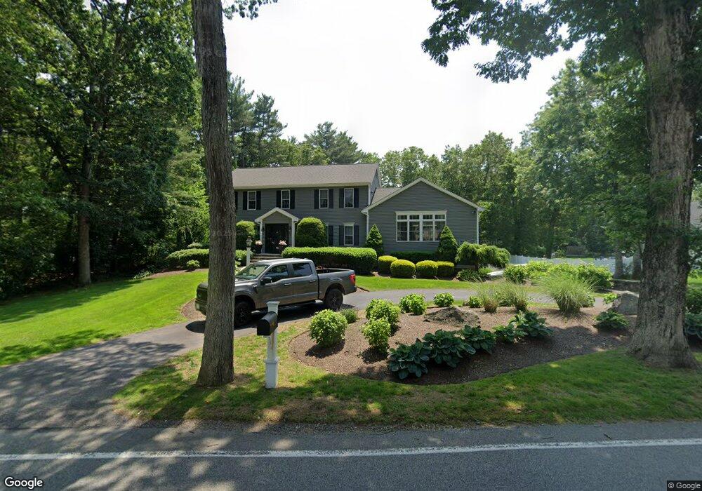
20 Rockland St North Easton, MA 02356
Estimated Value: $738,000 - $846,000
3
Beds
3
Baths
2,544
Sq Ft
$318/Sq Ft
Est. Value
About This Home
This home is located at 20 Rockland St, North Easton, MA 02356 and is currently estimated at $807,773, approximately $317 per square foot. 20 Rockland St is a home located in Bristol County with nearby schools including Easton Middle School and Oliver Ames High School.
Ownership History
Date
Name
Owned For
Owner Type
Purchase Details
Closed on
Nov 2, 2023
Sold by
Silver Sean S and Silver Erin M
Bought by
Silver Ft and Silver
Current Estimated Value
Purchase Details
Closed on
Sep 11, 2007
Sold by
Burns Edward B and Burns Alma G
Bought by
Cerqueira Paula J
Home Financials for this Owner
Home Financials are based on the most recent Mortgage that was taken out on this home.
Original Mortgage
$162,000
Interest Rate
6.74%
Mortgage Type
Purchase Money Mortgage
Purchase Details
Closed on
May 8, 2003
Sold by
Cupples Ronald A and Cupples Gretchen M
Bought by
Silver Sean S and Silver Erin M
Create a Home Valuation Report for This Property
The Home Valuation Report is an in-depth analysis detailing your home's value as well as a comparison with similar homes in the area
Home Values in the Area
Average Home Value in this Area
Purchase History
| Date | Buyer | Sale Price | Title Company |
|---|---|---|---|
| Silver Ft | -- | None Available | |
| Silver Ft | -- | None Available | |
| Cerqueira Paula J | $338,700 | -- | |
| Cerqueira Paula J | $338,700 | -- | |
| Silver Sean S | $435,000 | -- | |
| Silver Sean S | $435,000 | -- |
Source: Public Records
Mortgage History
| Date | Status | Borrower | Loan Amount |
|---|---|---|---|
| Previous Owner | Silver Sean S | $367,000 | |
| Previous Owner | Cerqueira Paula J | $162,000 |
Source: Public Records
Tax History Compared to Growth
Tax History
| Year | Tax Paid | Tax Assessment Tax Assessment Total Assessment is a certain percentage of the fair market value that is determined by local assessors to be the total taxable value of land and additions on the property. | Land | Improvement |
|---|---|---|---|---|
| 2025 | $8,967 | $718,500 | $364,800 | $353,700 |
| 2024 | $9,026 | $676,100 | $327,000 | $349,100 |
| 2023 | $8,382 | $574,500 | $327,000 | $247,500 |
| 2022 | $7,872 | $511,500 | $273,100 | $238,400 |
| 2021 | $7,675 | $495,800 | $257,400 | $238,400 |
| 2020 | $7,369 | $479,100 | $247,500 | $231,600 |
| 2019 | $8,117 | $508,600 | $245,600 | $263,000 |
| 2018 | $7,977 | $492,100 | $245,600 | $246,500 |
| 2017 | $7,714 | $475,600 | $245,600 | $230,000 |
| 2016 | $7,353 | $454,200 | $245,600 | $208,600 |
| 2015 | $6,932 | $413,100 | $204,500 | $208,600 |
| 2014 | $6,735 | $404,500 | $198,500 | $206,000 |
Source: Public Records
Map
Nearby Homes
- 25 Andrews Farm Rd
- 20 Quarry Ln
- 81 Rockland St
- 32 Heritage Dr
- 15 Randall Farm Dr
- 114 Summer St
- 89 Massapoag Ave
- 45 Randall St
- 295 Lincoln St
- 79 Summer St
- 66 Poquanticut Ave
- 321 Bay Rd
- 98 Massapoag Ave
- 9 Oak Ridge Dr
- 29 Owl Ridge Rd
- 16 Whittier Ln
- 15 Victory Ln
- 22 Pammys Path
- 33 Coughlin Rd
- 47 Guinevere Rd
- 16 Rockland St
- 24 Rockland St
- 23 Rockland St
- 19 Rockland St
- 27 Rockland St
- 27 Rockland St Unit 1
- 1 Deborah Lee Ln
- 9 Kingsbrook Way
- 4 Gunwood Ln
- 28 Rockland St
- 1 Kingsbrook Way
- 15 Rockland St
- 29 Rockland St
- 15 Kingsbrook Way
- 10 Gunwood Ln
- 11 Rockland St
- 4 Deborah Lee Ln Unit 3
- 4 Deborah Lee Ln Unit 2
- 4 Deborah Lee Ln Unit 1
- 2 Deborah Lee Ln Unit 3