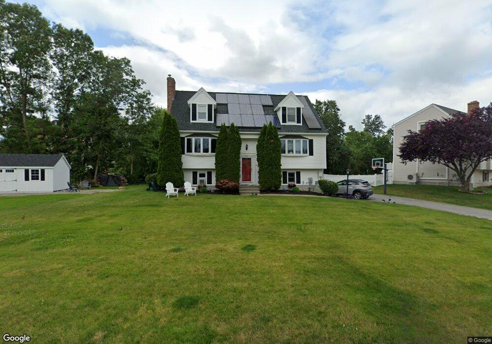
20 Rollie Shepard Dr Millbury, MA 01527
Estimated Value: $591,000 - $625,000
3
Beds
2
Baths
1,748
Sq Ft
$348/Sq Ft
Est. Value
About This Home
This home is located at 20 Rollie Shepard Dr, Millbury, MA 01527 and is currently estimated at $607,635, approximately $347 per square foot. 20 Rollie Shepard Dr is a home located in Worcester County with nearby schools including Elmwood Street Elementary School, Raymond E. Shaw Elementary School, and Millbury Junior/Senior High School.
Ownership History
Date
Name
Owned For
Owner Type
Purchase Details
Closed on
Nov 7, 2006
Sold by
Ayotte Michelle N and Ayotte Robert P
Bought by
Galipeau Elizabeth and Galipeau Paul R
Current Estimated Value
Home Financials for this Owner
Home Financials are based on the most recent Mortgage that was taken out on this home.
Original Mortgage
$212,000
Interest Rate
6.47%
Mortgage Type
Purchase Money Mortgage
Purchase Details
Closed on
Jul 28, 1999
Sold by
Zanadu Inc
Bought by
Ayotte Robert P and Ayotte Michelle N
Create a Home Valuation Report for This Property
The Home Valuation Report is an in-depth analysis detailing your home's value as well as a comparison with similar homes in the area
Home Values in the Area
Average Home Value in this Area
Purchase History
| Date | Buyer | Sale Price | Title Company |
|---|---|---|---|
| Galipeau Elizabeth | -- | -- | |
| Ayotte Michelle M | -- | -- | |
| Ayotte Michelle M | -- | -- | |
| Galipeau Elizabeth | -- | -- | |
| Ayotte Michelle M | -- | -- | |
| Ayotte Robert P | $157,000 | -- | |
| Ayotte Robert P | $157,000 | -- |
Source: Public Records
Mortgage History
| Date | Status | Borrower | Loan Amount |
|---|---|---|---|
| Open | Ayotte Robert P | $211,000 | |
| Closed | Ayotte Michelle M | $212,000 |
Source: Public Records
Tax History Compared to Growth
Tax History
| Year | Tax Paid | Tax Assessment Tax Assessment Total Assessment is a certain percentage of the fair market value that is determined by local assessors to be the total taxable value of land and additions on the property. | Land | Improvement |
|---|---|---|---|---|
| 2025 | $6,574 | $491,000 | $120,300 | $370,700 |
| 2024 | $6,043 | $456,800 | $111,400 | $345,400 |
| 2023 | $5,401 | $373,800 | $78,200 | $295,600 |
| 2022 | $5,282 | $352,100 | $78,200 | $273,900 |
| 2021 | $5,166 | $334,800 | $78,200 | $256,600 |
| 2020 | $4,999 | $326,100 | $78,200 | $247,900 |
| 2019 | $5,080 | $320,500 | $77,800 | $242,700 |
| 2018 | $4,980 | $304,800 | $77,800 | $227,000 |
| 2017 | $4,434 | $269,900 | $77,800 | $192,100 |
| 2016 | $4,424 | $268,800 | $77,800 | $191,000 |
| 2015 | $4,368 | $265,400 | $79,100 | $186,300 |
| 2014 | $4,113 | $240,500 | $82,700 | $157,800 |
Source: Public Records
Map
Nearby Homes
- 90 Macarthur Dr
- 3 May St
- 86 Wheelock Ave
- 2 Diane St
- 12 Irene Ct
- 11 Westview Ave
- 1 Pineland Ave
- 46 John Dr Unit 46
- 1 Broadmeadow Ave
- 5 Edward Dr
- 12 Alstead Path
- 28 Lincoln Ln
- 21 Lordvale Blvd Unit 406
- 5 Lincoln Ln Unit 5
- 123 Riverlin St
- 76 Samuel Dr
- 64 Millbury Ave
- 15 Rayburn Dr
- 330 Millbury Ave
- 11 Maplewood Rd
- 18 Rollie Shepard Dr
- 5 Montgomery Dr
- 7 Montgomery Dr
- 19 Rollie Shepard Dr
- 21 Rollie Shepard Dr
- 16 Rollie Shepard Dr
- 23 Rollie Shepard Dr
- 17 Rollie Shepard Dr
- 3 Montgomery Dr
- 25 Rollie Shepard Dr
- 2 Montgomery Dr
- 4 Montgomery Dr
- 14 Rollie Shepard Dr
- 15 Rollie Shepard Dr
- 27 Rollie Shepard Dr
- 6 Montgomery Dr
- 9 Montgomery Dr
- 13 Rollie Shepard Dr
- 12 Rollie Shepard Dr
- 1 Montgomery Dr