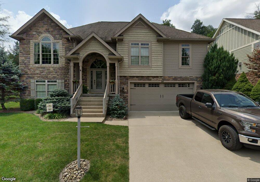
20 Round Table Ct Morgantown, WV 26508
Estimated Value: $469,247 - $621,000
4
Beds
3
Baths
2,835
Sq Ft
$189/Sq Ft
Est. Value
About This Home
This home is located at 20 Round Table Ct, Morgantown, WV 26508 and is currently estimated at $534,812, approximately $188 per square foot. 20 Round Table Ct is a home located in Monongalia County with nearby schools including Cheat Lake Elementary School, Mountaineer Middle School, and University High School.
Ownership History
Date
Name
Owned For
Owner Type
Purchase Details
Closed on
Apr 22, 2019
Sold by
Roland Darrell H and Roland Patricia B
Bought by
Tomasik Robert J and Tomasik Hope L
Current Estimated Value
Home Financials for this Owner
Home Financials are based on the most recent Mortgage that was taken out on this home.
Original Mortgage
$214,000
Outstanding Balance
$187,759
Interest Rate
4.3%
Mortgage Type
New Conventional
Estimated Equity
$347,053
Purchase Details
Closed on
Dec 16, 2008
Sold by
Legacy Ii Inc
Bought by
Roland Darrell H and Roland Patricia B
Home Financials for this Owner
Home Financials are based on the most recent Mortgage that was taken out on this home.
Original Mortgage
$50,000
Interest Rate
6.08%
Mortgage Type
New Conventional
Create a Home Valuation Report for This Property
The Home Valuation Report is an in-depth analysis detailing your home's value as well as a comparison with similar homes in the area
Home Values in the Area
Average Home Value in this Area
Purchase History
| Date | Buyer | Sale Price | Title Company |
|---|---|---|---|
| Tomasik Robert J | $381,000 | None Available | |
| Roland Darrell H | $375,000 | None Available |
Source: Public Records
Mortgage History
| Date | Status | Borrower | Loan Amount |
|---|---|---|---|
| Open | Tomasik Robert J | $214,000 | |
| Previous Owner | Roland Darrell H | $50,000 |
Source: Public Records
Tax History
| Year | Tax Paid | Tax Assessment Tax Assessment Total Assessment is a certain percentage of the fair market value that is determined by local assessors to be the total taxable value of land and additions on the property. | Land | Improvement |
|---|---|---|---|---|
| 2025 | $2,271 | $212,520 | $35,340 | $177,180 |
| 2024 | $2,271 | $213,600 | $35,340 | $178,260 |
| 2023 | $2,276 | $213,600 | $35,340 | $178,260 |
| 2022 | $2,156 | $210,420 | $35,340 | $175,080 |
| 2021 | $2,167 | $210,420 | $35,340 | $175,080 |
| 2020 | $2,177 | $210,420 | $35,340 | $175,080 |
| 2019 | $4,384 | $210,420 | $35,340 | $175,080 |
| 2018 | $2,081 | $199,080 | $35,340 | $163,740 |
| 2017 | $2,070 | $197,040 | $33,300 | $163,740 |
| 2016 | $2,065 | $195,300 | $31,560 | $163,740 |
| 2015 | $1,852 | $183,180 | $35,340 | $147,840 |
| 2014 | $1,733 | $179,760 | $33,960 | $145,800 |
Source: Public Records
Map
Nearby Homes
- 1229 Kings Rd
- 107 Nelson Dr
- 323 Salonika Dr
- 313 Salonika Dr
- 100 Mosaic Dr
- 308 Salonika Dr
- 3110 Sylvan Dr
- 512 Meteor Dr
- B-5R Meadowland Dr
- B7-R Meadowland Dr
- N-2 Lemley St
- N-1 Lemley St
- 24 Dunn Cemetary Rd
- 0 S Pierpont Rd
- 15 Belgian Ln
- 48 Gobblers Run
- 315 March Ln
- 317 March Ln
- 142 Vecchio Ln
- 304 Salonika Dr
- 18 Round Table Ct
- 16 Round Table Ct
- 19 Round Table Ct
- 17 Round Table Ct
- 992 Excaliber Dr
- 15 Round Table Ct
- 14 Round Table Ct
- 13 Round Table Ct
- 12 Round Table Ct
- 996 Excaliber Dr
- 11 Round Table Ct
- 10 Round Table Ct
- 996 & 992 Excalibur Dr
- 106 Joust Ct
- 9 Round Table Ct
- 102 Joust Ct
- 8 Round Table Ct
- 105 Joust Ct
- 7 Round Table Ct
- 101 Joust Ct
Your Personal Tour Guide
Ask me questions while you tour the home.