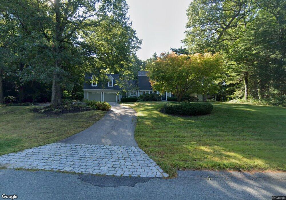
20 Roundtree Ln Scituate, MA 02066
Estimated Value: $1,668,000 - $2,183,000
4
Beds
3
Baths
4,591
Sq Ft
$416/Sq Ft
Est. Value
About This Home
This home is located at 20 Roundtree Ln, Scituate, MA 02066 and is currently estimated at $1,907,603, approximately $415 per square foot. 20 Roundtree Ln is a home located in Plymouth County with nearby schools including Jenkins Elementary School, Lester J. Gates Middle School, and Scituate High School.
Ownership History
Date
Name
Owned For
Owner Type
Purchase Details
Closed on
Dec 22, 2017
Sold by
Hickey Thomas J and Hickey Isabel L
Bought by
T & I Hickey Ft 2017
Current Estimated Value
Purchase Details
Closed on
Jul 31, 1992
Sold by
Vreeland William H and Vreeland Patricia A
Bought by
Hickey Thomas J and Hickey Isabel L
Purchase Details
Closed on
Mar 15, 1989
Sold by
Mcdonald Rt
Bought by
Vreeland William H
Create a Home Valuation Report for This Property
The Home Valuation Report is an in-depth analysis detailing your home's value as well as a comparison with similar homes in the area
Home Values in the Area
Average Home Value in this Area
Purchase History
| Date | Buyer | Sale Price | Title Company |
|---|---|---|---|
| T & I Hickey Ft 2017 | -- | -- | |
| Hickey Thomas J | $431,250 | -- | |
| Vreeland William H | $500,000 | -- |
Source: Public Records
Mortgage History
| Date | Status | Borrower | Loan Amount |
|---|---|---|---|
| Previous Owner | Vreeland William H | $465,750 | |
| Previous Owner | Vreeland William H | $550,000 | |
| Previous Owner | Vreeland William H | $550,000 |
Source: Public Records
Tax History
| Year | Tax Paid | Tax Assessment Tax Assessment Total Assessment is a certain percentage of the fair market value that is determined by local assessors to be the total taxable value of land and additions on the property. | Land | Improvement |
|---|---|---|---|---|
| 2025 | $14,608 | $1,462,300 | $494,200 | $968,100 |
| 2024 | $14,489 | $1,398,600 | $449,200 | $949,400 |
| 2023 | $13,601 | $1,266,400 | $410,700 | $855,700 |
| 2022 | $13,601 | $1,077,700 | $360,300 | $717,400 |
| 2021 | $12,750 | $956,500 | $343,200 | $613,300 |
| 2020 | $12,450 | $922,200 | $330,000 | $592,200 |
| 2019 | $12,567 | $914,600 | $355,800 | $558,800 |
| 2018 | $12,357 | $885,800 | $363,500 | $522,300 |
| 2017 | $12,291 | $872,300 | $350,000 | $522,300 |
| 2016 | $11,954 | $845,400 | $323,100 | $522,300 |
| 2015 | $10,722 | $818,500 | $296,200 | $522,300 |
Source: Public Records
Map
Nearby Homes
- 9 Cushing Park Rd
- 138 Judge Cushing Rd
- 95 Stony Brook Ln
- 32 Carolyn Cir
- 19 Ford Place Unit 1
- 19 Ford Place Unit 2
- 34 Ladds Way
- 2167 Main St
- 94 Old Oaken Bucket Rd
- 334 Chief Justice Cushing Hwy
- 14 Old Country Way Unit C
- 14 Old Country Way Unit B
- 98 Satuit Trail
- 21 Jenkins Place
- 3 Harbor Ln
- 3 Webster Farm Way
- 5 Webster Farm Way
- 25 Webster Farm Way
- 23 Webster Farm Way
- 15 Bearce Ln
- 30 Roundtree Ln
- 96 Neal Gate St
- 104 Neal Gate St
- 15 Roundtree Ln
- 31 Roundtree Ln
- 112 Neal Gate St
- 3 Cushing Rd
- 92 Neal Gate St
- 84 Neal Gate St
- 35 Roundtree Ln
- 103 Neal Gate St
- 26 Barrys Landing
- 38 Roundtree Ln
- 7 Cushing Rd
- 5 Cushing Rd
- 7 Salt Meadow Ln
- 81 Neal Gate St
- 9 Cushing Rd
- 74 Neal Gate St
- 95 Neal Gate St
Your Personal Tour Guide
Ask me questions while you tour the home.