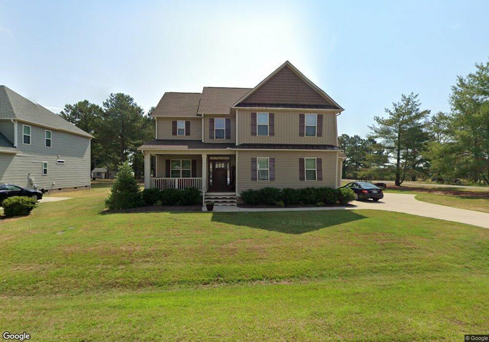
20 Ryland Dr Unit 1 Clayton, NC 27520
Estimated Value: $453,823 - $517,000
3
Beds
3
Baths
2,376
Sq Ft
$202/Sq Ft
Est. Value
About This Home
This home is located at 20 Ryland Dr Unit 1, Clayton, NC 27520 and is currently estimated at $480,206, approximately $202 per square foot. 20 Ryland Dr Unit 1 is a home located in Johnston County with nearby schools including Polenta Elementary School, Swift Creek Middle, and Cleveland High School.
Ownership History
Date
Name
Owned For
Owner Type
Purchase Details
Closed on
Apr 17, 2015
Sold by
Darryl D Evans Inc
Bought by
Flatten Daniel E and Flatten Danielle
Current Estimated Value
Home Financials for this Owner
Home Financials are based on the most recent Mortgage that was taken out on this home.
Original Mortgage
$195,768
Outstanding Balance
$72,134
Interest Rate
3.84%
Mortgage Type
New Conventional
Estimated Equity
$408,072
Purchase Details
Closed on
Aug 7, 2014
Sold by
341 Sonny Road Llc
Bought by
Darryl D Evans Inc
Create a Home Valuation Report for This Property
The Home Valuation Report is an in-depth analysis detailing your home's value as well as a comparison with similar homes in the area
Home Values in the Area
Average Home Value in this Area
Purchase History
| Date | Buyer | Sale Price | Title Company |
|---|---|---|---|
| Flatten Daniel E | $244,500 | None Available | |
| Darryl D Evans Inc | $175,000 | None Available |
Source: Public Records
Mortgage History
| Date | Status | Borrower | Loan Amount |
|---|---|---|---|
| Open | Flatten Daniel E | $195,768 |
Source: Public Records
Tax History
| Year | Tax Paid | Tax Assessment Tax Assessment Total Assessment is a certain percentage of the fair market value that is determined by local assessors to be the total taxable value of land and additions on the property. | Land | Improvement |
|---|---|---|---|---|
| 2025 | $2,715 | $427,490 | $75,000 | $352,490 |
| 2024 | $2,189 | $270,250 | $50,000 | $220,250 |
| 2023 | $2,115 | $270,250 | $50,000 | $220,250 |
| 2022 | $2,223 | $270,250 | $50,000 | $220,250 |
| 2021 | $2,223 | $270,250 | $50,000 | $220,250 |
| 2020 | $2,250 | $270,250 | $50,000 | $220,250 |
| 2019 | $2,250 | $270,250 | $50,000 | $220,250 |
| 2018 | $2,096 | $245,840 | $40,000 | $205,840 |
| 2017 | $2,096 | $245,840 | $40,000 | $205,840 |
| 2016 | $2,096 | $245,840 | $40,000 | $205,840 |
| 2015 | -- | $168,660 | $40,000 | $128,660 |
| 2014 | -- | $40,000 | $40,000 | $0 |
Source: Public Records
Map
Nearby Homes
- 42 Saltwater Cove
- 224 Stephens Timberline View
- 190 Stephens Timberline View
- 13 Knotty Pine Ln
- 135 Sommerset Dr
- 86 Troy Dr
- 157 Sommerset Dr
- 165 Sommerset Dr
- 233 Ambassador Dr
- 245 Ambassador Dr
- 91 Commons Cir
- 83 Eagle Rock Place
- 280 Ambassador Dr
- 302 Ambassador Dr
- 255 Ambassador Dr
- 269 Ambassador Dr
- 260 Ambassador Dr
- 305 Ambassador Dr
- 105 George Wilton Dr
- 274 Colson Ridge Dr
- 20 Ryland Dr
- 42 Ryland Dr
- 555 Sonny Rd
- 62 Ryland Dr Unit 3
- 0 Sonny Rd Unit 2456285
- 0 Sonny Rd
- 21 Pond Mountain Dr
- 21 Ryland Dr Unit 12
- 21 Ryland Dr
- 1360 Matthews Rd
- 41 Ryland Dr Unit 11
- 41 Ryland Dr
- 82 Ryland Dr Unit Lot4
- 1296 Matthews Rd
- 22 Pond Mountain Dr
- 63 Ryland Dr Unit 10
- 63 Pond Mountain Dr
- 44 Pond Mountain Dr
- 1350 Matthews Rd
- 359 Sonny Rd
Your Personal Tour Guide
Ask me questions while you tour the home.