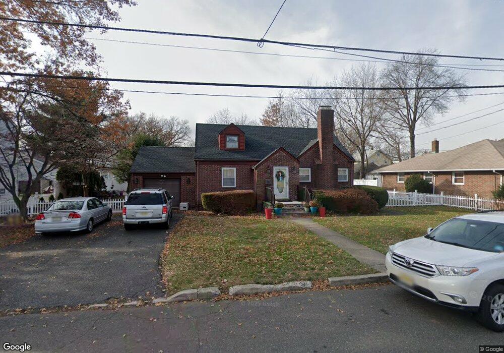
20 S Taylor St Bergenfield, NJ 07621
Estimated Value: $583,459 - $641,000
Studio
--
Bath
1,240
Sq Ft
$485/Sq Ft
Est. Value
About This Home
This home is located at 20 S Taylor St, Bergenfield, NJ 07621 and is currently estimated at $601,865, approximately $485 per square foot. 20 S Taylor St is a home located in Bergen County with nearby schools including Bergenfield High School.
Ownership History
Date
Name
Owned For
Owner Type
Purchase Details
Closed on
Oct 8, 1998
Sold by
Marino Lorraine M
Bought by
Delossantos Elizalde C and Delossantos Rebecca S
Current Estimated Value
Home Financials for this Owner
Home Financials are based on the most recent Mortgage that was taken out on this home.
Original Mortgage
$173,850
Outstanding Balance
$37,243
Interest Rate
6.65%
Estimated Equity
$564,622
Create a Home Valuation Report for This Property
The Home Valuation Report is an in-depth analysis detailing your home's value as well as a comparison with similar homes in the area
Home Values in the Area
Average Home Value in this Area
Purchase History
| Date | Buyer | Sale Price | Title Company |
|---|---|---|---|
| Delossantos Elizalde C | $183,000 | -- |
Source: Public Records
Mortgage History
| Date | Status | Borrower | Loan Amount |
|---|---|---|---|
| Open | Delossantos Elizalde C | $173,850 |
Source: Public Records
Tax History
| Year | Tax Paid | Tax Assessment Tax Assessment Total Assessment is a certain percentage of the fair market value that is determined by local assessors to be the total taxable value of land and additions on the property. | Land | Improvement |
|---|---|---|---|---|
| 2025 | $12,394 | $351,400 | $220,000 | $131,400 |
| 2024 | $11,983 | $351,400 | $220,000 | $131,400 |
| 2023 | $11,797 | $351,400 | $220,000 | $131,400 |
| 2022 | $11,797 | $351,400 | $220,000 | $131,400 |
| 2021 | $11,674 | $351,400 | $220,000 | $131,400 |
| 2020 | $11,596 | $351,400 | $220,000 | $131,400 |
| 2019 | $11,463 | $351,400 | $220,000 | $131,400 |
| 2018 | $11,378 | $351,400 | $220,000 | $131,400 |
| 2017 | $11,322 | $351,400 | $220,000 | $131,400 |
| 2016 | $11,143 | $351,400 | $220,000 | $131,400 |
| 2015 | $10,971 | $351,400 | $220,000 | $131,400 |
| 2014 | $10,770 | $351,400 | $220,000 | $131,400 |
Source: Public Records
Map
Nearby Homes
- 125 E Main St
- 109 Bradley Ave
- 50 S 1st St Unit 3A
- 34 N Washington Ave
- 21 E Clinton Ave
- 133 E Church St
- 83 N Washington Ave
- 41 W Church St Unit 11
- 241 E Main St Unit 1D
- 25 Ralph St
- 248 E Clinton Ave
- 42 S Demarest Ave
- 184 S Washington Ave Unit A6
- 70 Delford Ave
- 20 Dojean Ct
- 125 W Main St
- 22 W Central Ave
- 175 Hillside Ave
- 80 Roosevelt Ave
- 364 W Clinton Ave
Your Personal Tour Guide
Ask me questions while you tour the home.