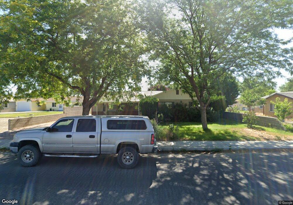
20 S West St Unit S2 Yerington, NV 89447
Estimated Value: $330,000 - $432,504
4
Beds
2
Baths
2,054
Sq Ft
$193/Sq Ft
Est. Value
About This Home
This home is located at 20 S West St Unit S2, Yerington, NV 89447 and is currently estimated at $396,376, approximately $192 per square foot. 20 S West St Unit S2 is a home located in Lyon County with nearby schools including Yerington Elementary School, Yerington Intermediate School, and Yerington High School.
Ownership History
Date
Name
Owned For
Owner Type
Purchase Details
Closed on
Mar 13, 2009
Sold by
Lommori Mario M and Lommori Clarice Elizabeth
Bought by
Christensen Matthew Raymond and Christensen Emily L
Current Estimated Value
Home Financials for this Owner
Home Financials are based on the most recent Mortgage that was taken out on this home.
Original Mortgage
$180,000
Outstanding Balance
$114,577
Interest Rate
5.15%
Mortgage Type
Seller Take Back
Estimated Equity
$281,799
Create a Home Valuation Report for This Property
The Home Valuation Report is an in-depth analysis detailing your home's value as well as a comparison with similar homes in the area
Home Values in the Area
Average Home Value in this Area
Purchase History
| Date | Buyer | Sale Price | Title Company |
|---|---|---|---|
| Christensen Matthew Raymond | $200,000 | Title Service & Escrow Co |
Source: Public Records
Mortgage History
| Date | Status | Borrower | Loan Amount |
|---|---|---|---|
| Open | Christensen Matthew Raymond | $180,000 |
Source: Public Records
Tax History Compared to Growth
Tax History
| Year | Tax Paid | Tax Assessment Tax Assessment Total Assessment is a certain percentage of the fair market value that is determined by local assessors to be the total taxable value of land and additions on the property. | Land | Improvement |
|---|---|---|---|---|
| 2025 | $1,171 | $61,386 | $31,500 | $29,886 |
| 2024 | $1,137 | $60,345 | $30,800 | $29,544 |
| 2023 | $1,137 | $57,716 | $30,800 | $26,916 |
| 2022 | $1,072 | $55,210 | $30,800 | $24,410 |
| 2021 | $1,041 | $28,950 | $5,600 | $23,350 |
| 2020 | $1,010 | $27,602 | $5,600 | $22,002 |
| 2019 | $1,003 | $27,393 | $5,600 | $21,793 |
| 2018 | $991 | $27,069 | $5,250 | $21,819 |
| 2017 | $1,011 | $27,620 | $5,250 | $22,370 |
| 2016 | $1,029 | $28,394 | $4,200 | $24,194 |
| 2015 | $1,039 | $28,854 | $4,200 | $24,654 |
| 2014 | $1,056 | $28,952 | $4,200 | $24,752 |
Source: Public Records
Map
Nearby Homes
- 0 Nevada 208
- 41 Nevada 208
- 0 S Whitacre St Unit 250001435
- 9 N Nevada St
- 234 S West St
- 104 Virginia St
- 115 Commercial Ave
- 311 S Main St
- 616 S Center St
- 321 S West St
- 329 S West St
- 317 Modesto St
- 13ac S Whitacre St
- 244 Valley Dr
- 200 Quail Run Dr
- 204 Quail Run Dr
- 416 Paul Ave
- 411 Paul Ave
- 500 W Goldfield Ave Unit 31
- 500 W Goldfield Ave Unit 32
- 24 S West St
- 115 Van Ness Ave
- 121 Van Ness Ave
- 9 S Center St
- 17 S Center St
- 15 S West St
- 32 S West St
- 32 S West St Unit + Guest House
- 23 S Center St
- 21 S West St
- 3 S West St
- 27 S Center St
- 31 S West St
- 33 S Center St
- 8 S West St
- 1 S Center St
- 215 Van Ness Ave
- 14 S Whitacre St
- 104 S West St
- 105 S Center St