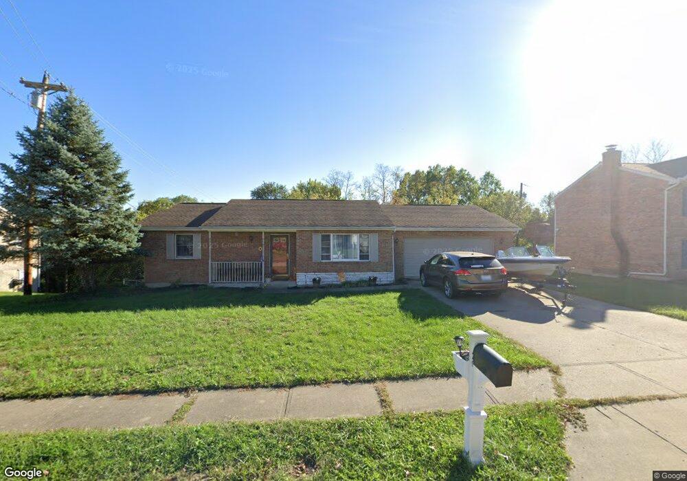
20 Sabre Dr Highland Heights, KY 41076
Estimated Value: $328,000 - $378,000
3
Beds
3
Baths
1,446
Sq Ft
$241/Sq Ft
Est. Value
About This Home
This home is located at 20 Sabre Dr, Highland Heights, KY 41076 and is currently estimated at $348,382, approximately $240 per square foot. 20 Sabre Dr is a home located in Campbell County with nearby schools including Crossroads Elementary School, Campbell County Middle School, and Campbell County High School.
Ownership History
Date
Name
Owned For
Owner Type
Purchase Details
Closed on
Sep 29, 2005
Sold by
Gosbee Robyn R
Bought by
Zepf Ronald S and Wikle Sandra Lynn
Current Estimated Value
Home Financials for this Owner
Home Financials are based on the most recent Mortgage that was taken out on this home.
Original Mortgage
$124,000
Outstanding Balance
$66,412
Interest Rate
5.77%
Mortgage Type
New Conventional
Estimated Equity
$281,970
Purchase Details
Closed on
Dec 3, 2002
Sold by
Stevens Norma J
Bought by
Gosbee Robyn R
Home Financials for this Owner
Home Financials are based on the most recent Mortgage that was taken out on this home.
Original Mortgage
$157,429
Interest Rate
6.15%
Mortgage Type
FHA
Purchase Details
Closed on
Oct 2, 2000
Sold by
Ray Smith Est
Bought by
Stevens Raymond L
Home Financials for this Owner
Home Financials are based on the most recent Mortgage that was taken out on this home.
Original Mortgage
$131,832
Interest Rate
7.92%
Mortgage Type
FHA
Create a Home Valuation Report for This Property
The Home Valuation Report is an in-depth analysis detailing your home's value as well as a comparison with similar homes in the area
Home Values in the Area
Average Home Value in this Area
Purchase History
| Date | Buyer | Sale Price | Title Company |
|---|---|---|---|
| Zepf Ronald S | $204,000 | None Available | |
| Gosbee Robyn R | $159,900 | -- | |
| Stevens Raymond L | $131,900 | -- |
Source: Public Records
Mortgage History
| Date | Status | Borrower | Loan Amount |
|---|---|---|---|
| Open | Zepf Ronald S | $124,000 | |
| Previous Owner | Gosbee Robyn R | $157,429 | |
| Previous Owner | Stevens Raymond L | $131,832 |
Source: Public Records
Tax History Compared to Growth
Tax History
| Year | Tax Paid | Tax Assessment Tax Assessment Total Assessment is a certain percentage of the fair market value that is determined by local assessors to be the total taxable value of land and additions on the property. | Land | Improvement |
|---|---|---|---|---|
| 2024 | $2,575 | $256,000 | $40,000 | $216,000 |
| 2023 | $2,516 | $256,000 | $40,000 | $216,000 |
| 2022 | $1,935 | $192,750 | $30,000 | $162,750 |
| 2021 | $1,935 | $192,750 | $30,000 | $162,750 |
| 2020 | $1,970 | $192,750 | $30,000 | $162,750 |
| 2019 | $1,937 | $192,750 | $30,000 | $162,750 |
| 2018 | $1,900 | $187,000 | $30,000 | $157,000 |
| 2017 | $1,875 | $187,000 | $30,000 | $157,000 |
| 2016 | $1,835 | $187,000 | $0 | $0 |
| 2015 | $1,864 | $187,000 | $0 | $0 |
| 2014 | $1,828 | $187,000 | $0 | $0 |
Source: Public Records
Map
Nearby Homes
- 34 Sabre Dr
- 107 Wayside Ct
- 201 Thornbush Ct
- 703 Queensway Ct
- 804 Buckingham Ct Unit 804
- 2045 Uhl Rd
- 886 Flint Ridge
- 411 Springmill Dr
- 405 Springmill Dr
- 5804 Granite Spring Dr
- 408 Millrace Dr
- 10 Barma Dr
- 24 Andrew Cir
- 664 Silver Ledge Dr
- 105-107 Jerome Ct
- 105 Jerome Ct
- 5274 Dodsworth Ln
- 5370 Skyline Dr
- 1419 Industrial Rd
- 00 Industrial Rd