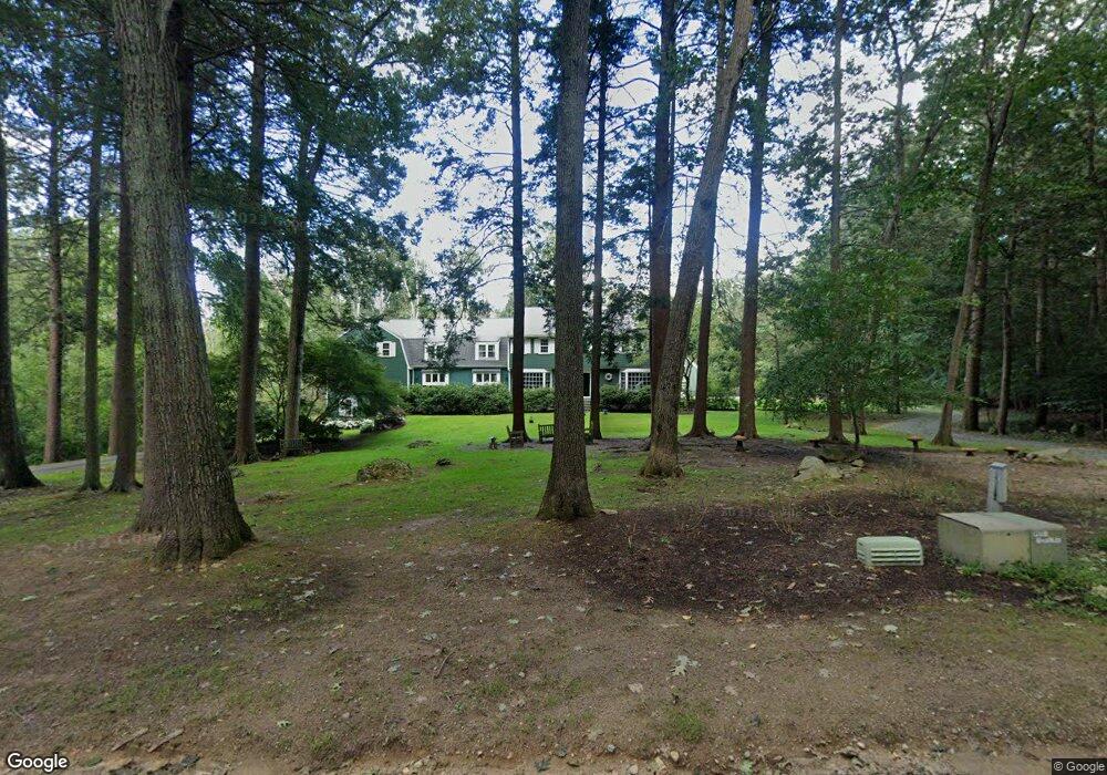
20 Saddlebrook Rd Sherborn, MA 01770
Estimated Value: $1,691,000 - $1,834,000
5
Beds
4
Baths
5,096
Sq Ft
$347/Sq Ft
Est. Value
About This Home
This home is located at 20 Saddlebrook Rd, Sherborn, MA 01770 and is currently estimated at $1,770,418, approximately $347 per square foot. 20 Saddlebrook Rd is a home located in Middlesex County with nearby schools including Pine Hill Elementary School, Dover-Sherborn Regional Middle School, and Dover-Sherborn Regional High School.
Ownership History
Date
Name
Owned For
Owner Type
Purchase Details
Closed on
Feb 23, 2007
Sold by
Tuck Susan H
Bought by
Tuck Alan W and Tuck Susan H
Current Estimated Value
Home Financials for this Owner
Home Financials are based on the most recent Mortgage that was taken out on this home.
Original Mortgage
$417,000
Outstanding Balance
$250,736
Interest Rate
6.23%
Mortgage Type
Purchase Money Mortgage
Estimated Equity
$1,519,682
Create a Home Valuation Report for This Property
The Home Valuation Report is an in-depth analysis detailing your home's value as well as a comparison with similar homes in the area
Home Values in the Area
Average Home Value in this Area
Purchase History
| Date | Buyer | Sale Price | Title Company |
|---|---|---|---|
| Tuck Alan W | -- | -- |
Source: Public Records
Mortgage History
| Date | Status | Borrower | Loan Amount |
|---|---|---|---|
| Open | Tuck Alan W | $417,000 |
Source: Public Records
Tax History
| Year | Tax Paid | Tax Assessment Tax Assessment Total Assessment is a certain percentage of the fair market value that is determined by local assessors to be the total taxable value of land and additions on the property. | Land | Improvement |
|---|---|---|---|---|
| 2025 | $27,332 | $1,648,500 | $497,400 | $1,151,100 |
| 2024 | $24,961 | $1,472,600 | $477,800 | $994,800 |
| 2023 | $24,391 | $1,354,300 | $477,800 | $876,500 |
| 2022 | $22,787 | $1,197,400 | $461,500 | $735,900 |
| 2021 | $22,419 | $1,142,100 | $461,500 | $680,600 |
| 2020 | $22,225 | $1,142,100 | $461,500 | $680,600 |
| 2019 | $22,241 | $1,133,600 | $461,500 | $672,100 |
| 2018 | $21,467 | $1,112,300 | $461,500 | $650,800 |
| 2017 | $21,203 | $1,036,300 | $461,500 | $574,800 |
| 2016 | $20,514 | $997,300 | $435,400 | $561,900 |
| 2015 | $19,698 | $969,400 | $409,200 | $560,200 |
| 2014 | $18,729 | $920,800 | $389,600 | $531,200 |
Source: Public Records
Map
Nearby Homes
- 121 Woodland St
- 76 Hollis St
- 59 Russett Hill Rd
- 14 Fiske Pond Rd
- 147 Washington Street Lot 2
- 59 Spywood Rd
- 54 Spywood Rd
- 2 Snow St
- 84 Old Orchard Rd
- 102 Washington St
- 21 Spywood Rd
- 16 Page Farm Rd
- 29 Southfield Ln Unit 29
- 3 Knollcrest Farm Ln
- 41 Ivy Ln
- 18 Northway St
- 00000 S Main St and Bullard St
- 14 Sewall Brook Ln
- 100 Maple St
- 90 Maple St
- 14 Saddlebrook Rd
- 28 Saddlebrook Rd
- 25 Saddlebrook Rd
- 19 Saddlebrook Rd
- 16 Saddlebrook Rd
- 32 Saddlebrook Rd
- 32 Mill St
- 35 Saddlebrook Rd
- 44 Mill St
- 52 Mill St
- 58 Mill St
- 62 Mill St
- 101 Woodland St
- 28 Mill St
- 43 Mill St
- 156 Lot 2 Nason Hill Rd
- 0 Nason Hill Rd Unit 70839380
- 0 Nason Hill Rd Unit 70643604
- 0 Nason Hill Rd Unit 70532766
- 2 Nason Hill Rd
Your Personal Tour Guide
Ask me questions while you tour the home.