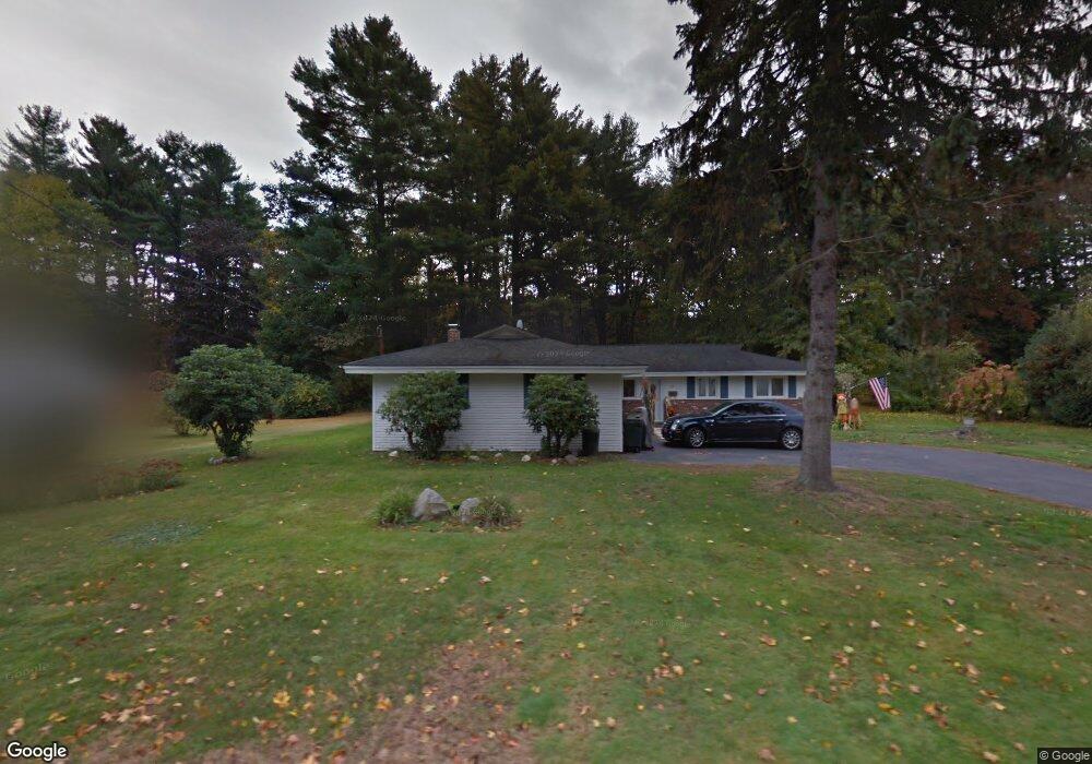
20 Samuel Rd Chelmsford, MA 01824
Estimated Value: $697,537 - $759,000
3
Beds
3
Baths
1,879
Sq Ft
$389/Sq Ft
Est. Value
About This Home
This home is located at 20 Samuel Rd, Chelmsford, MA 01824 and is currently estimated at $730,384, approximately $388 per square foot. 20 Samuel Rd is a home located in Middlesex County with nearby schools including South Row Elementary School, McCarthy Middle School, and Chelmsford High School.
Ownership History
Date
Name
Owned For
Owner Type
Purchase Details
Closed on
Dec 3, 2020
Sold by
Evelyn Aidan F and Grondin Janice M
Bought by
Evelyn Aiden F and Evelyn Janice M
Current Estimated Value
Home Financials for this Owner
Home Financials are based on the most recent Mortgage that was taken out on this home.
Original Mortgage
$277,500
Interest Rate
2.8%
Mortgage Type
New Conventional
Purchase Details
Closed on
Mar 10, 2000
Sold by
Berry Leon A and Berry Lillian S
Bought by
Evelyn Aidan F and Grondin Janice M
Home Financials for this Owner
Home Financials are based on the most recent Mortgage that was taken out on this home.
Original Mortgage
$191,600
Interest Rate
8.18%
Mortgage Type
Purchase Money Mortgage
Create a Home Valuation Report for This Property
The Home Valuation Report is an in-depth analysis detailing your home's value as well as a comparison with similar homes in the area
Purchase History
| Date | Buyer | Sale Price | Title Company |
|---|---|---|---|
| Evelyn Aiden F | -- | Stewart Title Guaranty Compa | |
| Evelyn Aiden F | -- | Stewart Title Guaranty Compa | |
| Evelyn Aidan F | $239,500 | -- | |
| Evelyn Aidan F | $239,500 | -- |
Source: Public Records
Mortgage History
| Date | Status | Borrower | Loan Amount |
|---|---|---|---|
| Previous Owner | Evelyn Aiden F | $277,500 | |
| Previous Owner | Evelyn Aidan F | $215,000 | |
| Previous Owner | Evelyn Aidan F | $191,600 |
Source: Public Records
Tax History
| Year | Tax Paid | Tax Assessment Tax Assessment Total Assessment is a certain percentage of the fair market value that is determined by local assessors to be the total taxable value of land and additions on the property. | Land | Improvement |
|---|---|---|---|---|
| 2025 | $7,888 | $567,500 | $317,800 | $249,700 |
| 2024 | $7,653 | $561,900 | $317,800 | $244,100 |
| 2023 | $7,559 | $526,000 | $341,800 | $184,200 |
| 2022 | $7,352 | $466,200 | $291,700 | $174,500 |
| 2021 | $6,674 | $424,000 | $267,700 | $156,300 |
| 2020 | $6,837 | $415,600 | $232,700 | $182,900 |
| 2019 | $6,594 | $403,300 | $230,500 | $172,800 |
| 2018 | $6,755 | $376,100 | $207,600 | $168,500 |
| 2017 | $6,297 | $351,400 | $194,400 | $157,000 |
| 2016 | $5,977 | $331,500 | $190,400 | $141,100 |
| 2015 | $5,842 | $312,400 | $173,000 | $139,400 |
| 2014 | $5,628 | $296,500 | $163,000 | $133,500 |
Source: Public Records
Map
Nearby Homes
- 175 Mill Rd
- 15 Roberts St
- 75 Stonegate Rd
- 1 Rosemary Ln
- 6 Walters St
- 24 Algonquin Rd
- 55 Parker Rd
- Map29-14-1 Rangeway Rd
- 216 Rangeway Rd Unit 164
- 216 Rangeway Rd Unit 192
- 243 Riverneck Rd
- 8 Perham St
- 6 Sinai Cir Unit C
- 9 Acton Rd Unit 6
- 9 Acton Rd Unit 10
- 9 Acton Rd Unit 8
- 41 Boston Rd Unit 442
- 41 Boston Rd Unit 121
- 41 Boston Rd Unit 464
- 41 Boston Rd Unit 351
Your Personal Tour Guide
Ask me questions while you tour the home.