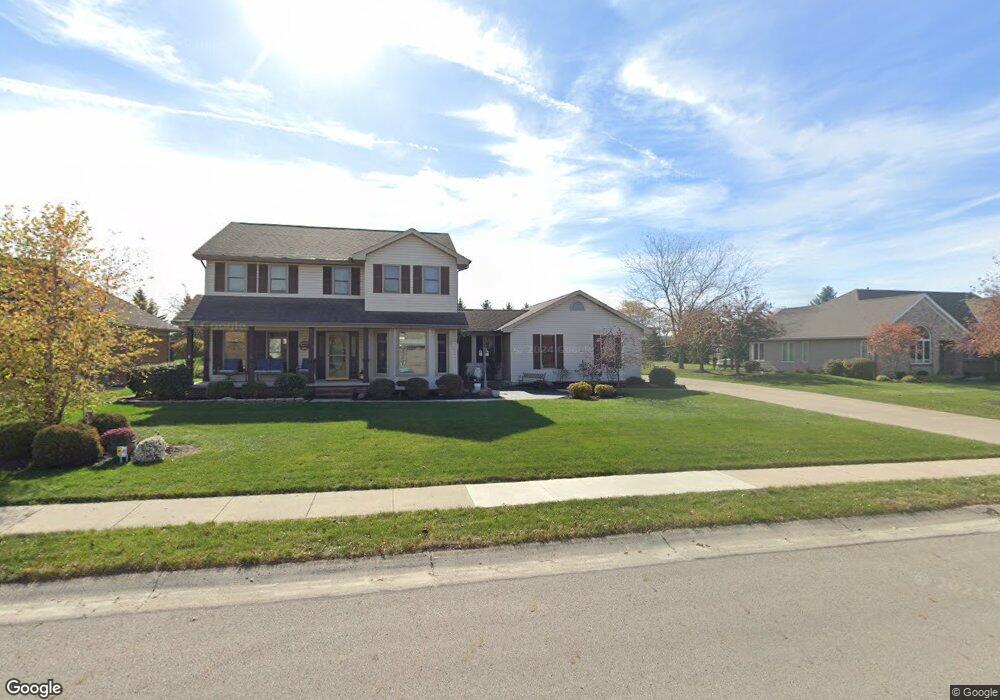
20 Settlers Ln Minster, OH 45865
Estimated Value: $447,000 - $587,000
4
Beds
3
Baths
2,253
Sq Ft
$219/Sq Ft
Est. Value
About This Home
This home is located at 20 Settlers Ln, Minster, OH 45865 and is currently estimated at $492,377, approximately $218 per square foot. 20 Settlers Ln is a home located in Auglaize County with nearby schools including Minster Elementary School and Minster Junior/Senior High School.
Ownership History
Date
Name
Owned For
Owner Type
Purchase Details
Closed on
Aug 31, 2006
Sold by
Westerheide Brian R and Westerheide Michele L
Bought by
Enneking Anthony D and Enneking Stacie A
Current Estimated Value
Home Financials for this Owner
Home Financials are based on the most recent Mortgage that was taken out on this home.
Original Mortgage
$193,000
Outstanding Balance
$117,224
Interest Rate
6.88%
Mortgage Type
Purchase Money Mortgage
Estimated Equity
$375,153
Purchase Details
Closed on
Mar 12, 2002
Sold by
Stricker David J
Bought by
Westerheide Brain R
Purchase Details
Closed on
May 1, 1989
Create a Home Valuation Report for This Property
The Home Valuation Report is an in-depth analysis detailing your home's value as well as a comparison with similar homes in the area
Home Values in the Area
Average Home Value in this Area
Purchase History
| Date | Buyer | Sale Price | Title Company |
|---|---|---|---|
| Enneking Anthony D | $263,000 | None Available | |
| Westerheide Brain R | $219,000 | -- | |
| -- | $19,500 | -- |
Source: Public Records
Mortgage History
| Date | Status | Borrower | Loan Amount |
|---|---|---|---|
| Open | Enneking Anthony D | $193,000 |
Source: Public Records
Tax History Compared to Growth
Tax History
| Year | Tax Paid | Tax Assessment Tax Assessment Total Assessment is a certain percentage of the fair market value that is determined by local assessors to be the total taxable value of land and additions on the property. | Land | Improvement |
|---|---|---|---|---|
| 2024 | $8,819 | $126,950 | $14,860 | $112,090 |
| 2023 | $4,075 | $120,610 | $14,860 | $105,750 |
| 2022 | $3,783 | $104,310 | $13,520 | $90,790 |
| 2021 | $3,875 | $104,310 | $13,520 | $90,790 |
| 2020 | $3,956 | $104,311 | $13,524 | $90,787 |
| 2019 | $3,480 | $85,526 | $11,053 | $74,473 |
| 2018 | $3,480 | $85,526 | $11,053 | $74,473 |
| 2017 | $3,227 | $85,526 | $11,053 | $74,473 |
| 2016 | $2,714 | $70,217 | $10,318 | $59,899 |
| 2015 | $2,667 | $70,217 | $10,318 | $59,899 |
| 2014 | $2,670 | $70,217 | $10,318 | $59,899 |
| 2013 | $2,801 | $70,217 | $10,318 | $59,899 |
Source: Public Records
Map
Nearby Homes
- 17 Stonegate Dr
- 0 Stonegate Dr Unit 21 10544857
- 0 Stonegate Dr Unit 14 10544847
- 36 Shania Place Unit 23
- 27 Shania Place Unit 26
- 19 Shania Place Unit 33
- 28 Shania Place Unit 33
- 11 Shania Place Unit 28
- 47 N Frankfort St
- 193 N Paris St
- 561 S Walnut St Unit Lot3
- 129 Janice Dr
- 323 Margaret St
- 319 Margaret St
- 316 Margaret St
- 312 Margaret St
- 130 Janice Dr
- 416 E Plum St
- 420 E Plum St
- 424 E Plum St