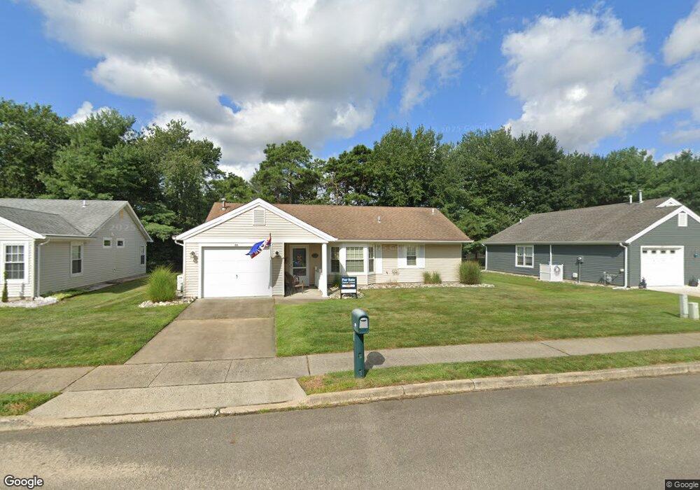
20 Sheffield Dr Forked River, NJ 08731
Lacey Township NeighborhoodEstimated Value: $350,000 - $395,000
2
Beds
2
Baths
1,267
Sq Ft
$296/Sq Ft
Est. Value
About This Home
This home is located at 20 Sheffield Dr, Forked River, NJ 08731 and is currently estimated at $375,144, approximately $296 per square foot. 20 Sheffield Dr is a home located in Ocean County with nearby schools including Lacey Township High School.
Ownership History
Date
Name
Owned For
Owner Type
Purchase Details
Closed on
Oct 24, 2025
Sold by
Osenenko James and Osenenko John
Bought by
Tanis Patricia J and Tanis James F
Current Estimated Value
Home Financials for this Owner
Home Financials are based on the most recent Mortgage that was taken out on this home.
Original Mortgage
$220,000
Outstanding Balance
$219,793
Interest Rate
6.3%
Mortgage Type
VA
Estimated Equity
$155,351
Purchase Details
Closed on
Sep 25, 2009
Sold by
Smith Maryann
Bought by
Osenenko James and Osenenko John
Purchase Details
Closed on
Nov 15, 2005
Sold by
Bartlett Grandison and Bartlett Enid
Bought by
Smith William and Smith Maryann
Purchase Details
Closed on
Apr 11, 1994
Sold by
Alessi Frank
Bought by
Bartlett Grandison and Bartlett Enid
Create a Home Valuation Report for This Property
The Home Valuation Report is an in-depth analysis detailing your home's value as well as a comparison with similar homes in the area
Home Values in the Area
Average Home Value in this Area
Purchase History
| Date | Buyer | Sale Price | Title Company |
|---|---|---|---|
| Tanis Patricia J | $399,900 | Coastline Title | |
| Osenenko James | $100,000 | None Available | |
| Smith William | $214,500 | Transnation Title | |
| Bartlett Grandison | $94,500 | -- |
Source: Public Records
Mortgage History
| Date | Status | Borrower | Loan Amount |
|---|---|---|---|
| Open | Tanis Patricia J | $220,000 |
Source: Public Records
Tax History Compared to Growth
Tax History
| Year | Tax Paid | Tax Assessment Tax Assessment Total Assessment is a certain percentage of the fair market value that is determined by local assessors to be the total taxable value of land and additions on the property. | Land | Improvement |
|---|---|---|---|---|
| 2025 | $4,277 | $168,800 | $45,000 | $123,800 |
| 2024 | $3,999 | $168,800 | $45,000 | $123,800 |
| 2023 | $3,820 | $168,800 | $45,000 | $123,800 |
| 2022 | $3,820 | $168,800 | $45,000 | $123,800 |
| 2021 | $3,756 | $168,800 | $45,000 | $123,800 |
| 2020 | $3,636 | $168,800 | $45,000 | $123,800 |
| 2019 | $3,572 | $168,800 | $45,000 | $123,800 |
| 2018 | $3,530 | $168,800 | $45,000 | $123,800 |
| 2017 | $3,449 | $168,800 | $45,000 | $123,800 |
| 2016 | $3,435 | $168,800 | $45,000 | $123,800 |
| 2015 | $3,281 | $168,800 | $45,000 | $123,800 |
| 2014 | $2,666 | $155,000 | $55,000 | $100,000 |
Source: Public Records
Map
Nearby Homes
- 1490 Earie Way
- 42 Canterbury Dr
- 0000 Earie Way
- 11 Portsmouth Dr
- 1988 Brookdale Dr
- 14 Portsmouth Dr
- 1427 Foch Ave
- 1409 Kay St
- 1533 Arient Rd
- 1515 Clair Rd
- 1223 Sylvania Place
- 1222 Taylor Ln
- 483 Lake Barnegat Dr S
- 1972 Glen Oak Dr
- 1800 Ravine Dr
- Juniper Plan at Lacey Pines
- 501 Windsor St
- 102 Maria Loretta Ln
- 302 Maria Loretta Ln
- 13 Parkers Point Blvd
- 18 Sheffield Dr
- 24 Sheffield Dr
- 16 Sheffield Dr
- 11 Lancaster Ct
- 15 Sheffield Dr
- 10 Lancaster Ct
- 12 Lancaster Ct
- 11 Sheffield Dr
- 17 Sheffield Dr
- 9 Lancaster Ct
- 26 Sheffield Dr
- 14 Sheffield Dr
- 9 Sheffield Dr
- 13 Lancaster Ct
- 19 Sheffield Dr
- 8 Lancaster Ct
- 28 Sheffield Dr
- 7 Sheffield Dr
- 12 Sheffield Dr
- 21 Sheffield Dr