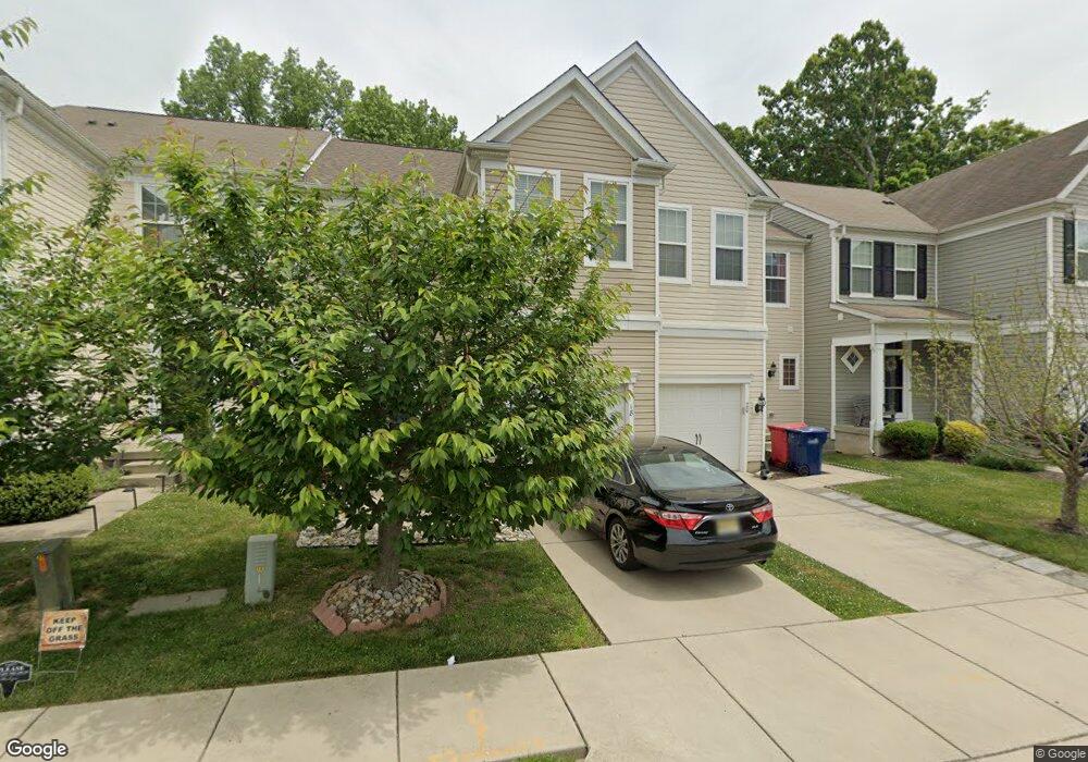
20 Shire Ct Somerdale, NJ 08083
Estimated Value: $290,723 - $408,000
--
Bed
--
Bath
1,835
Sq Ft
$197/Sq Ft
Est. Value
About This Home
This home is located at 20 Shire Ct, Somerdale, NJ 08083 and is currently estimated at $360,931, approximately $196 per square foot. 20 Shire Ct is a home with nearby schools including Somerdale Park School, Sterling High School, and Saint John Paul II Regional School.
Ownership History
Date
Name
Owned For
Owner Type
Purchase Details
Closed on
Jul 26, 2012
Sold by
Pulte Homes Of Nj Limited Pa
Bought by
Foster Fapohunda Crystal T and Fapohunda Henry T
Current Estimated Value
Home Financials for this Owner
Home Financials are based on the most recent Mortgage that was taken out on this home.
Original Mortgage
$215,563
Outstanding Balance
$154,353
Interest Rate
4.4%
Mortgage Type
FHA
Estimated Equity
$206,578
Create a Home Valuation Report for This Property
The Home Valuation Report is an in-depth analysis detailing your home's value as well as a comparison with similar homes in the area
Home Values in the Area
Average Home Value in this Area
Purchase History
| Date | Buyer | Sale Price | Title Company |
|---|---|---|---|
| Foster Fapohunda Crystal T | $219,540 | None Available |
Source: Public Records
Mortgage History
| Date | Status | Borrower | Loan Amount |
|---|---|---|---|
| Open | Foster Fapohunda Crystal T | $215,563 |
Source: Public Records
Tax History Compared to Growth
Tax History
| Year | Tax Paid | Tax Assessment Tax Assessment Total Assessment is a certain percentage of the fair market value that is determined by local assessors to be the total taxable value of land and additions on the property. | Land | Improvement |
|---|---|---|---|---|
| 2025 | $7,956 | $170,700 | $21,100 | $149,600 |
| 2024 | $7,615 | $170,700 | $21,100 | $149,600 |
| 2023 | $7,615 | $170,700 | $21,100 | $149,600 |
| 2022 | $7,291 | $170,700 | $21,100 | $149,600 |
| 2021 | $7,492 | $170,700 | $21,100 | $149,600 |
| 2020 | $7,306 | $170,700 | $21,100 | $149,600 |
| 2019 | $7,173 | $170,700 | $21,100 | $149,600 |
| 2018 | $7,349 | $170,700 | $21,100 | $149,600 |
| 2017 | $7,270 | $170,700 | $21,100 | $149,600 |
| 2016 | $7,069 | $170,700 | $21,100 | $149,600 |
| 2015 | $6,968 | $169,300 | $21,100 | $148,200 |
| 2014 | $6,623 | $169,300 | $21,100 | $148,200 |
Source: Public Records
Map
Nearby Homes
- 18 Yale Ave
- 8 Pennsylvania Ave
- 113 Harvard Ave
- 401 S Browning Ave
- 804 S Burnt Mill Rd
- 1100 Rural Ave
- 7 Wright Ave
- 37 Dunhill Dr
- 58 Dunhill Dr
- 4801 Gina Ct
- 1800 S Burnt Mill Rd
- 1135 Gibbsboro Rd
- 123 Dartmouth Ave
- 1309 Locust Ave
- 120 Webster Ave
- 121 Union Ave
- 21 Hiawatha Rd
- 12 Country Ln
- 401 N Atlantic Ave E
- 505 N Atlantic Ave E