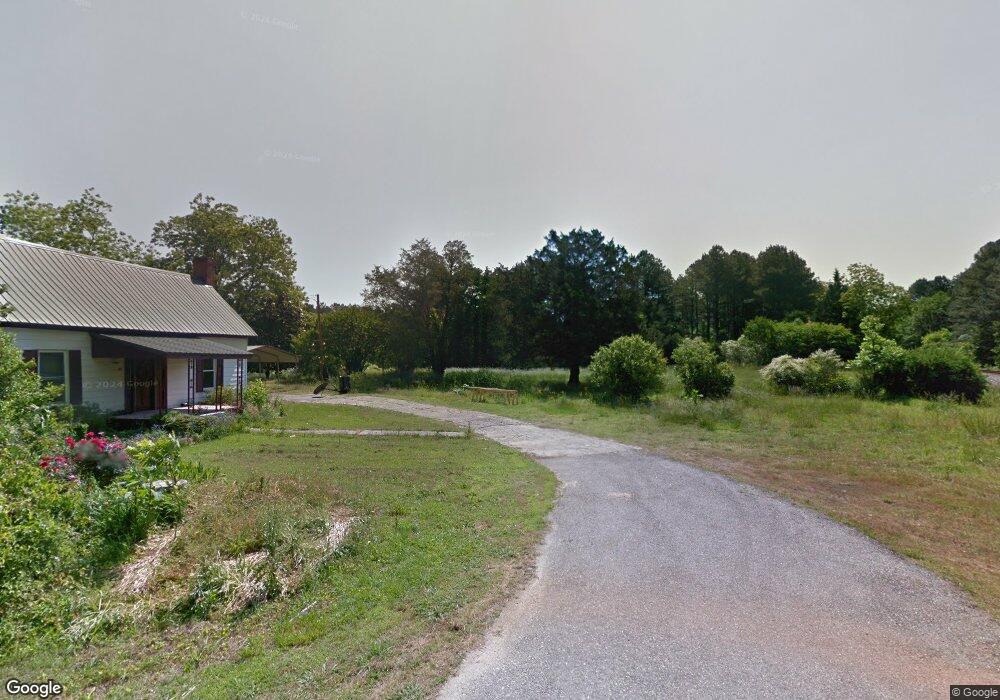
20 Singley Dr Locust Grove, GA 30248
Estimated Value: $275,374 - $456,000
3
Beds
3
Baths
1,800
Sq Ft
$192/Sq Ft
Est. Value
About This Home
This home is located at 20 Singley Dr, Locust Grove, GA 30248 and is currently estimated at $345,594, approximately $191 per square foot. 20 Singley Dr is a home located in Henry County with nearby schools including Unity Grove Elementary School, Locust Grove Middle School, and Locust Grove High School.
Ownership History
Date
Name
Owned For
Owner Type
Purchase Details
Closed on
Apr 4, 2023
Sold by
Hardin John
Bought by
Hutcherson Donald
Current Estimated Value
Purchase Details
Closed on
Dec 19, 2000
Sold by
Yates Willie
Bought by
Hardin John M
Home Financials for this Owner
Home Financials are based on the most recent Mortgage that was taken out on this home.
Original Mortgage
$45,809
Interest Rate
7.81%
Mortgage Type
New Conventional
Purchase Details
Closed on
Aug 28, 1997
Sold by
Dodd William
Bought by
Mccullough Timothy P and Mccullough Lora J
Home Financials for this Owner
Home Financials are based on the most recent Mortgage that was taken out on this home.
Original Mortgage
$99,655
Interest Rate
7.52%
Mortgage Type
New Conventional
Create a Home Valuation Report for This Property
The Home Valuation Report is an in-depth analysis detailing your home's value as well as a comparison with similar homes in the area
Home Values in the Area
Average Home Value in this Area
Purchase History
| Date | Buyer | Sale Price | Title Company |
|---|---|---|---|
| Hutcherson Donald | $55,000 | -- | |
| Hardin John | -- | -- | |
| Hardin John M | $22,500 | -- | |
| Mccullough Timothy P | $104,900 | -- |
Source: Public Records
Mortgage History
| Date | Status | Borrower | Loan Amount |
|---|---|---|---|
| Previous Owner | Hardin John M | $45,809 | |
| Previous Owner | Mccullough Timothy P | $99,655 |
Source: Public Records
Tax History
| Year | Tax Paid | Tax Assessment Tax Assessment Total Assessment is a certain percentage of the fair market value that is determined by local assessors to be the total taxable value of land and additions on the property. | Land | Improvement |
|---|---|---|---|---|
| 2025 | $4,099 | $102,680 | $19,600 | $83,080 |
| 2024 | $4,099 | $22,000 | $3,564 | $18,436 |
| 2023 | $2,414 | $105,800 | $17,000 | $88,800 |
| 2022 | $2,337 | $81,160 | $15,680 | $65,480 |
| 2021 | $2,004 | $67,080 | $13,480 | $53,600 |
| 2020 | $1,866 | $61,240 | $12,680 | $48,560 |
| 2019 | $1,763 | $56,880 | $12,040 | $44,840 |
| 2018 | $1,694 | $53,960 | $11,120 | $42,840 |
| 2016 | $1,446 | $43,720 | $9,800 | $33,920 |
| 2015 | $1,291 | $38,920 | $9,400 | $29,520 |
| 2014 | $978 | $30,800 | $9,400 | $21,400 |
Source: Public Records
Map
Nearby Homes
- 608 Kimberwick Dr
- 540 Davis Rd
- 301 S Singley Dr
- 197 Weymouth Dr
- 61 Weymouth Dr
- 58 Weymouth Dr
- 760 Singley Dr
- 1052 Bodega Loop
- 72 Weymouth Dr
- 78 Weymouth Dr
- 76 Weymouth Dr
- 74 Weymouth Dr
- 70 Weymouth Dr
- 56 Weymouth Dr
- 75 Weymouth Dr
- 73 Weymouth Dr
- 1734 Cadence St
- 1547 Stinson Ln
- 3682 S Ola Rd
- 1700 Cadence St
- 18 Singley Dr
- 45 S Singley Dr
- 5430 Highway 42
- 5436 Highway 42
- 46 S Singley Dr
- 28 Singley Dr
- 5438 Highway 42
- 5438 Georgia 42
- 53 S Singley Dr
- 5428 Georgia 42
- 5428 Highway 42 S
- 24 Singley Dr
- 50 S Singley Dr
- 122 Singley Cir
- 122 Singley Cir Unit 2
- 525 Davis Rd Unit Lot 05
- 34 Singley Dr
- 34 Singley Dr Unit 34
- 34 Singley Dr
- 5440 Highway 42
Your Personal Tour Guide
Ask me questions while you tour the home.