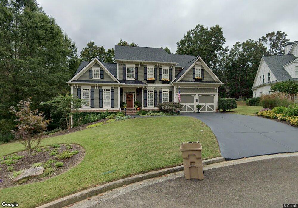
20 Sourwood Cir Dawsonville, GA 30534
Dawson County NeighborhoodEstimated Value: $906,210 - $1,112,000
5
Beds
4
Baths
3,964
Sq Ft
$258/Sq Ft
Est. Value
About This Home
This home is located at 20 Sourwood Cir, Dawsonville, GA 30534 and is currently estimated at $1,023,303, approximately $258 per square foot. 20 Sourwood Cir is a home located in Dawson County with nearby schools including Kilough Elementary School, Dawson County Junior High School, and Dawson County Middle School.
Ownership History
Date
Name
Owned For
Owner Type
Purchase Details
Closed on
Dec 19, 2014
Sold by
Schroeder Charles C
Bought by
Schroeder Barbara L
Current Estimated Value
Purchase Details
Closed on
Jun 19, 2006
Sold by
Eagle Lance L
Bought by
Charles C Schroeder
Purchase Details
Closed on
May 24, 2002
Sold by
Eagle Lance L
Bought by
Eagle Lance L & Tracey A
Purchase Details
Closed on
Dec 17, 2001
Sold by
Chestatee Development Corporation
Bought by
Homes By Williamscraft Inc
Create a Home Valuation Report for This Property
The Home Valuation Report is an in-depth analysis detailing your home's value as well as a comparison with similar homes in the area
Home Values in the Area
Average Home Value in this Area
Purchase History
| Date | Buyer | Sale Price | Title Company |
|---|---|---|---|
| Schroeder Barbara L | $415,580 | -- | |
| Charles C Schroeder | $570,000 | -- | |
| Eagle Lance L & Tracey A | -- | -- | |
| Eagle Lance L | $455,000 | -- | |
| Homes By Williamscraft Inc | $180,000 | -- |
Source: Public Records
Tax History Compared to Growth
Tax History
| Year | Tax Paid | Tax Assessment Tax Assessment Total Assessment is a certain percentage of the fair market value that is determined by local assessors to be the total taxable value of land and additions on the property. | Land | Improvement |
|---|---|---|---|---|
| 2024 | $4,318 | $345,880 | $38,000 | $307,880 |
| 2023 | $4,318 | $339,600 | $38,000 | $301,600 |
| 2022 | $4,371 | $284,240 | $30,000 | $254,240 |
| 2021 | $3,660 | $242,000 | $30,000 | $212,000 |
| 2020 | $3,552 | $230,800 | $24,000 | $206,800 |
| 2019 | $3,643 | $232,640 | $24,000 | $208,640 |
| 2018 | $2,820 | $232,640 | $24,000 | $208,640 |
| 2017 | $2,608 | $188,886 | $29,440 | $159,446 |
| 2016 | $2,519 | $185,178 | $29,440 | $155,738 |
| 2015 | $4,571 | $185,178 | $29,440 | $155,738 |
| 2014 | $4,185 | $166,232 | $29,440 | $136,792 |
| 2013 | -- | $152,516 | $27,200 | $125,316 |
Source: Public Records
Map
Nearby Homes
- 184 Scarlet Oak Ln
- 189 Scarlet Oak Ln
- 135 Scarlet Oak Ln
- 95 Ridgetop Ct
- 503 Night Fire Dr
- 299 Landrum Rd
- 37 Ridgetop Ct
- 121 River Sound Alley
- 147 Blue Heron Bluff
- 116 River Sound Alley
- 25 River Sound Cir
- 194 E Harbor Dr
- 230 E Harbor Dr
- 206 E Harbor Dr
- 9 Fieldstone Ct E
- 472 River Overlook Rd
- 648 Dogwood Way
- 26 Sourwood Cir
- 236 N East Cove
- 202 NE Cove Rd
- 236 NE Cove Rd
- 0 Sourwood Cir Unit 10022145
- 0 Sourwood Cir Unit 8583863
- 0 Landrum Rd Unit 7444573
- 0 Landrum Rd Unit 8553896
- 0 Landrum Rd Unit 7507949
- 156 NE Cove Rd
- 30 Sourwood Cir
- 0 NE Cove Cir Unit 10196981
- 0 NE Cove Cir Unit 7266789
- 0 NE Cove Cir Unit 8438455
- 0 NE Cove Cir Unit 7618853
- 0 NE Cove Cir Unit 3194760
- 0 NE Cove Cir
- 0 NE Cove Rd Unit 7413653
- 0 NE Cove Rd Unit 8834655
- 0 NE Cove Rd Unit 7531482