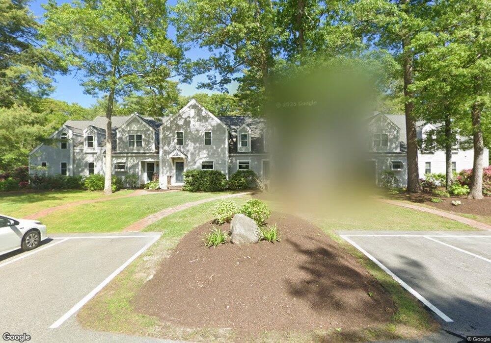
20 Southpoint Dr Sandwich, MA 02563
Estimated Value: $371,000 - $435,000
2
Beds
2
Baths
1,224
Sq Ft
$332/Sq Ft
Est. Value
About This Home
This home is located at 20 Southpoint Dr, Sandwich, MA 02563 and is currently estimated at $406,891, approximately $332 per square foot. 20 Southpoint Dr is a home located in Barnstable County with nearby schools including Sandwich Middle High School and Montessori School of Sandwich.
Ownership History
Date
Name
Owned For
Owner Type
Purchase Details
Closed on
Apr 3, 2021
Sold by
Mckenna Kevin
Bought by
Mckenna Lt
Current Estimated Value
Purchase Details
Closed on
Jan 28, 2016
Sold by
Fnma
Bought by
Mckenna Kevin
Purchase Details
Closed on
Mar 10, 2015
Sold by
Zastrow Horst G and Onewest Bank Na
Bought by
Fhlmc
Purchase Details
Closed on
Mar 19, 1999
Sold by
Hartel Joan A and Hartel Paul J
Bought by
Zastrow Horst G and Jennings Zastrow Gail
Create a Home Valuation Report for This Property
The Home Valuation Report is an in-depth analysis detailing your home's value as well as a comparison with similar homes in the area
Home Values in the Area
Average Home Value in this Area
Purchase History
| Date | Buyer | Sale Price | Title Company |
|---|---|---|---|
| Mckenna Lt | -- | None Available | |
| Mckenna Lt | -- | None Available | |
| Mckenna Kevin | -- | -- | |
| Mckenna Kevin | -- | -- | |
| Fhlmc | $168,500 | -- | |
| Fhlmc | $168,500 | -- | |
| Zastrow Horst G | $108,500 | -- | |
| Zastrow Horst G | $108,500 | -- |
Source: Public Records
Tax History Compared to Growth
Tax History
| Year | Tax Paid | Tax Assessment Tax Assessment Total Assessment is a certain percentage of the fair market value that is determined by local assessors to be the total taxable value of land and additions on the property. | Land | Improvement |
|---|---|---|---|---|
| 2025 | $3,380 | $319,800 | $0 | $319,800 |
| 2024 | $3,283 | $304,000 | $0 | $304,000 |
| 2023 | $3,388 | $294,600 | $0 | $294,600 |
| 2022 | $3,401 | $258,400 | $0 | $258,400 |
| 2021 | $3,270 | $237,500 | $0 | $237,500 |
| 2020 | $3,191 | $223,000 | $0 | $223,000 |
| 2019 | $2,984 | $208,400 | $0 | $208,400 |
| 2018 | $2,935 | $205,400 | $0 | $205,400 |
| 2017 | $2,917 | $195,400 | $0 | $195,400 |
| 2016 | $2,752 | $190,200 | $0 | $190,200 |
| 2015 | $2,765 | $186,600 | $0 | $186,600 |
Source: Public Records
Map
Nearby Homes
- 58 Southpoint Dr Unit J
- 17 Southpoint Dr Unit 17
- 17 Southpoint Dr Unit 17C
- 34 Southpoint Dr
- 5 Aviators Ln
- 84 Harlow Rd
- 3 Glenwood Ln
- 163 Cotuit Rd
- 10 Wintergreen Ln
- 193 Farmersville Rd
- 23 Pimlico Pond Rd
- 15 Hunters Tr
- 15 Hunters Trail
- 46 Holly Ridge Dr
- 93 Deerfield Rd
- 185 Cotuit Rd Unit BE4
- 185 Cotuit Rd Unit JP1
- 185 Cotuit Rd Unit MA 5
- 111 Reflection Dr
- 3 Anne Cir
- 15 Southpoint Dr Unit 15C
- 18 Southpoint Dr
- 16 Southpoint Dr
- 15 Southpoint Dr
- 18 Southpoint Dr Unit C
- 16 Southpoint Dr Unit C
- 18 Southpoint Dr Unit 18C
- 15 Southpoint Dr Unit C
- 20 Southpoint Dr Unit 20
- 15C Southpoint Dr Unit 15C
- 13 Southpoint Dr
- 12 Southpoint Dr
- 11 Southpoint Dr
- 10 Southpoint Dr
- 8 Southpoint Dr
- 10 Southpoint Dr Unit 10B
- 8 Southpoint Dr Unit B
- 8 Southpoint Dr Unit 8B
- 12 Southpoint Dr Unit B
- 11 Southpoint Dr Unit B