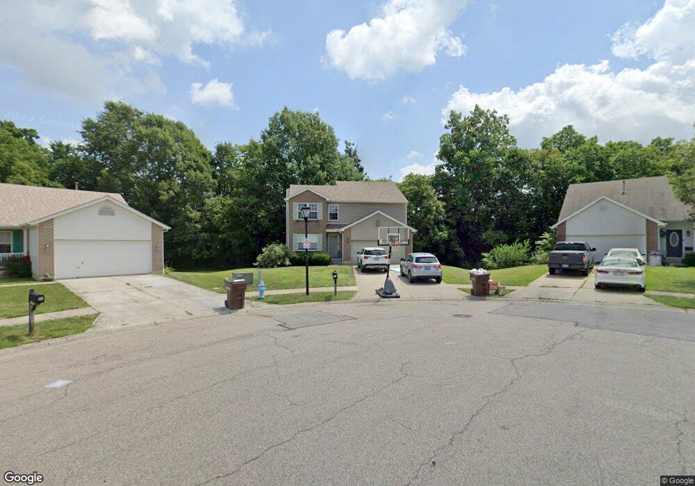
20 Sparrow Ln Amelia, OH 45102
Estimated Value: $304,000 - $337,000
2
Beds
3
Baths
1,900
Sq Ft
$169/Sq Ft
Est. Value
About This Home
This home is located at 20 Sparrow Ln, Amelia, OH 45102 and is currently estimated at $320,539, approximately $168 per square foot. 20 Sparrow Ln is a home located in Clermont County with nearby schools including Amelia Elementary School, West Clermont Middle School, and West Clermont High School.
Ownership History
Date
Name
Owned For
Owner Type
Purchase Details
Closed on
Oct 8, 2025
Sold by
King Glenda Gail and King Paul Jonathan
Bought by
King Paul Jonathan
Current Estimated Value
Purchase Details
Closed on
Jul 21, 2006
Sold by
Miller James and Miller Cynthia
Bought by
King Glenda Gail and King Paul Jonathan
Purchase Details
Closed on
Jun 20, 2005
Sold by
Sfjv 2003 & 1 Llc
Bought by
Miller James and Miller Cynthia
Purchase Details
Closed on
Feb 16, 2005
Sold by
Baumann Joseph D and Baumann Terri M
Bought by
Sfjv & 2003 & 1 Llc
Purchase Details
Closed on
Jan 28, 2003
Sold by
Crossmann Communities Oh
Bought by
Baumann Joseph D and Baumann Terri M
Home Financials for this Owner
Home Financials are based on the most recent Mortgage that was taken out on this home.
Original Mortgage
$162,824
Interest Rate
6.13%
Mortgage Type
FHA
Create a Home Valuation Report for This Property
The Home Valuation Report is an in-depth analysis detailing your home's value as well as a comparison with similar homes in the area
Home Values in the Area
Average Home Value in this Area
Purchase History
| Date | Buyer | Sale Price | Title Company |
|---|---|---|---|
| King Paul Jonathan | -- | None Listed On Document | |
| King Glenda Gail | $142,000 | None Available | |
| Miller James | $135,500 | -- | |
| Sfjv & 2003 & 1 Llc | $103,400 | -- | |
| Baumann Joseph D | $165,380 | -- |
Source: Public Records
Mortgage History
| Date | Status | Borrower | Loan Amount |
|---|---|---|---|
| Previous Owner | Baumann Joseph D | $162,824 |
Source: Public Records
Tax History
| Year | Tax Paid | Tax Assessment Tax Assessment Total Assessment is a certain percentage of the fair market value that is determined by local assessors to be the total taxable value of land and additions on the property. | Land | Improvement |
|---|---|---|---|---|
| 2024 | $4,630 | $90,650 | $14,910 | $75,740 |
| 2023 | $4,637 | $90,650 | $14,910 | $75,740 |
| 2022 | $3,758 | $63,880 | $10,500 | $53,380 |
| 2021 | $3,716 | $63,880 | $10,500 | $53,380 |
| 2020 | $3,717 | $63,880 | $10,500 | $53,380 |
| 2019 | $2,810 | $52,820 | $10,290 | $42,530 |
| 2018 | $2,838 | $52,820 | $10,290 | $42,530 |
| 2017 | $2,880 | $52,820 | $10,290 | $42,530 |
| 2016 | $2,780 | $46,730 | $9,100 | $37,630 |
| 2015 | $2,599 | $46,730 | $9,100 | $37,630 |
| 2014 | $2,597 | $46,730 | $9,100 | $37,630 |
| 2013 | $2,508 | $44,700 | $7,350 | $37,350 |
Source: Public Records
Map
Nearby Homes
- 253 Deer Creek Dr
- 21 Mallard Dr
- 23 Mallard Dr
- 11 Finch Ct
- 27 Heron Dr
- 9 Mynah Dr
- 27 Locustwood Ct
- 8 Robin Way
- 288 Samplewood Ln
- 1538 Denny Dr
- 1554 Denny Dr
- 185 Woodside Park Dr
- 1969 Ohio 125
- 1700 White Birch
- 16 Sperling Dr
- 46 Huntington Ave
- 9 Letitia Ave
- 1821 Ohio 125
- 1613 W Concord Rd
- 65 Wooded Ridge Dr
Your Personal Tour Guide
Ask me questions while you tour the home.