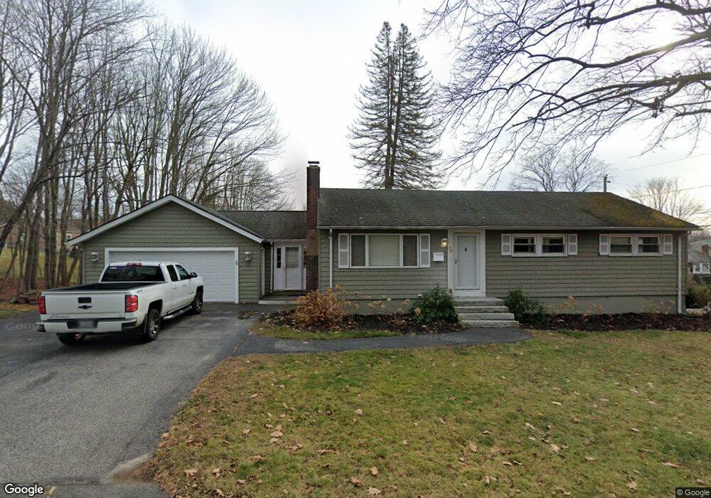
20 Starbird Rd Portland, ME 04102
Nasons Corner NeighborhoodEstimated Value: $506,000 - $672,000
3
Beds
2
Baths
1,264
Sq Ft
$451/Sq Ft
Est. Value
About This Home
This home is located at 20 Starbird Rd, Portland, ME 04102 and is currently estimated at $569,586, approximately $450 per square foot. 20 Starbird Rd is a home located in Cumberland County with nearby schools including Amanda C Rowe School, Lincoln Middle School, and Breakwater School.
Ownership History
Date
Name
Owned For
Owner Type
Purchase Details
Closed on
Aug 21, 2017
Sold by
Roberta D White Ret
Bought by
Cyr Jamie J
Current Estimated Value
Home Financials for this Owner
Home Financials are based on the most recent Mortgage that was taken out on this home.
Original Mortgage
$274,640
Outstanding Balance
$229,166
Interest Rate
3.96%
Mortgage Type
New Conventional
Estimated Equity
$340,420
Create a Home Valuation Report for This Property
The Home Valuation Report is an in-depth analysis detailing your home's value as well as a comparison with similar homes in the area
Home Values in the Area
Average Home Value in this Area
Purchase History
| Date | Buyer | Sale Price | Title Company |
|---|---|---|---|
| Cyr Jamie J | -- | -- |
Source: Public Records
Mortgage History
| Date | Status | Borrower | Loan Amount |
|---|---|---|---|
| Open | Cyr Jamie J | $274,640 |
Source: Public Records
Tax History Compared to Growth
Tax History
| Year | Tax Paid | Tax Assessment Tax Assessment Total Assessment is a certain percentage of the fair market value that is determined by local assessors to be the total taxable value of land and additions on the property. | Land | Improvement |
|---|---|---|---|---|
| 2024 | $6,235 | $415,400 | $80,300 | $335,100 |
| 2023 | $5,986 | $415,400 | $80,300 | $335,100 |
| 2022 | $5,654 | $415,400 | $80,300 | $335,100 |
| 2021 | $5,396 | $415,400 | $80,300 | $335,100 |
| 2020 | $3,881 | $166,500 | $57,500 | $109,000 |
| 2019 | $3,881 | $166,500 | $57,500 | $109,000 |
| 2018 | $3,076 | $166,500 | $57,500 | $109,000 |
| 2017 | $3,605 | $166,500 | $57,500 | $109,000 |
| 2016 | $3,515 | $166,500 | $57,500 | $109,000 |
| 2015 | $3,435 | $166,500 | $57,500 | $109,000 |
| 2014 | $3,330 | $166,500 | $57,500 | $109,000 |
Source: Public Records
Map
Nearby Homes
- 63A Capisic St
- 0 Hillcrest Ave
- 99 Webb St
- 159 Bancroft St
- 1346 Westbrook St
- 1549 Westbrook St
- 7 Dale Ct
- 18 Stoneledge Dr
- 16 Black Sparrow Dr
- 1542 Congress St
- 4 Fairview St
- 37 Tremont St
- 7 Twin Knolls Ln
- 2 Firefly St Unit 303
- 24 Celebration Ct Unit 13
- 1 Firefly St Unit 402
- 1 Firefly St Unit 201
- 1 Firefly St Unit 303
- 1 Firefly St Unit 302
- 1 Firefly St Unit 403/103
- 38 Starbird Rd
- 31 Starbird Rd
- 44 Starbird Rd
- 0 Starbird Unit 868540
- 0 Starbird Unit 2 563451
- 0 Starbird Unit 12 752135
- 0 Starbird Unit 11 752103
- 0 Starbird Unit 10 752069
- 0 Starbird Unit 9 746317
- 0 Starbird Unit 8 746312
- 0 Starbird Unit 7 746302
- 0 Starbird Unit 6 701778
- 0 Starbird Unit 4 701714
- 0 Starbird Unit 5 701739
- 0 Starbird Unit 2 701691
- 0 Starbird Unit 3
- 0 Starbird Unit 1
- 4 Winding Way
- 4 Winding Way
- 400 Capisic St