Estimated Value: $735,000 - $1,217,684
1
Bed
1
Bath
786
Sq Ft
$1,133/Sq Ft
Est. Value
About This Home
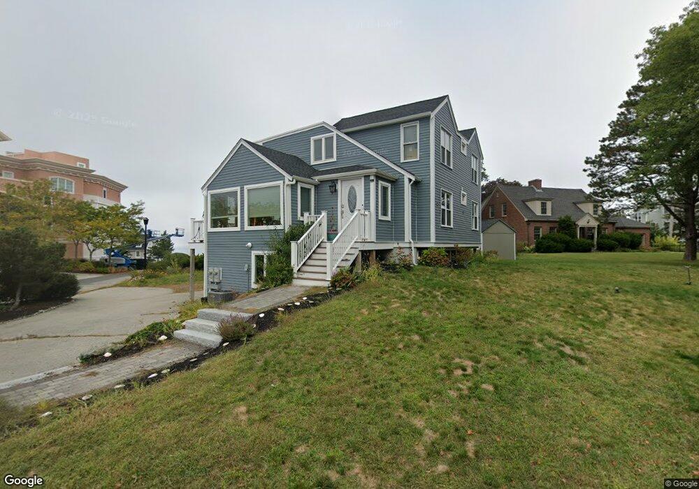
This home is located at 20 State Park Rd Unit 2, Hull, MA 02045 and is currently estimated at $890,421, approximately $1,132 per square foot. 20 State Park Rd Unit 2 is a home located in Plymouth County with nearby schools including Lillian M. Jacobs Elementary School, Memorial Middle School, and Hull High School.
Ownership History
Date
Name
Owned For
Owner Type
Purchase Details
Closed on
Mar 16, 2009
Sold by
Emc Mortgage Corp and First American Asset C
Bought by
Gacicia Philip
Current Estimated Value
Purchase Details
Closed on
Nov 24, 2008
Sold by
Dray David L
Bought by
Emc Mortgage Corp
Purchase Details
Closed on
May 23, 1997
Sold by
Notarangelo John L and Notarangelo Kim M
Bought by
Dray Donna L
Purchase Details
Closed on
Jan 30, 1990
Sold by
Notarangel Laurence
Bought by
Notarangelo John L
Create a Home Valuation Report for This Property
The Home Valuation Report is an in-depth analysis detailing your home's value as well as a comparison with similar homes in the area
Purchase History
| Date | Buyer | Sale Price | Title Company |
|---|---|---|---|
| Gacicia Philip | $227,000 | -- | |
| Emc Mortgage Corp | $386,280 | -- | |
| Dray Donna L | $255,000 | -- | |
| Notarangelo John L | $136,000 | -- | |
| Notarangelo John L | $136,000 | -- |
Source: Public Records
Mortgage History
| Date | Status | Borrower | Loan Amount |
|---|---|---|---|
| Open | Notarangelo John L | $75,000 |
Source: Public Records
Tax History
| Year | Tax Paid | Tax Assessment Tax Assessment Total Assessment is a certain percentage of the fair market value that is determined by local assessors to be the total taxable value of land and additions on the property. | Land | Improvement |
|---|---|---|---|---|
| 2025 | $11,696 | $1,044,300 | $310,200 | $734,100 |
| 2024 | $11,434 | $981,500 | $299,500 | $682,000 |
| 2023 | $8,866 | $728,500 | $255,900 | $472,600 |
| 2022 | $7,708 | $614,700 | $236,200 | $378,500 |
| 2021 | $5,691 | $448,800 | $196,800 | $252,000 |
| 2020 | $5,473 | $426,900 | $196,800 | $230,100 |
| 2019 | $5,460 | $418,400 | $188,300 | $230,100 |
| 2018 | $5,177 | $394,400 | $188,300 | $206,100 |
| 2017 | $5,177 | $377,300 | $171,200 | $206,100 |
| 2016 | $4,967 | $368,500 | $171,200 | $197,300 |
| 2015 | $4,586 | $329,000 | $145,500 | $183,500 |
| 2014 | $4,563 | $329,000 | $145,500 | $183,500 |
Source: Public Records
Map
Nearby Homes
- 1 Longbeach Ave Unit 202
- 6 State Park Rd Unit 2
- 62 Oceanside Dr
- 120 Nantasket Ave Unit 207
- 120 Nantasket Ave Unit 204
- 120 Nantasket Ave Unit 304
- 120 Nantasket Ave Unit PH5
- 120 Nantasket Ave Unit 201
- 99 Nantasket Ave
- 121 Nantasket Ave Unit 503
- 22 Berkley Rd Unit B
- 10 Berkley Rd Unit A
- 0 Seaview Ave
- 23 Wyola Rd
- 37 Richards Rd
- 181 Atlantic Ave
- 6 Montana Ave
- 155 George Washington Blvd Unit 210
- 10 Chestnut Place
- 2 Cliff Rd
- 20 State Park Rd
- 6 Longbeach Ave
- 23 State Park Rd
- 19 State Park Rd
- 25 State Park Rd
- 21 State Park Rd
- 1 Longbeach Ave Unit 404
- 1 Longbeach Ave Unit 403
- 1 Longbeach Ave Unit 402
- 1 Longbeach Ave Unit 401
- 1 Longbeach Ave Unit 304
- 1 Longbeach Ave Unit 303
- 1 Longbeach Ave Unit 301
- 1 Longbeach Ave Unit 204
- 1 Longbeach Ave Unit 203
- 1 Longbeach Ave Unit 201
- 1 Longbeach Ave Unit 104
- 1 Longbeach Ave Unit 103
- 1 Longbeach Ave Unit 102
- 1 Longbeach Ave Unit 101
Your Personal Tour Guide
Ask me questions while you tour the home.