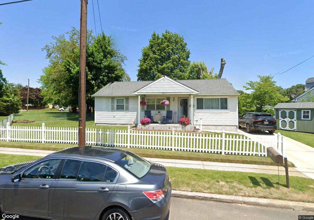
20 Station Ave Somerdale, NJ 08083
Estimated Value: $272,993 - $297,000
--
Bed
--
Bath
1,008
Sq Ft
$288/Sq Ft
Est. Value
About This Home
This home is located at 20 Station Ave, Somerdale, NJ 08083 and is currently estimated at $290,498, approximately $288 per square foot. 20 Station Ave is a home located in Camden County with nearby schools including Somerdale Park School, Sterling High School, and Saint John Paul II Regional School.
Ownership History
Date
Name
Owned For
Owner Type
Purchase Details
Closed on
May 1, 2007
Sold by
Casarow John A and Herman Anthony M
Bought by
Herman Carol L
Current Estimated Value
Purchase Details
Closed on
Feb 27, 2001
Sold by
Concepcion Gladys
Bought by
Herman Anthony M and Herman Carol L
Home Financials for this Owner
Home Financials are based on the most recent Mortgage that was taken out on this home.
Original Mortgage
$83,700
Interest Rate
7.15%
Mortgage Type
FHA
Create a Home Valuation Report for This Property
The Home Valuation Report is an in-depth analysis detailing your home's value as well as a comparison with similar homes in the area
Home Values in the Area
Average Home Value in this Area
Purchase History
| Date | Buyer | Sale Price | Title Company |
|---|---|---|---|
| Herman Carol L | $22,500 | -- | |
| Herman Anthony M | $84,400 | -- |
Source: Public Records
Mortgage History
| Date | Status | Borrower | Loan Amount |
|---|---|---|---|
| Previous Owner | Herman Anthony M | $83,700 |
Source: Public Records
Tax History Compared to Growth
Tax History
| Year | Tax Paid | Tax Assessment Tax Assessment Total Assessment is a certain percentage of the fair market value that is determined by local assessors to be the total taxable value of land and additions on the property. | Land | Improvement |
|---|---|---|---|---|
| 2025 | $4,992 | $107,100 | $40,800 | $66,300 |
| 2024 | $4,778 | $107,100 | $40,800 | $66,300 |
| 2023 | $4,778 | $107,100 | $40,800 | $66,300 |
| 2022 | $4,574 | $107,100 | $40,800 | $66,300 |
| 2021 | $4,348 | $107,100 | $40,800 | $66,300 |
| 2020 | $4,584 | $107,100 | $40,800 | $66,300 |
| 2019 | $4,500 | $107,100 | $40,800 | $66,300 |
| 2018 | $4,611 | $107,100 | $40,800 | $66,300 |
| 2017 | $4,561 | $107,100 | $40,800 | $66,300 |
| 2016 | $4,435 | $107,100 | $40,800 | $66,300 |
| 2015 | $4,372 | $107,100 | $40,800 | $66,300 |
| 2014 | $4,190 | $107,100 | $40,800 | $66,300 |
Source: Public Records
Map
Nearby Homes
- 26 Station Ave
- 113 Harvard Ave
- 124 Cornell Ave
- 121 Union Ave
- 7 Wright Ave
- 1800 S Burnt Mill Rd
- 401 S Browning Ave
- 1135 Gibbsboro Rd
- 7 Sidney Ln
- 1309 Locust Ave
- 37 Dunhill Dr
- 123 Whitman Ave
- 804 S Burnt Mill Rd
- 120 Webster Ave
- 505 N Atlantic Ave E
- 1100 Rural Ave
- 207 Lucas Ln
- 123 Dartmouth Ave
- 5102 Tracy Ct
- 1193 Kirkwood-Gibbsboro R
- 5 Colgate Ave
- 7 Colgate Ave
- 15 Harvard Ave
- 1 Harvard Ave
- 11 Station Ave
- 13 Station Ave
- 7 Station Ave
- 15 Station Ave
- 5 Station Ave
- 17 Station Ave
- 1208 S Browning Ave
- 3 Station Ave
- 18 Harvard Ave
- 19 Station Ave
- 10 Harvard Ave
- 1109 S Browning Ave
- 1 Station Ave
- 109 Colgate Ave
- 21 Station Ave
- 104 Colgate Ave