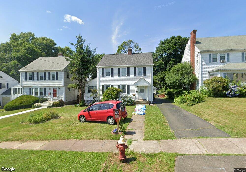
20 Stillman Rd Wethersfield, CT 06109
Estimated Value: $376,000 - $410,000
3
Beds
6
Baths
1,592
Sq Ft
$249/Sq Ft
Est. Value
About This Home
This home is located at 20 Stillman Rd, Wethersfield, CT 06109 and is currently estimated at $396,374, approximately $248 per square foot. 20 Stillman Rd is a home located in Hartford County with nearby schools including Charles Wright School, Silas Deane Middle School, and Wethersfield High School.
Ownership History
Date
Name
Owned For
Owner Type
Purchase Details
Closed on
Feb 26, 2010
Sold by
Greiner Neil Allen and Greiner Veronica
Bought by
Rivers Chandra N and Rivers Michael
Current Estimated Value
Home Financials for this Owner
Home Financials are based on the most recent Mortgage that was taken out on this home.
Original Mortgage
$175,900
Outstanding Balance
$117,338
Interest Rate
5.11%
Estimated Equity
$279,036
Purchase Details
Closed on
Dec 3, 1998
Sold by
Est Mcgann Margaret E and Mcgann John F
Bought by
Greiner Neil Allen and Greiner Veronica
Home Financials for this Owner
Home Financials are based on the most recent Mortgage that was taken out on this home.
Original Mortgage
$87,900
Interest Rate
6.68%
Create a Home Valuation Report for This Property
The Home Valuation Report is an in-depth analysis detailing your home's value as well as a comparison with similar homes in the area
Home Values in the Area
Average Home Value in this Area
Purchase History
| Date | Buyer | Sale Price | Title Company |
|---|---|---|---|
| Rivers Chandra N | $219,900 | -- | |
| Greiner Neil Allen | $109,900 | -- |
Source: Public Records
Mortgage History
| Date | Status | Borrower | Loan Amount |
|---|---|---|---|
| Open | Greiner Neil Allen | $175,900 | |
| Previous Owner | Greiner Neil Allen | $87,900 | |
| Closed | Greiner Neil Allen | $10,990 |
Source: Public Records
Tax History Compared to Growth
Tax History
| Year | Tax Paid | Tax Assessment Tax Assessment Total Assessment is a certain percentage of the fair market value that is determined by local assessors to be the total taxable value of land and additions on the property. | Land | Improvement |
|---|---|---|---|---|
| 2025 | $9,155 | $222,090 | $63,830 | $158,260 |
| 2024 | $6,675 | $154,450 | $58,090 | $96,360 |
| 2023 | $6,453 | $154,450 | $58,090 | $96,360 |
| 2022 | $6,345 | $154,450 | $58,090 | $96,360 |
| 2021 | $6,281 | $154,450 | $58,090 | $96,360 |
| 2020 | $6,285 | $154,450 | $58,090 | $96,360 |
| 2019 | $6,292 | $154,450 | $58,090 | $96,360 |
| 2018 | $6,411 | $157,200 | $55,900 | $101,300 |
| 2017 | $6,252 | $157,200 | $55,900 | $101,300 |
| 2016 | $6,058 | $157,200 | $55,900 | $101,300 |
| 2015 | $6,003 | $157,200 | $55,900 | $101,300 |
| 2014 | $5,776 | $157,200 | $55,900 | $101,300 |
Source: Public Records
Map
Nearby Homes
- 24 Stillman Rd
- 52 Stillman Rd
- 70 Stillman Rd
- 53 Wolcott Hill Rd Unit C23
- 126 Tredeau St
- 393 Campfield Ave
- 839 Wethersfield Ave
- 281 Brown St
- 19 Albert Ave
- 18 Avalon Place
- 23 Highview Ave
- 167 Campfield Ave
- 9 Avalon Place
- 80 Spruce St
- 183 Preston St Unit 185
- 49 Ridge Rd Unit 49
- 90 Salem St
- 405 W Preston St Unit 407
- 107 Amherst St
- 14 Fernwood St
- 16 Stillman Rd
- 28 Stillman Rd
- 12 Stillman Rd
- 157 Victoria Rd
- 8 Stillman Rd
- 32 Stillman Rd
- 161 Victoria Rd
- 153 Victoria Rd
- 167 Victoria Rd
- 147 Victoria Rd
- 171 Victoria Rd
- 36 Stillman Rd
- 4 Stillman Rd
- 21 Stillman Rd
- 141 Victoria Rd
- 15 Stillman Rd
- 23 Stillman Rd
- 175 Victoria Rd
- 13 Stillman Rd
- 27 Stillman Rd