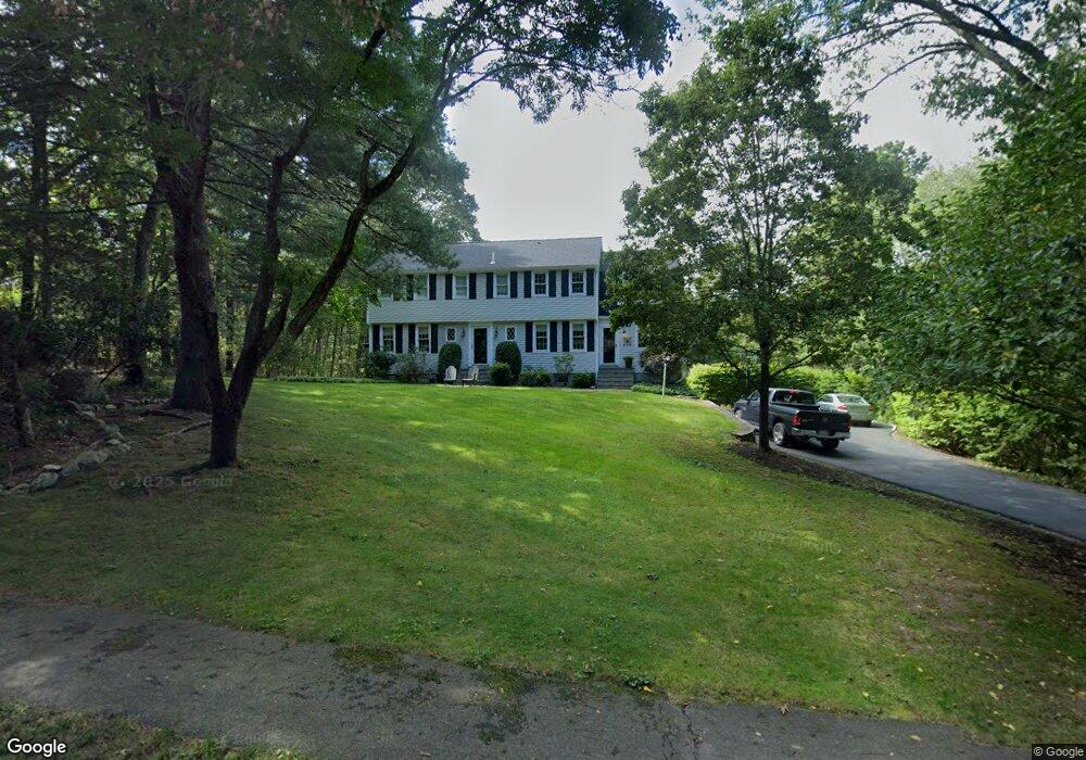
20 Stoneybrook Rd Sherborn, MA 01770
Estimated Value: $1,254,341 - $1,330,000
5
Beds
3
Baths
2,998
Sq Ft
$431/Sq Ft
Est. Value
About This Home
This home is located at 20 Stoneybrook Rd, Sherborn, MA 01770 and is currently estimated at $1,291,085, approximately $430 per square foot. 20 Stoneybrook Rd is a home located in Middlesex County with nearby schools including Pine Hill Elementary School, Dover-Sherborn Regional Middle School, and Dover-Sherborn Regional High School.
Ownership History
Date
Name
Owned For
Owner Type
Purchase Details
Closed on
Sep 16, 2005
Sold by
Mcbride Robert C and Mcbride Robert Creig
Bought by
Mastrobuono Elviro James and Mastrobuono Laura E
Current Estimated Value
Home Financials for this Owner
Home Financials are based on the most recent Mortgage that was taken out on this home.
Original Mortgage
$250,000
Outstanding Balance
$132,844
Interest Rate
5.84%
Mortgage Type
Purchase Money Mortgage
Estimated Equity
$1,158,241
Create a Home Valuation Report for This Property
The Home Valuation Report is an in-depth analysis detailing your home's value as well as a comparison with similar homes in the area
Home Values in the Area
Average Home Value in this Area
Purchase History
| Date | Buyer | Sale Price | Title Company |
|---|---|---|---|
| Mastrobuono Elviro James | $795,000 | -- |
Source: Public Records
Mortgage History
| Date | Status | Borrower | Loan Amount |
|---|---|---|---|
| Open | Mastrobuono Elviro James | $250,000 |
Source: Public Records
Tax History Compared to Growth
Tax History
| Year | Tax Paid | Tax Assessment Tax Assessment Total Assessment is a certain percentage of the fair market value that is determined by local assessors to be the total taxable value of land and additions on the property. | Land | Improvement |
|---|---|---|---|---|
| 2025 | $18,997 | $1,145,800 | $450,900 | $694,900 |
| 2024 | $17,777 | $1,048,800 | $450,900 | $597,900 |
| 2023 | $16,135 | $895,900 | $450,900 | $445,000 |
| 2022 | $15,374 | $807,900 | $440,900 | $367,000 |
| 2021 | $7,042 | $778,900 | $440,900 | $338,000 |
| 2020 | $15,157 | $778,900 | $440,900 | $338,000 |
| 2019 | $15,194 | $774,400 | $440,900 | $333,500 |
| 2018 | $5,912 | $763,300 | $440,900 | $322,400 |
| 2017 | $14,797 | $723,200 | $440,900 | $282,300 |
| 2016 | $14,736 | $716,400 | $440,900 | $275,500 |
| 2015 | $14,545 | $715,800 | $435,900 | $279,900 |
| 2014 | $13,868 | $681,800 | $415,900 | $265,900 |
Source: Public Records
Map
Nearby Homes
- 220 S Main St
- 20 Nason Hill Rd
- 7 Fawn Rd
- 2 Surrey Ln
- 14 Sewall Brook Ln
- 38 Bullard St
- 54 Spywood Rd
- 00000 S Main St and Bullard St
- 27 Spywood Rd
- 21 Spywood Rd
- 65 Farm Road Lot 6
- 61 Old Orchard Rd
- 4 Green Ln
- 121 Bullard St
- 18 Wildwood Dr
- 6 Brook St
- 2 Towne Lyne Rd
- 114 Farm St
- 84 Middlesex St
- 30 Powderhorn Ln
- 24 Stoneybrook Rd
- 16 Stoneybrook Rd
- 21 Stoneybrook Rd
- 26 Stoneybrook Rd
- 14 Stoneybrook Rd
- 15 Stoneybrook Rd
- 23 Stoneybrook Rd
- 11 Stoneybrook Rd
- 27 Stoneybrook Rd
- 30 Stoneybrook Rd
- 10 Stoneybrook Rd
- 30 Stoney Brook Rd
- 29 Stoneybrook Rd
- 5 Stoneybrook Rd
- 180 S Main St
- 176 S Main St
- 6 Stoney Brook Rd
- 36 Stoneybrook Rd
- 174 S Main St
- 8 Stoneybrook Rd