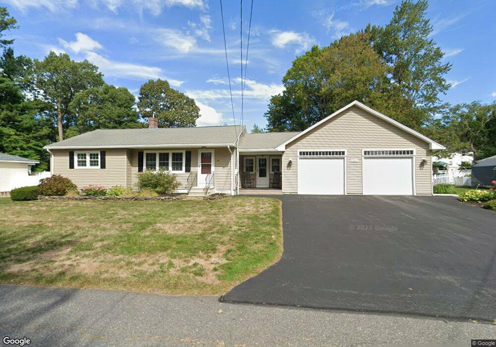
20 Stuart Ct Leominster, MA 01453
Estimated Value: $468,899 - $551,000
2
Beds
2
Baths
1,368
Sq Ft
$371/Sq Ft
Est. Value
About This Home
This home is located at 20 Stuart Ct, Leominster, MA 01453 and is currently estimated at $507,475, approximately $370 per square foot. 20 Stuart Ct is a home located in Worcester County with nearby schools including Leominster High School, St Bernards Elementary School, and St. Leo School.
Ownership History
Date
Name
Owned For
Owner Type
Purchase Details
Closed on
Sep 17, 2010
Sold by
Persuitte Daniel E and Rivera Nahir E
Bought by
Belliveau Leandre J and Belliveau Ann
Current Estimated Value
Home Financials for this Owner
Home Financials are based on the most recent Mortgage that was taken out on this home.
Original Mortgage
$75,000
Outstanding Balance
$49,718
Interest Rate
4.44%
Estimated Equity
$457,757
Purchase Details
Closed on
Mar 17, 2008
Sold by
Chaban Donald S
Bought by
Persuitte Daniel E and Rivera Nahir E
Home Financials for this Owner
Home Financials are based on the most recent Mortgage that was taken out on this home.
Original Mortgage
$267,387
Interest Rate
5.72%
Mortgage Type
Purchase Money Mortgage
Purchase Details
Closed on
Jan 27, 2003
Sold by
Gaulin Denise P
Bought by
Chaban Donald S
Home Financials for this Owner
Home Financials are based on the most recent Mortgage that was taken out on this home.
Original Mortgage
$205,000
Interest Rate
6.11%
Mortgage Type
Purchase Money Mortgage
Purchase Details
Closed on
May 31, 2000
Sold by
Est Pucillo Helen M and Pucillo Nancy
Bought by
Cote Denise P
Home Financials for this Owner
Home Financials are based on the most recent Mortgage that was taken out on this home.
Original Mortgage
$112,000
Interest Rate
8.14%
Mortgage Type
Purchase Money Mortgage
Create a Home Valuation Report for This Property
The Home Valuation Report is an in-depth analysis detailing your home's value as well as a comparison with similar homes in the area
Home Values in the Area
Average Home Value in this Area
Purchase History
| Date | Buyer | Sale Price | Title Company |
|---|---|---|---|
| Belliveau Leandre J | $210,000 | -- | |
| Persuitte Daniel E | $269,500 | -- | |
| Chaban Donald S | $220,000 | -- | |
| Cote Denise P | $140,000 | -- |
Source: Public Records
Mortgage History
| Date | Status | Borrower | Loan Amount |
|---|---|---|---|
| Open | Cote Denise P | $75,000 | |
| Previous Owner | Persuitte Daniel E | $267,387 | |
| Previous Owner | Cote Denise P | $205,000 | |
| Previous Owner | Cote Denise P | $148,800 | |
| Previous Owner | Cote Denise P | $112,000 |
Source: Public Records
Tax History
| Year | Tax Paid | Tax Assessment Tax Assessment Total Assessment is a certain percentage of the fair market value that is determined by local assessors to be the total taxable value of land and additions on the property. | Land | Improvement |
|---|---|---|---|---|
| 2025 | $6,140 | $437,600 | $135,400 | $302,200 |
| 2024 | $5,917 | $407,800 | $129,000 | $278,800 |
| 2023 | $5,739 | $369,300 | $112,100 | $257,200 |
| 2022 | $5,514 | $333,000 | $97,500 | $235,500 |
| 2021 | $5,334 | $294,200 | $75,900 | $218,300 |
| 2020 | $5,106 | $284,000 | $75,900 | $208,100 |
| 2019 | $4,878 | $263,100 | $72,300 | $190,800 |
| 2018 | $4,749 | $245,700 | $70,200 | $175,500 |
| 2017 | $4,451 | $225,600 | $65,500 | $160,100 |
| 2016 | $4,266 | $217,900 | $65,500 | $152,400 |
| 2015 | $4,049 | $208,300 | $65,500 | $142,800 |
| 2014 | $3,867 | $204,700 | $70,100 | $134,600 |
Source: Public Records
Map
Nearby Homes
- 87 Norwood Ave
- 37 Wallis Park
- 1177 Main St
- 3 Rennie St
- 24 North St
- 26 Claflin St
- 365 Hollis Rd
- 17 Fernwood Dr Unit D
- 45 Fox Meadow Rd Unit F
- 795 Leominster Rd
- 381 Summer St
- 0 Summer St
- 75 Dale Ave
- 1130 Water St
- 2 Arden Mills Way Unit 2304
- 77 Electric Ave
- 57 Liberty St Unit 2
- 146-148 Kilburn St
- 363 Lunenburg St
- 93 Benjamin St
Your Personal Tour Guide
Ask me questions while you tour the home.