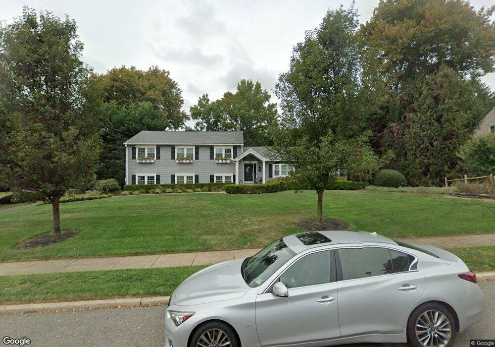
20 Sugar Maple Dr Red Bank, NJ 07701
New Monmouth NeighborhoodEstimated Value: $970,599 - $1,223,000
--
Bed
--
Bath
2,498
Sq Ft
$431/Sq Ft
Est. Value
About This Home
This home is located at 20 Sugar Maple Dr, Red Bank, NJ 07701 and is currently estimated at $1,076,650, approximately $431 per square foot. 20 Sugar Maple Dr is a home located in Monmouth County with nearby schools including Nut Swamp Elementary School, Thompson Middle School, and Middletown - South High School.
Ownership History
Date
Name
Owned For
Owner Type
Purchase Details
Closed on
Jan 10, 2014
Sold by
Martin Steve and Martin Jodi A
Bought by
Martin Steven A
Current Estimated Value
Home Financials for this Owner
Home Financials are based on the most recent Mortgage that was taken out on this home.
Original Mortgage
$417,000
Outstanding Balance
$315,536
Interest Rate
4.45%
Mortgage Type
New Conventional
Estimated Equity
$761,114
Purchase Details
Closed on
Jun 14, 2004
Sold by
Cohen Martin
Bought by
Martin Steve and Martin Jodi
Create a Home Valuation Report for This Property
The Home Valuation Report is an in-depth analysis detailing your home's value as well as a comparison with similar homes in the area
Home Values in the Area
Average Home Value in this Area
Purchase History
| Date | Buyer | Sale Price | Title Company |
|---|---|---|---|
| Martin Steven A | -- | New Jersey Land Title | |
| Martin Steve | $520,000 | -- |
Source: Public Records
Mortgage History
| Date | Status | Borrower | Loan Amount |
|---|---|---|---|
| Open | Martin Steven A | $417,000 |
Source: Public Records
Tax History Compared to Growth
Tax History
| Year | Tax Paid | Tax Assessment Tax Assessment Total Assessment is a certain percentage of the fair market value that is determined by local assessors to be the total taxable value of land and additions on the property. | Land | Improvement |
|---|---|---|---|---|
| 2025 | $13,209 | $815,700 | $463,600 | $352,100 |
| 2024 | $12,854 | $803,000 | $457,300 | $345,700 |
| 2023 | $12,854 | $739,600 | $392,200 | $347,400 |
| 2022 | $11,232 | $619,500 | $288,700 | $330,800 |
| 2021 | $11,232 | $540,000 | $241,600 | $298,400 |
| 2020 | $11,400 | $533,200 | $241,600 | $291,600 |
| 2019 | $11,255 | $532,900 | $241,600 | $291,300 |
| 2018 | $11,253 | $519,300 | $241,600 | $277,700 |
| 2017 | $10,930 | $514,600 | $241,600 | $273,000 |
| 2016 | $9,956 | $467,200 | $226,600 | $240,600 |
| 2015 | $9,744 | $456,200 | $226,600 | $229,600 |
| 2014 | $9,553 | $436,400 | $226,600 | $209,800 |
Source: Public Records
Map
Nearby Homes
- 11 Mayflower Dr
- 24 Princeton St
- 74 Fish Hawk Dr
- 8 Allston St
- 0 Hamiltonian Dr Unit 22514980
- 44 Monroe St
- 164 Heights Terrace
- 17 Terry Ln
- 304 April Way Unit 304
- 211 April Way Unit 211
- 20 Devon Rd
- 833 Lincoln St
- 163 Lexington Ct
- 143 Lexington Ct
- 109 Lexington Ct
- 83 Green Meadow Blvd
- 911 Middletown Lincroft Rd
- 93 Twin Brooks Ave
- 126 Manchester Ct
- 19 Manchester Ct
- 16 Sugar Maple Dr
- 7 Mayflower Dr
- 15 Sugar Maple Dr
- 15 Mayflower Dr
- 11 Sugar Maple Dr
- 28 Sugar Maple Dr
- 19 Sugar Maple Dr
- 12 Sugar Maple Dr
- 3 Mayflower Dr
- 7 Sugar Maple Dr
- 12 Mayflower Dr
- 24 Fireside Rd
- 8 Mayflower Dr
- 23 Sugar Maple Dr
- 8 Sugar Maple Dr
- 16 Mayflower Dr
- 28 Fireside Rd
- 27 Sugar Maple Dr
- 4 Mayflower Dr
- 20 Mayflower Dr