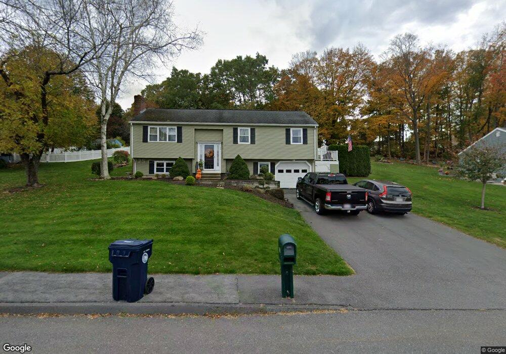
20 Tassi Dr Marlborough, MA 01752
French Hill NeighborhoodEstimated Value: $636,149 - $894,000
4
Beds
2
Baths
1,900
Sq Ft
$375/Sq Ft
Est. Value
About This Home
This home is located at 20 Tassi Dr, Marlborough, MA 01752 and is currently estimated at $713,287, approximately $375 per square foot. 20 Tassi Dr is a home located in Middlesex County with nearby schools including Marlborough High School, New Covenant Christian School, and Glenhaven Academy - JRI School.
Ownership History
Date
Name
Owned For
Owner Type
Purchase Details
Closed on
May 29, 2015
Sold by
Braswell Donald and Braswell Juanita C
Bought by
Braswell Ft and Braswell Donald
Current Estimated Value
Purchase Details
Closed on
Sep 10, 2007
Sold by
Sack Amy and Sack Michael
Bought by
Braswell Donald and Braswell Juanita C
Home Financials for this Owner
Home Financials are based on the most recent Mortgage that was taken out on this home.
Original Mortgage
$275,625
Interest Rate
6.74%
Mortgage Type
Purchase Money Mortgage
Purchase Details
Closed on
Jul 1, 1998
Sold by
Chaves Jose M and Chaves Beatrice
Bought by
Sack Michael and Sack Amy
Purchase Details
Closed on
Mar 5, 1996
Sold by
Avila Gil M and Avila Ameila M
Bought by
Chaves Jose M and Chaves Beatrice
Purchase Details
Closed on
Jul 1, 1987
Sold by
Durkin Thomas
Bought by
Avila Gil M
Create a Home Valuation Report for This Property
The Home Valuation Report is an in-depth analysis detailing your home's value as well as a comparison with similar homes in the area
Home Values in the Area
Average Home Value in this Area
Purchase History
| Date | Buyer | Sale Price | Title Company |
|---|---|---|---|
| Braswell Ft | -- | -- | |
| Braswell Donald | $367,500 | -- | |
| Sack Michael | $191,000 | -- | |
| Chaves Jose M | $150,000 | -- | |
| Avila Gil M | $179,000 | -- |
Source: Public Records
Mortgage History
| Date | Status | Borrower | Loan Amount |
|---|---|---|---|
| Previous Owner | Braswell Donald | $275,625 | |
| Previous Owner | Avila Gil M | $210,000 | |
| Previous Owner | Avila Gil M | $188,000 |
Source: Public Records
Tax History Compared to Growth
Tax History
| Year | Tax Paid | Tax Assessment Tax Assessment Total Assessment is a certain percentage of the fair market value that is determined by local assessors to be the total taxable value of land and additions on the property. | Land | Improvement |
|---|---|---|---|---|
| 2025 | $5,862 | $594,500 | $262,200 | $332,300 |
| 2024 | $5,697 | $556,300 | $238,400 | $317,900 |
| 2023 | $5,932 | $514,000 | $195,700 | $318,300 |
| 2022 | $5,778 | $440,400 | $186,300 | $254,100 |
| 2021 | $5,592 | $405,200 | $158,200 | $247,000 |
| 2020 | $5,411 | $381,600 | $145,300 | $236,300 |
| 2019 | $5,278 | $375,100 | $142,400 | $232,700 |
| 2018 | $5,355 | $366,000 | $123,400 | $242,600 |
| 2017 | $5,293 | $345,500 | $120,700 | $224,800 |
| 2016 | $5,182 | $337,800 | $120,700 | $217,100 |
| 2015 | -- | $301,400 | $129,900 | $171,500 |
Source: Public Records
Map
Nearby Homes
- 67 Hunter Ave
- 53 Russell St
- 14 Calder St
- 71 Hudson St
- 29 Elm St
- 4 Quinn Rd
- 52 Norwood St
- 73 Howland St
- 287 Elm St
- 582 Pleasant St
- 36 Chestnut St
- 27 Jefferson St
- 27 Jefferson St Unit 204
- 132 Prospect St
- 315 Bolton St
- 110 Prospect St
- 156 Chestnut St
- 82 Brimsmead St
- 280 Elm St Unit A6
- 272 Lincoln St Unit 102