Estimated Value: $206,000 - $233,000
3
Beds
2
Baths
1,580
Sq Ft
$137/Sq Ft
Est. Value
About This Home
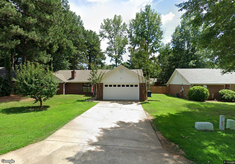
This home is located at 20 Timber Ln, Cabot, AR 72023 and is currently estimated at $217,236, approximately $137 per square foot. 20 Timber Ln is a home located in Lonoke County with nearby schools including Central Elementary School, Cabot Junior High South, and Cabot Middle School South.
Ownership History
Date
Name
Owned For
Owner Type
Purchase Details
Closed on
Oct 15, 2020
Sold by
Flowers Michael Patrick and Lindsey Erin
Bought by
Flowers Michael Patrick and Flowers Lindsey Erin
Current Estimated Value
Purchase Details
Closed on
Oct 1, 2020
Sold by
Flowers Michael Patrick and Flowers Lindsey Erin
Bought by
Flowers Michael Patrick and Flowers Lindsey Erin
Purchase Details
Closed on
Jul 25, 2016
Sold by
Hughes Homer Bruce and Hughes Geraldine Therese
Bought by
Flowers Michael Patrick
Home Financials for this Owner
Home Financials are based on the most recent Mortgage that was taken out on this home.
Original Mortgage
$125,000
Interest Rate
3.54%
Mortgage Type
VA
Purchase Details
Closed on
Mar 25, 2015
Sold by
Hughes Homer Bruce and Hughes Therese
Bought by
Hughes Homer Bruce and Hughes Therese Geraldine
Purchase Details
Closed on
Jul 15, 1994
Bought by
Flowers and Wife Geraldine
Purchase Details
Closed on
Feb 2, 1994
Bought by
Sentell
Create a Home Valuation Report for This Property
The Home Valuation Report is an in-depth analysis detailing your home's value as well as a comparison with similar homes in the area
Purchase History
| Date | Buyer | Sale Price | Title Company |
|---|---|---|---|
| Flowers Michael Patrick | -- | None Listed On Document | |
| Flowers Michael Patrick | -- | None Available | |
| Flowers Michael Patrick | $125,000 | Realty Title | |
| Flowers Michael P | $125,000 | Realty Title Inc | |
| Hughes Homer Bruce | -- | None Available | |
| Flowers | $86,000 | -- | |
| Flowers | $86,000 | -- | |
| Sentell | $10,000 | -- |
Source: Public Records
Mortgage History
| Date | Status | Borrower | Loan Amount |
|---|---|---|---|
| Previous Owner | Flowers Michael P | $125,000 |
Source: Public Records
Tax History
| Year | Tax Paid | Tax Assessment Tax Assessment Total Assessment is a certain percentage of the fair market value that is determined by local assessors to be the total taxable value of land and additions on the property. | Land | Improvement |
|---|---|---|---|---|
| 2025 | $853 | $25,100 | $2,800 | $22,300 |
| 2024 | $853 | $25,100 | $2,800 | $22,300 |
| 2023 | $853 | $25,100 | $2,800 | $22,300 |
| 2022 | $903 | $25,100 | $2,800 | $22,300 |
| 2021 | $846 | $25,100 | $2,800 | $22,300 |
| 2020 | $788 | $22,850 | $2,800 | $20,050 |
| 2019 | $788 | $22,850 | $2,800 | $20,050 |
| 2018 | $779 | $22,850 | $2,800 | $20,050 |
| 2017 | $1,049 | $22,850 | $2,800 | $20,050 |
| 2016 | $779 | $22,850 | $2,800 | $20,050 |
| 2015 | $764 | $22,550 | $2,800 | $19,750 |
| 2014 | $764 | $22,550 | $2,800 | $19,750 |
Source: Public Records
Map
Nearby Homes
- 34 Bent Tree Dr
- 40 Bent Tree Dr
- 92 Sycamore Cir
- 00 Plaza Blvd
- 37 Pond St
- 49 Oak Meadows Dr
- 57 Meadowlark Dr
- 51 Meadowlark Dr
- 16 Meadowlark Dr
- 19 Sycamore St
- 20 Paige Ave
- 23 Robinson St
- 28 Pheasant Run Dr
- 35 Warren St
- 00 Kerr Station Rd
- 105 Earnhardt Cir
- 509 E Myrtle St
- Lots 44 &45 Broadmoor Cir
- 19 Talladega Dr
- 11 Warren St
Your Personal Tour Guide
Ask me questions while you tour the home.