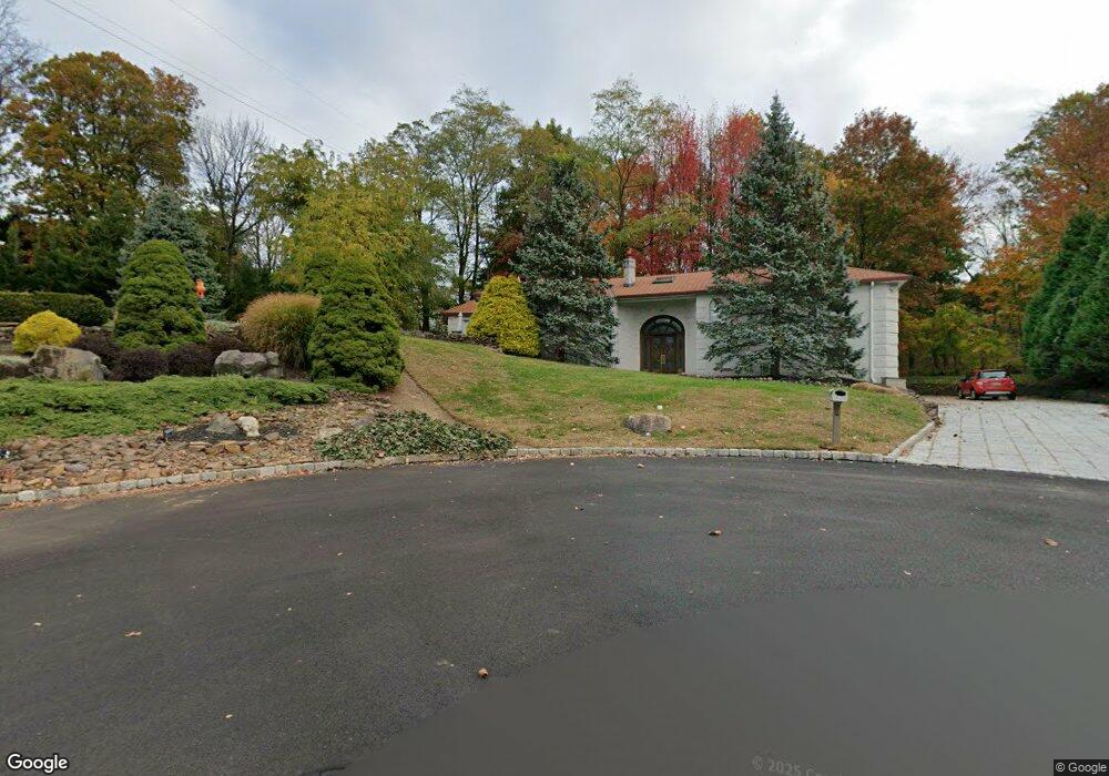
20 Timber Rock Ct Cedar Grove, NJ 07009
Estimated Value: $1,445,000 - $1,528,000
--
Bed
--
Bath
4,242
Sq Ft
$350/Sq Ft
Est. Value
About This Home
This home is located at 20 Timber Rock Ct, Cedar Grove, NJ 07009 and is currently estimated at $1,483,563, approximately $349 per square foot. 20 Timber Rock Ct is a home located in Essex County with nearby schools including Cedar Grove High School, St Catherine Of Siena School, and Monarch Montessori School.
Ownership History
Date
Name
Owned For
Owner Type
Purchase Details
Closed on
Aug 21, 2007
Sold by
Wells Fargo Bank Na
Bought by
Poon Wally and Poon Alice Kit Ying
Current Estimated Value
Home Financials for this Owner
Home Financials are based on the most recent Mortgage that was taken out on this home.
Original Mortgage
$160,500
Outstanding Balance
$102,500
Interest Rate
6.74%
Mortgage Type
Credit Line Revolving
Estimated Equity
$1,381,063
Purchase Details
Closed on
Dec 2, 2004
Sold by
Rabb William
Bought by
Rabb Sharon
Home Financials for this Owner
Home Financials are based on the most recent Mortgage that was taken out on this home.
Original Mortgage
$800,000
Interest Rate
5.69%
Create a Home Valuation Report for This Property
The Home Valuation Report is an in-depth analysis detailing your home's value as well as a comparison with similar homes in the area
Home Values in the Area
Average Home Value in this Area
Purchase History
| Date | Buyer | Sale Price | Title Company |
|---|---|---|---|
| Poon Wally | $770,000 | First American Title Ins Co | |
| Rabb Sharon | $1,000,000 | -- |
Source: Public Records
Mortgage History
| Date | Status | Borrower | Loan Amount |
|---|---|---|---|
| Open | Poon Wally | $160,500 | |
| Open | Poon Wally | $417,000 | |
| Previous Owner | Rabb Sharon | $800,000 |
Source: Public Records
Tax History Compared to Growth
Tax History
| Year | Tax Paid | Tax Assessment Tax Assessment Total Assessment is a certain percentage of the fair market value that is determined by local assessors to be the total taxable value of land and additions on the property. | Land | Improvement |
|---|---|---|---|---|
| 2025 | $27,374 | $1,048,800 | $357,100 | $691,700 |
| 2024 | $27,374 | $1,048,800 | $357,100 | $691,700 |
| 2022 | $26,891 | $1,048,800 | $357,100 | $691,700 |
| 2021 | $26,566 | $1,048,800 | $357,100 | $691,700 |
| 2020 | $26,954 | $1,048,800 | $357,100 | $691,700 |
| 2019 | $26,335 | $1,048,800 | $357,100 | $691,700 |
| 2018 | $25,129 | $1,048,800 | $357,100 | $691,700 |
| 2017 | $24,857 | $1,048,800 | $357,100 | $691,700 |
| 2016 | $24,091 | $1,048,800 | $357,100 | $691,700 |
| 2015 | $23,535 | $1,048,800 | $357,100 | $691,700 |
| 2014 | $23,053 | $1,048,800 | $357,100 | $691,700 |
Source: Public Records
Map
Nearby Homes
- 50 Laura Dr
- 68 Eileen Dr
- 41 Sequoia Dr
- 6 Hillside Ave
- 51 Brookside Terrace
- 38 Deer Trail Rd
- 822 Pompton Ave
- 857 Pompton Ave
- 215 Eileen Dr
- 911 Holly Ln Unit 11
- 911 Holly Ln
- 806 Holly Ln
- 207 Eileen Dr
- 9 Acorn Place
- 531 Mountain Ave
- 82 Little Falls Rd
- 151 Little Falls Rd
- 11 Hillcrest Place
- 265 Little Falls Rd
- 451 Mountain Ave