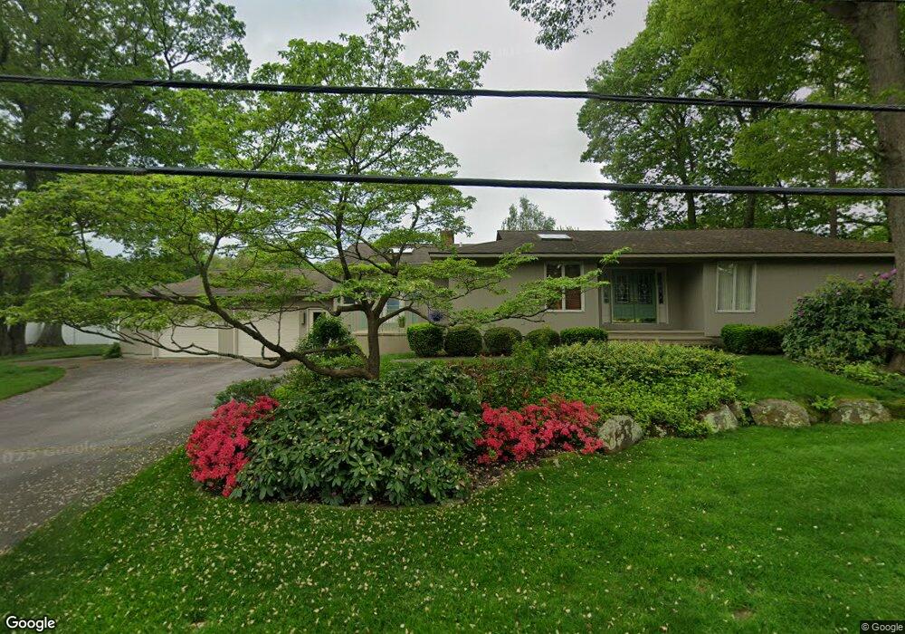
20 Tomahawk Trail Cranston, RI 02921
Western Cranston NeighborhoodEstimated Value: $663,000 - $766,000
3
Beds
3
Baths
2,122
Sq Ft
$338/Sq Ft
Est. Value
About This Home
This home is located at 20 Tomahawk Trail, Cranston, RI 02921 and is currently estimated at $716,860, approximately $337 per square foot. 20 Tomahawk Trail is a home located in Providence County with nearby schools including Orchard Farms El. School, Hope Highlands Middle School, and Cranston High School West.
Ownership History
Date
Name
Owned For
Owner Type
Purchase Details
Closed on
Jul 9, 2012
Sold by
Paolino Michael J and Paolino Barbara
Bought by
Paolino Fmly Income Ir
Current Estimated Value
Create a Home Valuation Report for This Property
The Home Valuation Report is an in-depth analysis detailing your home's value as well as a comparison with similar homes in the area
Home Values in the Area
Average Home Value in this Area
Purchase History
| Date | Buyer | Sale Price | Title Company |
|---|---|---|---|
| Paolino Fmly Income Ir | -- | -- |
Source: Public Records
Mortgage History
| Date | Status | Borrower | Loan Amount |
|---|---|---|---|
| Previous Owner | Paolino Fmly Income Ir | $35,000 | |
| Previous Owner | Paolino Fmly Income Ir | $25,000 | |
| Previous Owner | Paolino Fmly Income Ir | $66,000 |
Source: Public Records
Tax History
| Year | Tax Paid | Tax Assessment Tax Assessment Total Assessment is a certain percentage of the fair market value that is determined by local assessors to be the total taxable value of land and additions on the property. | Land | Improvement |
|---|---|---|---|---|
| 2025 | $7,938 | $571,900 | $141,800 | $430,100 |
| 2024 | $7,784 | $571,900 | $141,800 | $430,100 |
| 2023 | $7,588 | $401,500 | $101,400 | $300,100 |
| 2022 | $7,432 | $401,500 | $101,400 | $300,100 |
| 2021 | $7,227 | $401,500 | $101,400 | $300,100 |
| 2020 | $6,860 | $330,300 | $101,400 | $228,900 |
| 2019 | $6,860 | $330,300 | $101,400 | $228,900 |
| 2018 | $6,702 | $330,300 | $101,400 | $228,900 |
| 2017 | $6,471 | $282,100 | $86,900 | $195,200 |
| 2016 | $6,333 | $282,100 | $86,900 | $195,200 |
| 2015 | $6,333 | $282,100 | $86,900 | $195,200 |
| 2014 | $5,845 | $255,900 | $72,500 | $183,400 |
Source: Public Records
Map
Nearby Homes
- 82 Mohawk Trail
- 0 Anthony Dr Unit 1394338
- 117 Moccasin Trail
- 311 Hope Rd
- 1495 Pippin Orchard Rd
- 1221 Phenix Ave
- 1213 Phenix Ave
- 38 Angela Ave
- 74 Cardinal Rd
- 12 Beechwood Dr
- 7 Gray Coach W Unit 711
- 1100 Phenix Ave
- 02 Paula Ln
- 01 Paula Ln
- 244 Beechwood Dr
- 22 Derby Ln
- 75 Elite Dr
- 71 Elite Dr
- 51 Janet Dr
- 20 Doreen Ct
- 28 Tomahawk Trail
- 23 Canonchet Trail
- 15 Canonchet Trail
- 33 Canonchet Trail
- 35 Tomahawk Trail
- 34 Tomahawk Trail
- 9 Tomahawk Trail
- 41 Canonchet Trail
- 51 Thunder Trail
- 4 Tomahawk
- 5 Tomahawk
- 2 Tomahawk
- 3 Tomahawk
- 24 Canonchet Trail
- 18 Canonchet Trail
- 1 Tomahawk Trail
- 45 Canonchet Trail
- 32 Canonchet Trail
- 10 Canonchet Trail
- 40 Tomahawk Trail
Your Personal Tour Guide
Ask me questions while you tour the home.