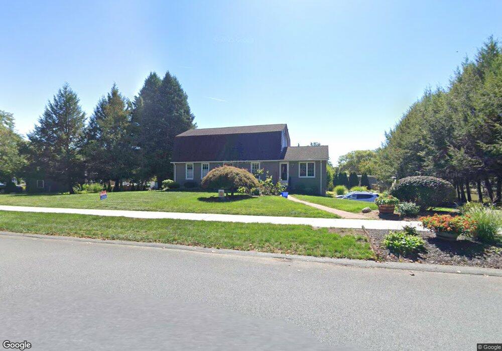
20 Valley View Cir West Springfield, MA 01089
Estimated Value: $437,000 - $555,000
4
Beds
2
Baths
2,084
Sq Ft
$232/Sq Ft
Est. Value
About This Home
This home is located at 20 Valley View Cir, West Springfield, MA 01089 and is currently estimated at $482,913, approximately $231 per square foot. 20 Valley View Cir is a home located in Hampden County with nearby schools including Hampden Charter School of Science West and St Thomas The Apostle School.
Ownership History
Date
Name
Owned For
Owner Type
Purchase Details
Closed on
Jan 5, 2016
Sold by
Morrissey Richard C and Morrissey Pamela A
Bought by
R C&P A Morrissey Irt and Morrissey Richard N
Current Estimated Value
Purchase Details
Closed on
Nov 1, 1983
Bought by
R C & P A Morrissey Irt
Create a Home Valuation Report for This Property
The Home Valuation Report is an in-depth analysis detailing your home's value as well as a comparison with similar homes in the area
Home Values in the Area
Average Home Value in this Area
Purchase History
| Date | Buyer | Sale Price | Title Company |
|---|---|---|---|
| R C&P A Morrissey Irt | -- | -- | |
| R C & P A Morrissey Irt | $86,000 | -- |
Source: Public Records
Mortgage History
| Date | Status | Borrower | Loan Amount |
|---|---|---|---|
| Previous Owner | R C & P A Morrissey Irt | $127,500 | |
| Previous Owner | R C & P A Morrissey Irt | $80,000 | |
| Previous Owner | R C & P A Morrissey Irt | $40,000 |
Source: Public Records
Tax History Compared to Growth
Tax History
| Year | Tax Paid | Tax Assessment Tax Assessment Total Assessment is a certain percentage of the fair market value that is determined by local assessors to be the total taxable value of land and additions on the property. | Land | Improvement |
|---|---|---|---|---|
| 2025 | $5,776 | $388,400 | $138,600 | $249,800 |
| 2024 | $5,514 | $372,300 | $138,600 | $233,700 |
| 2023 | $5,279 | $339,700 | $145,500 | $194,200 |
| 2022 | $4,818 | $305,700 | $132,100 | $173,600 |
| 2021 | $4,837 | $286,200 | $125,200 | $161,000 |
| 2020 | $4,808 | $283,000 | $125,200 | $157,800 |
| 2019 | $4,800 | $283,000 | $125,200 | $157,800 |
| 2018 | $4,825 | $283,000 | $125,200 | $157,800 |
| 2017 | $4,825 | $283,000 | $125,200 | $157,800 |
| 2016 | $4,844 | $285,100 | $120,300 | $164,800 |
| 2015 | $4,752 | $279,700 | $118,000 | $161,700 |
| 2014 | $1,155 | $279,700 | $118,000 | $161,700 |
Source: Public Records
Map
Nearby Homes
- 86 Birnie Ave
- 42 Gregory Ln
- 64 Apple Ridge Rd
- 34 High Meadow Dr
- 43 Wishing Well Way
- 36 Shady Brook
- 283 Forest Glen
- 11 Annie's Way
- 32 Windpath E
- 31 Stone Path Ln
- 59 Clayton Dr
- 80 Brush Hill Ave Unit 28
- 80 Brush Hill Ave Unit 32
- 17 Laurence Dr
- 81 Laurence Dr
- 147 Grandview Ave
- 50 Overlook Dr
- 514 Dewey St
- 61 Clarence St
- 39 Bonnie Brae Dr
- 132 Birnie Ave
- 116 Birnie Ave
- 36 Valley View Cir
- 263 Valley View Cir
- 160 Birnie Ave
- 51 Valley View Cir
- 129 Birnie Ave
- 100 Birnie Ave
- 251 Valley View Cir
- 268 Valley View Cir
- 115 Birnie Ave
- 282 Valley View Cir
- 174 Birnie Ave
- 69 Valley View Cir
- 256 Valley View Cir
- 161 Birnie Ave
- 56 Valley View Cir
- 95 Birnie Ave
- 241 Valley View Cir
- 80 Valley View Cir