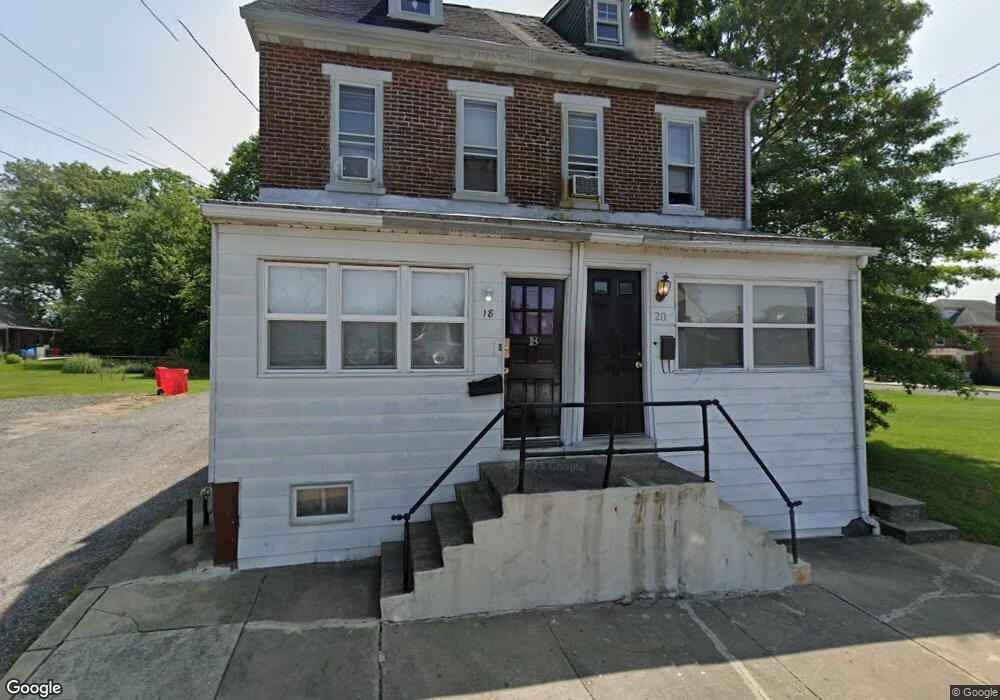
20 W Howard St Pottstown, PA 19464
Estimated Value: $182,602 - $217,000
2
Beds
1
Bath
1,305
Sq Ft
$157/Sq Ft
Est. Value
About This Home
This home is located at 20 W Howard St, Pottstown, PA 19464 and is currently estimated at $204,651, approximately $156 per square foot. 20 W Howard St is a home located in Montgomery County with nearby schools including Lower Pottsgrove Elementary School, Pottsgrove Middle School, and Pottsgrove Senior High School.
Ownership History
Date
Name
Owned For
Owner Type
Purchase Details
Closed on
Feb 21, 2024
Sold by
Hcf Properties Llc
Bought by
Union Propco Llc
Current Estimated Value
Purchase Details
Closed on
Jun 26, 2008
Sold by
Mclaughlin Frank
Bought by
210 Chain Llc
Home Financials for this Owner
Home Financials are based on the most recent Mortgage that was taken out on this home.
Original Mortgage
$175,000
Interest Rate
6.17%
Create a Home Valuation Report for This Property
The Home Valuation Report is an in-depth analysis detailing your home's value as well as a comparison with similar homes in the area
Home Values in the Area
Average Home Value in this Area
Purchase History
| Date | Buyer | Sale Price | Title Company |
|---|---|---|---|
| Union Propco Llc | $250,000 | Alpert Abstract | |
| Union Propco Llc | $250,000 | Alpert Abstract | |
| 210 Chain Llc | $82,000 | None Available |
Source: Public Records
Mortgage History
| Date | Status | Borrower | Loan Amount |
|---|---|---|---|
| Previous Owner | 210 Chain Llc | $175,000 |
Source: Public Records
Tax History Compared to Growth
Tax History
| Year | Tax Paid | Tax Assessment Tax Assessment Total Assessment is a certain percentage of the fair market value that is determined by local assessors to be the total taxable value of land and additions on the property. | Land | Improvement |
|---|---|---|---|---|
| 2025 | $2,291 | $47,700 | -- | -- |
| 2024 | $2,291 | $47,700 | -- | -- |
| 2023 | $2,219 | $47,700 | $0 | $0 |
| 2022 | $2,184 | $47,700 | $0 | $0 |
| 2021 | $2,152 | $47,700 | $0 | $0 |
| 2020 | $2,120 | $47,700 | $0 | $0 |
| 2019 | $2,109 | $47,700 | $0 | $0 |
| 2018 | $2,109 | $47,700 | $0 | $0 |
| 2017 | $2,102 | $47,700 | $0 | $0 |
| 2016 | $2,083 | $65,000 | $36,850 | $28,150 |
| 2015 | $2,741 | $65,000 | $36,850 | $28,150 |
| 2014 | $2,741 | $65,000 | $36,850 | $28,150 |
Source: Public Records
Map
Nearby Homes
- 0 Ash St Unit PAMC2144590
- 536 & 538 W Vine St
- 601 W High St
- 501 and 507 E Race St
- 530 E Howard St
- 703 Holly Dr
- 160 Linden St Unit 69
- 8 Ryan St
- 145 Random Rd
- 25 Random Rd
- 150 Random Rd
- 94 Random Rd
- 86 Westin Rd
- 104 Pulaski St
- 131 Squirrel Hollow Rd
- 356 W Beech St Unit 160
- 39 Westin Rd
- 0 Squirrel Hollow Rd
- 1209 Grosstown Rd
- 377 Circle of Progress Dr