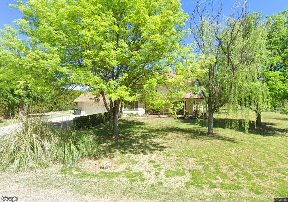
20 W Shill Rd Camp Verde, AZ 86322
Estimated Value: $761,835 - $1,031,000
3
Beds
--
Bath
3,350
Sq Ft
$275/Sq Ft
Est. Value
About This Home
This home is located at 20 W Shill Rd, Camp Verde, AZ 86322 and is currently estimated at $920,959, approximately $274 per square foot. 20 W Shill Rd is a home located in Yavapai County with nearby schools including Camp Verde Elementary School, Camp Verde Middle School, and Camp Verde High School.
Ownership History
Date
Name
Owned For
Owner Type
Purchase Details
Closed on
May 5, 2009
Sold by
Surber Dale L and Surber Janell L
Bought by
Surber Dale L and Surber Janell L
Current Estimated Value
Home Financials for this Owner
Home Financials are based on the most recent Mortgage that was taken out on this home.
Original Mortgage
$259,000
Outstanding Balance
$163,818
Interest Rate
4.87%
Mortgage Type
New Conventional
Estimated Equity
$757,141
Purchase Details
Closed on
Oct 16, 2007
Sold by
Surber Dale L and Surber Janell L
Bought by
Surber Dale L and Surber Janell L
Purchase Details
Closed on
Dec 1, 2003
Sold by
Hall Thomas Roy and Hall Catherine M
Bought by
Surber Dale L and Surber Janell L
Home Financials for this Owner
Home Financials are based on the most recent Mortgage that was taken out on this home.
Original Mortgage
$280,000
Interest Rate
6.04%
Mortgage Type
New Conventional
Create a Home Valuation Report for This Property
The Home Valuation Report is an in-depth analysis detailing your home's value as well as a comparison with similar homes in the area
Home Values in the Area
Average Home Value in this Area
Purchase History
| Date | Buyer | Sale Price | Title Company |
|---|---|---|---|
| Surber Dale L | -- | Accommodation | |
| Surber Dale L | -- | Yavapai Title Agency Inc | |
| Surber Dale L | -- | None Available | |
| Surber Dale L | $350,000 | Transnation Title Ins Co |
Source: Public Records
Mortgage History
| Date | Status | Borrower | Loan Amount |
|---|---|---|---|
| Open | Surber Dale L | $259,000 | |
| Closed | Surber Dale L | $280,000 |
Source: Public Records
Tax History Compared to Growth
Tax History
| Year | Tax Paid | Tax Assessment Tax Assessment Total Assessment is a certain percentage of the fair market value that is determined by local assessors to be the total taxable value of land and additions on the property. | Land | Improvement |
|---|---|---|---|---|
| 2026 | $2,733 | $67,033 | -- | -- |
| 2024 | $2,643 | $68,956 | -- | -- |
| 2023 | $2,643 | $56,303 | $10,264 | $46,039 |
| 2022 | $2,491 | $45,719 | $7,521 | $38,198 |
| 2021 | $2,589 | $42,631 | $7,802 | $34,829 |
| 2020 | $2,498 | $0 | $0 | $0 |
| 2019 | $2,444 | $0 | $0 | $0 |
| 2018 | $2,361 | $0 | $0 | $0 |
| 2017 | $2,237 | $0 | $0 | $0 |
| 2016 | $2,151 | $0 | $0 | $0 |
| 2015 | -- | $0 | $0 | $0 |
| 2014 | -- | $0 | $0 | $0 |
Source: Public Records
Map
Nearby Homes
- 2045 S Hillcrest Dr
- 2095 S Hillcrest Dr
- 2050 S Hillcrest Dr
- 452 E Cole Blvd Unit 17
- 2400 S Kynlee Dr Unit 3
- 1844 S Quarterhorse Ln
- 2444 S Kynlee Dr Unit 2
- 405 E Cole Blvd Unit 8
- 437 E Cole Blvd Unit 7
- 356 E Cole Blvd Unit 15
- 270 E Cole Blvd Unit 13
- 328 E Cole Blvd Unit 14
- 469 E Cole Blvd Unit 6
- 590 E Cole Blvd Unit 18
- 1785 S Fort Apache Rd
- 618 E Cole Blvd Unit 19
- 2876 S Salt Mine Rd
- 646 E Cole Blvd Unit 20
- 2332 S Diamond Creek Ln
- 1846 S Dodge Rd