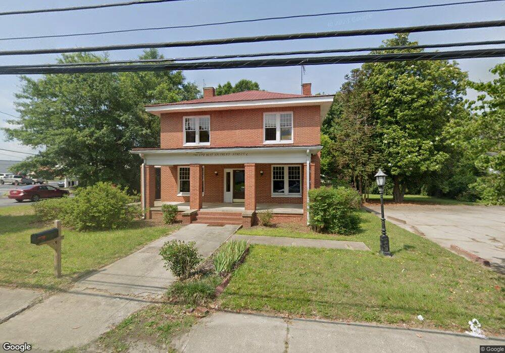
20 W Stephens St Winder, GA 30680
Estimated Value: $332,179
Studio
--
Bath
2,656
Sq Ft
$125/Sq Ft
Est. Value
About This Home
This home is located at 20 W Stephens St, Winder, GA 30680 and is currently estimated at $332,179, approximately $125 per square foot. 20 W Stephens St is a home located in Barrow County with nearby schools including County Line Elementary School, Russell Middle School, and Winder-Barrow High School.
Ownership History
Date
Name
Owned For
Owner Type
Purchase Details
Closed on
May 22, 2023
Sold by
Russell John D
Bought by
Ade 1072 Llc
Current Estimated Value
Purchase Details
Closed on
Aug 4, 2008
Sold by
Mingledorff Currie M
Bought by
Russell John D
Home Financials for this Owner
Home Financials are based on the most recent Mortgage that was taken out on this home.
Original Mortgage
$118,013
Interest Rate
6.43%
Mortgage Type
Commercial
Purchase Details
Closed on
Sep 4, 1992
Bought by
Mingledorff Currie M
Create a Home Valuation Report for This Property
The Home Valuation Report is an in-depth analysis detailing your home's value as well as a comparison with similar homes in the area
Home Values in the Area
Average Home Value in this Area
Purchase History
| Date | Buyer | Sale Price | Title Company |
|---|---|---|---|
| Ade 1072 Llc | $318,000 | -- | |
| Russell John D | $105,500 | -- | |
| Mingledorff Currie M | $143,000 | -- |
Source: Public Records
Mortgage History
| Date | Status | Borrower | Loan Amount |
|---|---|---|---|
| Previous Owner | Russell John D | $118,013 |
Source: Public Records
Tax History
| Year | Tax Paid | Tax Assessment Tax Assessment Total Assessment is a certain percentage of the fair market value that is determined by local assessors to be the total taxable value of land and additions on the property. | Land | Improvement |
|---|---|---|---|---|
| 2025 | $3,375 | $121,088 | $40,800 | $80,288 |
| 2024 | $3,434 | $121,088 | $40,800 | $80,288 |
| 2023 | $3,413 | $121,088 | $40,800 | $80,288 |
| 2022 | $4,138 | $121,088 | $40,800 | $80,288 |
| 2021 | $3,434 | $93,472 | $15,800 | $77,672 |
| 2020 | $3,240 | $93,472 | $15,800 | $77,672 |
| 2019 | $3,285 | $93,472 | $15,800 | $77,672 |
| 2018 | $3,155 | $89,762 | $15,800 | $73,962 |
| 2017 | $2,505 | $83,965 | $15,800 | $68,165 |
| 2016 | $2,477 | $73,471 | $15,800 | $57,671 |
| 2015 | $2,480 | $73,471 | $15,800 | $57,671 |
| 2014 | $2,226 | $65,413 | $7,742 | $57,671 |
| 2013 | -- | $62,867 | $7,742 | $55,125 |
Source: Public Records
Map
Nearby Homes
- 1 W Kimball St
- 3 W Kimball St
- 127 N Center St
- 5 W Kimball St
- 0 Georgia Highway 211 Unit 7483562
- 69 W Stephens St
- 0 W Athens St Unit 10544465
- 168 Park Ave
- 253 3rd Ave
- 160 N Broad St
- 178 Hamilton Ave
- 88 W New St
- 59 W Wright St
- 209 Georgia Ave
- 88 E Stephens St
- 24 Richardson St
- 26 Hosch Cir
- 352 3rd Ave
- 131 Pinehurst Dr
- 236 6th Ave
- W W Stephens St
- 24 W Stephens St
- 17 W Stephens St
- 30 W Stephens St
- 13 W Stephens St
- 102 N Broad St
- 99 Woodlawn Ave
- 25 W Stephens St
- 57 W Stephens St
- 31 W Stephens St
- 110 N Broad St
- 119 Hamilton Ave
- 83 Woodlawn Ave
- 15 W Midland Ave
- 98 Woodlawn Ave
- 104 Woodlawn Ave
- 114 N Broad St
- 96 Woodlawn Ave
- 92 Woodlawn Ave Unit C
- 92 Woodlawn Ave Unit B
Your Personal Tour Guide
Ask me questions while you tour the home.