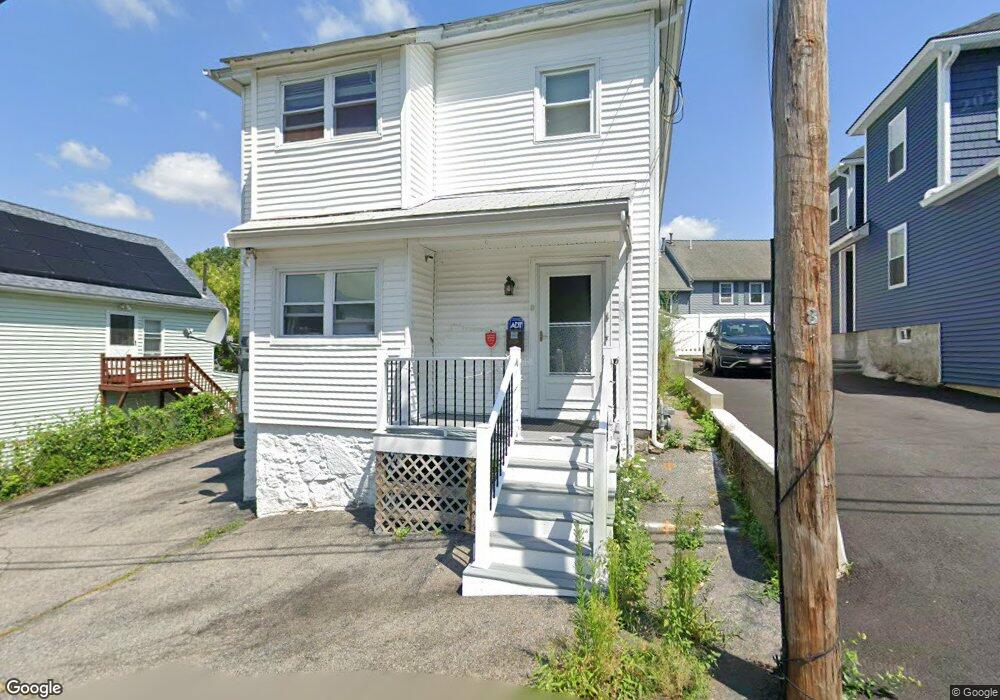
20 Warnock St Lowell, MA 01852
South Lowell NeighborhoodEstimated Value: $528,000 - $832,000
3
Beds
2
Baths
2,376
Sq Ft
$265/Sq Ft
Est. Value
About This Home
This home is located at 20 Warnock St, Lowell, MA 01852 and is currently estimated at $629,258, approximately $264 per square foot. 20 Warnock St is a home located in Middlesex County with nearby schools including Moody Elementary School, Abraham Lincoln Elementary School, and Greenhalge Elementary School.
Ownership History
Date
Name
Owned For
Owner Type
Purchase Details
Closed on
Oct 6, 2022
Sold by
Fam Cm Rt and Miele
Bought by
Miele Frank A and Li Wenjuan
Current Estimated Value
Purchase Details
Closed on
Dec 22, 2017
Sold by
Miele Catherine E
Bought by
Fam-Cm Rt and Miele
Purchase Details
Closed on
May 19, 2017
Sold by
Fam Cm Rt and Miele
Bought by
Miele Catherine E
Purchase Details
Closed on
Feb 29, 2016
Sold by
Miele Frank A
Bought by
Fam Cm Rt and Miele
Purchase Details
Closed on
Jan 25, 2016
Sold by
Miele Catherine E
Bought by
Miele Frank A
Create a Home Valuation Report for This Property
The Home Valuation Report is an in-depth analysis detailing your home's value as well as a comparison with similar homes in the area
Home Values in the Area
Average Home Value in this Area
Purchase History
| Date | Buyer | Sale Price | Title Company |
|---|---|---|---|
| Miele Frank A | -- | None Available | |
| Miele Frank A | -- | None Available | |
| Fam-Cm Rt | -- | -- | |
| Fam-Cm Rt | -- | -- | |
| Miele Catherine E | -- | -- | |
| Miele Catherine E | -- | -- | |
| Fam Cm Rt | -- | -- | |
| Fam Cm Rt | -- | -- | |
| Miele Frank A | -- | -- | |
| Miele Frank A | -- | -- |
Source: Public Records
Mortgage History
| Date | Status | Borrower | Loan Amount |
|---|---|---|---|
| Previous Owner | Miele Frank A | $30,000 | |
| Previous Owner | Miele Frank A | $36,400 | |
| Previous Owner | Miele Frank A | $14,500 |
Source: Public Records
Tax History Compared to Growth
Tax History
| Year | Tax Paid | Tax Assessment Tax Assessment Total Assessment is a certain percentage of the fair market value that is determined by local assessors to be the total taxable value of land and additions on the property. | Land | Improvement |
|---|---|---|---|---|
| 2025 | $5,741 | $500,100 | $133,100 | $367,000 |
| 2024 | $5,601 | $470,300 | $124,400 | $345,900 |
| 2023 | $5,297 | $426,500 | $108,200 | $318,300 |
| 2022 | $5,070 | $399,500 | $98,300 | $301,200 |
| 2021 | $4,735 | $351,800 | $85,500 | $266,300 |
| 2020 | $4,465 | $334,200 | $81,300 | $252,900 |
| 2019 | $4,305 | $306,600 | $75,300 | $231,300 |
| 2018 | $4,093 | $292,400 | $71,700 | $220,700 |
| 2017 | $4,010 | $268,800 | $65,200 | $203,600 |
| 2016 | $3,688 | $243,300 | $56,900 | $186,400 |
| 2015 | $3,551 | $229,400 | $56,900 | $172,500 |
| 2013 | $2,972 | $198,000 | $63,600 | $134,400 |
Source: Public Records
Map
Nearby Homes
- 10 Mission Place
- 45 Woburn St
- 55 Stratham St
- 157 Billerica St
- 25 Juniper St Unit 21
- 79 Eugene St
- 90 Roper St Unit G
- 50 Arnold Ave
- 106 Lundberg St Unit 6
- 197 Moore St
- 357 Boylston St Unit 2
- 5 Lenox St Unit 2
- 21 Bishop St
- 58 Fay St Unit 2
- 64 S Whipple St
- 106 Park Ave W Unit D9
- 29 Crystal St
- 67 Wellington Ave
- 137 Hoyt Ave
- 15 Alton St Unit 10
- 14 Warnock St
- 14 Warnock St Unit B
- 21 Warnock St
- 28 Warnock St
- 28 Warnock St Unit 2
- 15 Warnock St
- 25 Warnock St
- 52 Huntoon Ave Unit 14
- 52 Huntoon Ave Unit 12
- 52 Huntoon Ave Unit 11
- 52 Huntoon Ave Unit 10
- 52 Huntoon Ave Unit 9
- 52 Huntoon Ave Unit 8
- 52 Huntoon Ave Unit 7
- 52 Huntoon Ave Unit 6
- 52 Huntoon Ave Unit 5
- 52 Huntoon Ave Unit 4
- 52 Huntoon Ave Unit 3
- 52 Huntoon Ave Unit 2
- 52 Huntoon Ave Unit 13