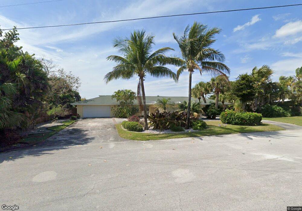
20 West Point Dr Cocoa Beach, FL 32931
Estimated Value: $1,787,000 - $1,941,000
5
Beds
4
Baths
4,065
Sq Ft
$455/Sq Ft
Est. Value
About This Home
This home is located at 20 West Point Dr, Cocoa Beach, FL 32931 and is currently estimated at $1,850,150, approximately $455 per square foot. 20 West Point Dr is a home located in Brevard County with nearby schools including Theodore Roosevelt Elementary School, Cocoa Beach Junior/Senior High School, and Cocoa Beach Christian School.
Ownership History
Date
Name
Owned For
Owner Type
Purchase Details
Closed on
May 26, 2016
Sold by
Stoner Robert B and Stoner Lawrence M
Bought by
Vertolli Frank S and Vertolli Erin L
Current Estimated Value
Home Financials for this Owner
Home Financials are based on the most recent Mortgage that was taken out on this home.
Original Mortgage
$682,000
Outstanding Balance
$543,503
Interest Rate
3.61%
Estimated Equity
$1,306,647
Purchase Details
Closed on
Mar 22, 2007
Sold by
Stoner Lawrence M and Stoner Roberta B
Bought by
Stoner Lawrence M and Stoner Roberta B
Purchase Details
Closed on
Sep 30, 1996
Sold by
Porcher Linda L
Bought by
Stoner Lawrence M and Stoner Roberta B
Home Financials for this Owner
Home Financials are based on the most recent Mortgage that was taken out on this home.
Original Mortgage
$240,000
Interest Rate
8.05%
Purchase Details
Closed on
Mar 10, 1995
Sold by
Porcher Linda L and Porcher Arthur G
Bought by
Porcher Linda L
Create a Home Valuation Report for This Property
The Home Valuation Report is an in-depth analysis detailing your home's value as well as a comparison with similar homes in the area
Home Values in the Area
Average Home Value in this Area
Purchase History
| Date | Buyer | Sale Price | Title Company |
|---|---|---|---|
| Vertolli Frank S | $852,500 | Title Security And Escrow Of | |
| Stoner Lawrence M | -- | Attorney | |
| Stoner Lawrence M | -- | -- | |
| Stoner Lawrence M | $300,000 | -- | |
| Porcher Linda L | -- | -- |
Source: Public Records
Mortgage History
| Date | Status | Borrower | Loan Amount |
|---|---|---|---|
| Open | Vertolli Frank S | $682,000 | |
| Previous Owner | Stoner Lawrence M | $240,000 |
Source: Public Records
Tax History
| Year | Tax Paid | Tax Assessment Tax Assessment Total Assessment is a certain percentage of the fair market value that is determined by local assessors to be the total taxable value of land and additions on the property. | Land | Improvement |
|---|---|---|---|---|
| 2025 | $16,004 | $1,456,040 | -- | -- |
| 2024 | $15,365 | $1,500,070 | -- | -- |
| 2023 | $15,365 | $1,433,850 | -- | -- |
| 2022 | $14,098 | $1,459,610 | $0 | $0 |
| 2021 | $10,858 | $826,300 | $522,500 | $303,800 |
| 2020 | $10,355 | $773,560 | $467,500 | $306,060 |
| 2019 | $10,728 | $783,260 | $467,500 | $315,760 |
| 2018 | $10,551 | $747,300 | $440,000 | $307,300 |
| 2017 | $10,105 | $683,240 | $429,000 | $254,240 |
| 2016 | $9,486 | $608,260 | $368,500 | $239,760 |
| 2015 | $6,042 | $395,090 | $291,500 | $103,590 |
| 2014 | $6,099 | $391,960 | $291,500 | $100,460 |
Source: Public Records
Map
Nearby Homes
- 1790 Bayshore Dr
- 1675 Bayshore Dr
- 1375 Bayshore Dr
- 2 River Falls Dr
- 1299 S Orlando Ave
- 1277 S Orlando Ave Unit 4B
- 1531 S Orlando Ave
- 1305 S Atlantic Ave Unit 110
- 2050 S Atlantic Ave
- 1139 S Brevard Ave
- 1527 S Atlantic Ave Unit 201
- 1563 S Atlantic Ave Unit 13
- 1515 S Atlantic Ave Unit 404
- 24 Olive St
- 1800 S Orlando Ave Unit 1
- 7 Cove View Ct
- 1700 S Atlantic Ave Unit 104
- 1155 S Atlantic Ave Unit 203
- 1000 S Orlando Ave
- 1081 S Atlantic Ave
- 20 W Point Dr
- 19 West Point Dr
- 21 W Point Dr
- 21 W Point Dr Unit 101
- 21 West Point Dr
- 21 West Point Dr Unit 101
- 15 W Point Dr
- 15 West Point Dr
- 18 West Point Dr
- 17 West Point Dr
- 22 W Point Dr
- 14 West Point Dr
- 16 W Point Dr
- 14 W Point Dr
- 22 West Point Dr
- 13 W Point Dr
- 13 West Point Dr
- 1800 Bayshore Dr
- 23 W Point Dr
- 23 West Point Dr
Your Personal Tour Guide
Ask me questions while you tour the home.