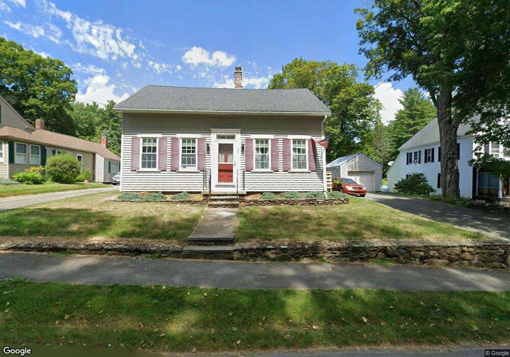
20 West St Petersham, MA 01366
Estimated Value: $326,158 - $576,000
3
Beds
2
Baths
1,656
Sq Ft
$249/Sq Ft
Est. Value
About This Home
This home is located at 20 West St, Petersham, MA 01366 and is currently estimated at $411,540, approximately $248 per square foot. 20 West St is a home located in Worcester County with nearby schools including Petersham Center, Ralph C Mahar Regional School, and Petersham Montessori School.
Ownership History
Date
Name
Owned For
Owner Type
Purchase Details
Closed on
Jan 6, 2011
Sold by
Bartus Richard N and Bartus Michaele L
Bought by
Bartus Tr Anne Marie and Cooley Margaret
Current Estimated Value
Purchase Details
Closed on
Jul 22, 1981
Bought by
Bartus Anne Marie and Cooley Margaret
Create a Home Valuation Report for This Property
The Home Valuation Report is an in-depth analysis detailing your home's value as well as a comparison with similar homes in the area
Home Values in the Area
Average Home Value in this Area
Purchase History
| Date | Buyer | Sale Price | Title Company |
|---|---|---|---|
| Bartus Tr Anne Marie | -- | -- | |
| Bartus Anne Marie | -- | -- |
Source: Public Records
Mortgage History
| Date | Status | Borrower | Loan Amount |
|---|---|---|---|
| Previous Owner | Bartus Anne Marie | $50,000 | |
| Previous Owner | Bartus Anne Marie | $63,000 |
Source: Public Records
Tax History
| Year | Tax Paid | Tax Assessment Tax Assessment Total Assessment is a certain percentage of the fair market value that is determined by local assessors to be the total taxable value of land and additions on the property. | Land | Improvement |
|---|---|---|---|---|
| 2025 | $4,260 | $294,000 | $45,000 | $249,000 |
| 2024 | $3,834 | $268,100 | $45,000 | $223,100 |
| 2023 | $3,329 | $210,800 | $42,900 | $167,900 |
| 2022 | $2,854 | $210,800 | $42,900 | $167,900 |
| 2021 | $3,119 | $203,700 | $38,900 | $164,800 |
| 2020 | $3,234 | $186,200 | $33,700 | $152,500 |
| 2019 | $2,795 | $165,100 | $29,600 | $135,500 |
| 2018 | $2,683 | $163,900 | $28,400 | $135,500 |
| 2017 | $2,671 | $165,000 | $30,900 | $134,100 |
| 2016 | $2,709 | $165,000 | $30,900 | $134,100 |
| 2015 | $2,780 | $163,600 | $30,900 | $132,700 |
| 2014 | $2,606 | $163,600 | $30,900 | $132,700 |
Source: Public Records
Map
Nearby Homes
- 17 S Main St
- 0 Popple Camp Rd Unit 73432026
- 22 Old Hardwick Rd
- 0 Nichewaug Rd
- 47 Harty Dr
- 32 Edward Ln
- 21 Varney Ln
- 31 Edward Ln
- 37 Gauthier Rd
- 20 Dana Rd
- 550 Old Dana Rd
- 420 Queen Lake Rd
- 1082 Old Dana Rd
- 225 Queen Lake Rd
- 0 Riceville Rd Unit 73429842
- 321 Doe Valley Rd
- 1000 West St
- 156 Vaughn Rd
- 14 Jackson Ln
- 40 Jackson Ln
Your Personal Tour Guide
Ask me questions while you tour the home.