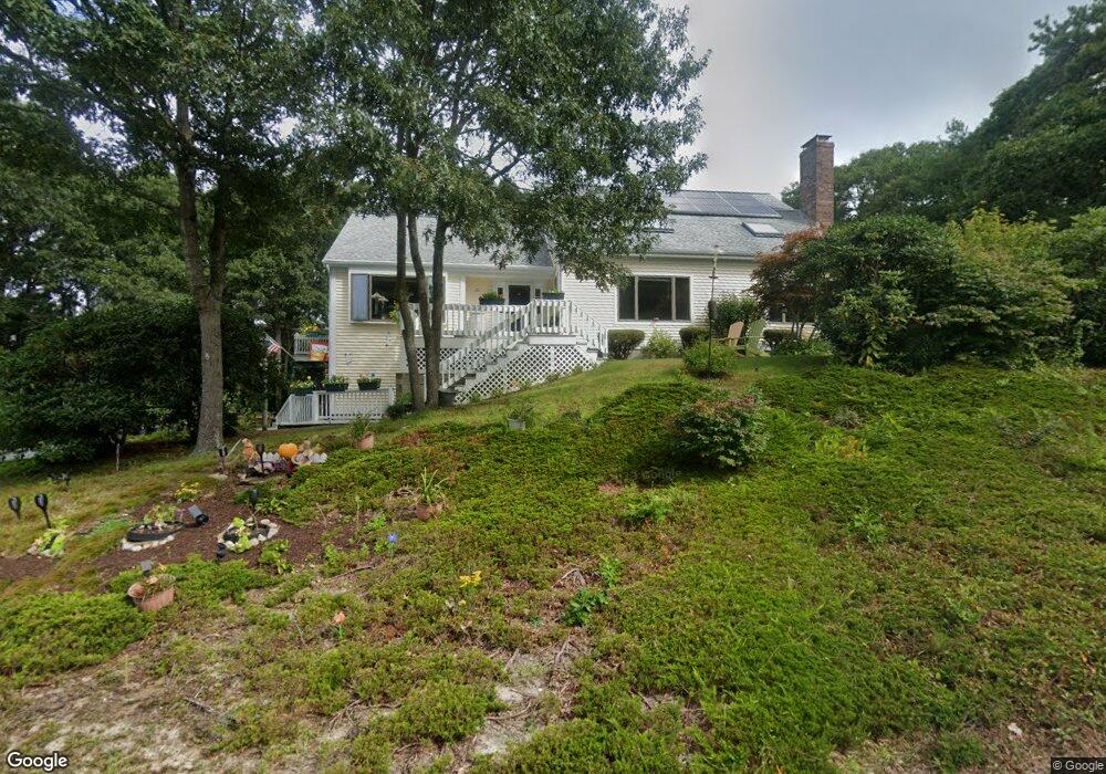
20 Westerly Dr Bourne, MA 2532
Monument Beach NeighborhoodEstimated Value: $670,758 - $836,000
3
Beds
3
Baths
2,083
Sq Ft
$364/Sq Ft
Est. Value
About This Home
This home is located at 20 Westerly Dr, Bourne, MA 2532 and is currently estimated at $759,190, approximately $364 per square foot. 20 Westerly Dr is a home located in Barnstable County with nearby schools including Bourne High School, St Margaret Regional School, and Cadence Academy Preschool - Bourne.
Ownership History
Date
Name
Owned For
Owner Type
Purchase Details
Closed on
May 10, 2016
Sold by
Carchidi Rebecca and Allegrezza Michelle
Bought by
Flanders Cynthia L and Shorey Edward R
Current Estimated Value
Home Financials for this Owner
Home Financials are based on the most recent Mortgage that was taken out on this home.
Original Mortgage
$200,000
Outstanding Balance
$154,794
Interest Rate
3%
Mortgage Type
Adjustable Rate Mortgage/ARM
Estimated Equity
$604,396
Purchase Details
Closed on
Nov 10, 2010
Sold by
Szady Ann T
Bought by
Carchidi Rebecca and Fontecchio Cynthia
Purchase Details
Closed on
Mar 21, 1994
Sold by
Wespi George E and Wespi Ruth
Bought by
Szady Ann T
Home Financials for this Owner
Home Financials are based on the most recent Mortgage that was taken out on this home.
Original Mortgage
$25,000
Interest Rate
6.9%
Mortgage Type
Purchase Money Mortgage
Create a Home Valuation Report for This Property
The Home Valuation Report is an in-depth analysis detailing your home's value as well as a comparison with similar homes in the area
Home Values in the Area
Average Home Value in this Area
Purchase History
| Date | Buyer | Sale Price | Title Company |
|---|---|---|---|
| Flanders Cynthia L | $380,000 | -- | |
| Flanders Cynthia L | $380,000 | -- | |
| Carchidi Rebecca | -- | -- | |
| Carchidi Rebecca | -- | -- | |
| Szady Ann T | $174,900 | -- | |
| Szady Ann T | $174,900 | -- |
Source: Public Records
Mortgage History
| Date | Status | Borrower | Loan Amount |
|---|---|---|---|
| Open | Flanders Cynthia L | $200,000 | |
| Closed | Flanders Cynthia L | $200,000 | |
| Previous Owner | Szady Ann T | $25,000 |
Source: Public Records
Tax History
| Year | Tax Paid | Tax Assessment Tax Assessment Total Assessment is a certain percentage of the fair market value that is determined by local assessors to be the total taxable value of land and additions on the property. | Land | Improvement |
|---|---|---|---|---|
| 2025 | $4,731 | $605,800 | $195,000 | $410,800 |
| 2024 | $4,626 | $576,800 | $185,700 | $391,100 |
| 2023 | $4,498 | $510,500 | $164,400 | $346,100 |
| 2022 | $4,276 | $423,800 | $145,500 | $278,300 |
| 2021 | $4,155 | $385,800 | $132,400 | $253,400 |
| 2020 | $4,024 | $374,700 | $131,100 | $243,600 |
| 2019 | $3,794 | $361,000 | $131,100 | $229,900 |
| 2018 | $3,624 | $343,800 | $124,900 | $218,900 |
| 2017 | $3,916 | $380,200 | $117,500 | $262,700 |
| 2016 | $3,472 | $341,700 | $117,500 | $224,200 |
| 2015 | $3,251 | $322,800 | $105,200 | $217,600 |
Source: Public Records
Map
Nearby Homes
- 4 Harbor Hill Dr
- 16 Amberwood Ct
- 20 Colony Ave
- 12 Turnberry Rd Unit 12
- 4 Hollyhock Knoll Ct Unit 4
- 4 Hollyhock Knoll Ct Unit 4
- 203 County Rd
- 5 Sea Knoll Ct
- 13 Laurel Hill Ct
- 5 Zoli Ln
- 44 Cotuit Rd
- 10 Sandy Ln
- 566 Shore Rd
- 60 Sandwich Rd
- 3 1st St
- 709 County Rd
- 7 4th Ave
- 3 4th Ave
- 3 Honora Ln Unit 3
- 38 Old Bridge Rd
- 20 Westerly Dr
- 18 Westerly Dr
- 18 Westerly Dr
- 19 Westerly Dr
- 47 Harbor Hill Dr
- 46 Harbor Hill Dr
- 45 Harbor Hill Dr
- 44 Harbor Hill Dr
- 43 Harbor Hill Dr
- 43 Harbor Hill Dr Unit 9
- 45 Harbor Hill Dr Unit 45
- 45 Harbor Hill Dr
- 44 Harbor Hill Dr
- 43 Harbor Hill Dr
- 42 Harbor Hill Dr
- 41 Harbor Hill Dr
- 40 Harbor Hill Dr
- 39 Harbor Hill Dr
- 42 Harbor Hill Dr
- 41 Harbor Hill Dr
Your Personal Tour Guide
Ask me questions while you tour the home.