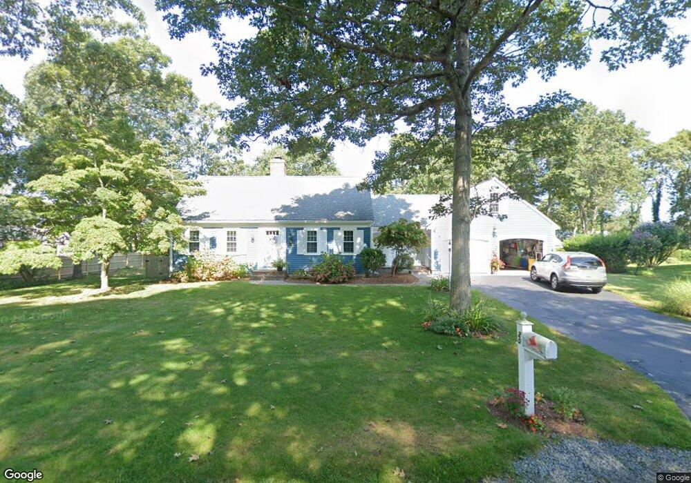
20 Whippoorwill Ln Yarmouth Port, MA 02675
Yarmouth Port NeighborhoodEstimated Value: $833,848 - $1,059,000
3
Beds
2
Baths
2,027
Sq Ft
$453/Sq Ft
Est. Value
About This Home
This home is located at 20 Whippoorwill Ln, Yarmouth Port, MA 02675 and is currently estimated at $918,712, approximately $453 per square foot. 20 Whippoorwill Ln is a home located in Barnstable County with nearby schools including Dennis-Yarmouth Regional High School.
Ownership History
Date
Name
Owned For
Owner Type
Purchase Details
Closed on
Jan 16, 2007
Sold by
Clark Andrew H
Bought by
Kerr Gayle E and Kerr Thomas G
Current Estimated Value
Home Financials for this Owner
Home Financials are based on the most recent Mortgage that was taken out on this home.
Original Mortgage
$372,000
Interest Rate
6.18%
Mortgage Type
Purchase Money Mortgage
Purchase Details
Closed on
Apr 12, 1999
Sold by
Clark Matthew D and Clark Sandra D
Bought by
Clark Keith
Purchase Details
Closed on
Dec 4, 1998
Sold by
Clark Matthew D and Clark Sandra D
Bought by
Clark Keith
Purchase Details
Closed on
Sep 4, 1992
Sold by
Hobbie William F and Hobbie Frances R
Bought by
Clark Matthew D and Clark Sandra D
Purchase Details
Closed on
Dec 9, 1988
Sold by
Seaman Edmund F
Bought by
Hobbie William F
Create a Home Valuation Report for This Property
The Home Valuation Report is an in-depth analysis detailing your home's value as well as a comparison with similar homes in the area
Home Values in the Area
Average Home Value in this Area
Purchase History
| Date | Buyer | Sale Price | Title Company |
|---|---|---|---|
| Kerr Gayle E | $465,000 | -- | |
| Clark Keith | $180,000 | -- | |
| Clark Keith | $200,000 | -- | |
| Clark Matthew D | $180,000 | -- | |
| Hobbie William F | $217,500 | -- |
Source: Public Records
Mortgage History
| Date | Status | Borrower | Loan Amount |
|---|---|---|---|
| Open | Hobbie William F | $417,000 | |
| Closed | Hobbie William F | $23,000 | |
| Closed | Kerr Gayle E | $372,000 | |
| Closed | Kerr Gayle E | $69,750 |
Source: Public Records
Tax History Compared to Growth
Tax History
| Year | Tax Paid | Tax Assessment Tax Assessment Total Assessment is a certain percentage of the fair market value that is determined by local assessors to be the total taxable value of land and additions on the property. | Land | Improvement |
|---|---|---|---|---|
| 2025 | $5,852 | $826,500 | $229,500 | $597,000 |
| 2024 | $5,426 | $735,200 | $199,600 | $535,600 |
| 2023 | $5,492 | $677,200 | $188,200 | $489,000 |
| 2022 | $5,351 | $582,900 | $213,700 | $369,200 |
| 2021 | $5,182 | $542,100 | $204,000 | $338,100 |
| 2020 | $5,010 | $501,000 | $203,600 | $297,400 |
| 2019 | $4,698 | $465,100 | $203,600 | $261,500 |
| 2018 | $4,692 | $456,000 | $194,500 | $261,500 |
| 2017 | $4,532 | $452,300 | $194,500 | $257,800 |
| 2016 | $4,514 | $452,300 | $194,500 | $257,800 |
| 2015 | $4,389 | $437,200 | $194,500 | $242,700 |
Source: Public Records
Map
Nearby Homes
- 30 W Woods
- 30 W Woods Cir Unit 30
- 2 Pine Grove
- 7 Forest Gate Unit 7
- 23 Dauphine Dr
- 25 Oak Glen Village Unit 25
- 25 Oak Glen
- 50 John Hall Cartway
- 50 John Hall Cartway Unit 50
- 42 John Hall Cartway Unit 42
- 228 Kates Path
- 17 Kates Path Unit A
- 49 Rodoalph's Way
- 4 Spadoni Way
- 4 Spadoni Rd
- 34 Kates Path
- 34 Kates Path Unit 34
- 64 Kates Path
- 24 Minnetuxet Way
- 43 Canterbury Rd
- 2 Shell Dr
- 11 Windswept Path
- 26 Whippoorwill Ln
- 17 Windswept Path
- 1 Windswept Path
- 15 Whippoorwill Ln
- 23 Whippoorwill Ln
- 32 Whippoorwill Ln
- 7 Whippoorwill Ln
- 23 Windswept Path
- 7 Shell Dr
- 2 Pheasant Cove Cir
- 8 Windswept Path
- 2 Whippoorwill Ln
- 9 Pheasant Cove Cir
- 125 Homers Dock Rd
- 15 Shell Dr
- 2 Windswept Path
- 8 Pheasant Cove Cir
- 1 Whippoorwill Ln