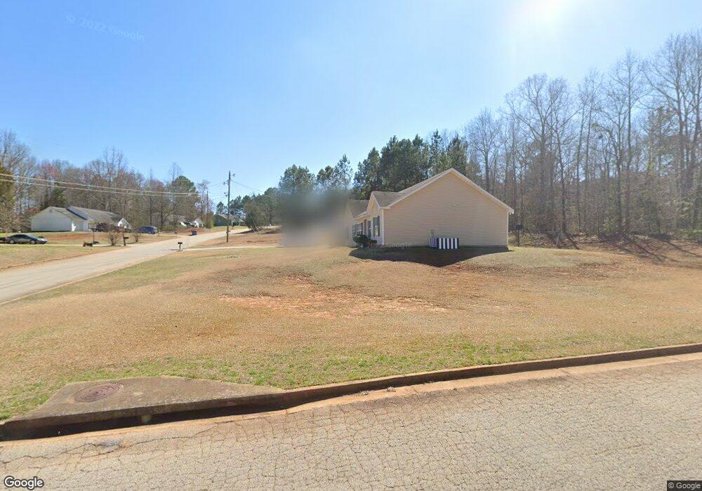
20 Whitehead Ct Covington, GA 30016
Estimated Value: $209,000 - $246,000
Studio
2
Baths
1,389
Sq Ft
$166/Sq Ft
Est. Value
About This Home
This home is located at 20 Whitehead Ct, Covington, GA 30016 and is currently estimated at $230,217, approximately $165 per square foot. 20 Whitehead Ct is a home located in Newton County with nearby schools including Livingston Elementary School, Liberty Middle School, and Alcovy High School.
Ownership History
Date
Name
Owned For
Owner Type
Purchase Details
Closed on
May 4, 2023
Sold by
Griswold Nancy
Bought by
Mangum Nancy and Mangum Tony L
Current Estimated Value
Purchase Details
Closed on
Dec 20, 2000
Sold by
Hinds Susan
Bought by
Griswold Nancy
Home Financials for this Owner
Home Financials are based on the most recent Mortgage that was taken out on this home.
Original Mortgage
$90,953
Interest Rate
7.65%
Mortgage Type
FHA
Purchase Details
Closed on
Oct 29, 1999
Sold by
Ech Homes Inc
Bought by
Hinds Susan
Home Financials for this Owner
Home Financials are based on the most recent Mortgage that was taken out on this home.
Original Mortgage
$84,100
Interest Rate
7.85%
Mortgage Type
FHA
Create a Home Valuation Report for This Property
The Home Valuation Report is an in-depth analysis detailing your home's value as well as a comparison with similar homes in the area
Home Values in the Area
Average Home Value in this Area
Purchase History
| Date | Buyer | Sale Price | Title Company |
|---|---|---|---|
| Mangum Nancy | -- | -- | |
| Griswold Nancy | $91,000 | -- | |
| Hinds Susan | $84,900 | -- |
Source: Public Records
Mortgage History
| Date | Status | Borrower | Loan Amount |
|---|---|---|---|
| Previous Owner | Griswold Nancy | $90,953 | |
| Previous Owner | Hinds Susan | $84,100 |
Source: Public Records
Tax History
| Year | Tax Paid | Tax Assessment Tax Assessment Total Assessment is a certain percentage of the fair market value that is determined by local assessors to be the total taxable value of land and additions on the property. | Land | Improvement |
|---|---|---|---|---|
| 2025 | $2,210 | $91,160 | $12,800 | $78,360 |
| 2024 | $2,234 | $90,240 | $12,800 | $77,440 |
| 2023 | $2,145 | $81,240 | $4,400 | $76,840 |
| 2022 | $1,789 | $68,120 | $4,400 | $63,720 |
| 2021 | $1,662 | $57,200 | $4,400 | $52,800 |
| 2020 | $1,182 | $37,760 | $6,400 | $31,360 |
| 2019 | $1,191 | $37,520 | $6,400 | $31,120 |
| 2018 | $970 | $30,880 | $5,000 | $25,880 |
| 2017 | $863 | $27,760 | $3,800 | $23,960 |
| 2016 | $863 | $27,760 | $3,800 | $23,960 |
| 2015 | $806 | $26,080 | $2,000 | $24,080 |
| 2014 | $669 | $22,120 | $0 | $0 |
Source: Public Records
Map
Nearby Homes
- 90 Harville Rd
- 120 Harville Rd
- 240 Harville Rd
- 220 Harville Rd
- 674 Lower River Rd
- 125 Shelby Oaks Trail
- 0 Spring Hill Dr Unit 7725409
- 0 Spring Hill Dr Unit 10699182
- 0 River Shoals Ct Unit 10620666
- 711 Highway 162
- 25 Shady Oaks Trail
- 115 Mountainview Dr
- 0 White Laurel Ln Unit 16
- 20 Mountainview Ct Unit 2
- 0 Tempie Ln
- 195 Twin Lakes Dr
- 185 Mountain Ridge
- 10 Barberry Cir
- 0 Roseberry Rd
- 55 Twin Lakes Dr
- 30 Whitehead Ct
- 10 Whitehead Ct
- 15 Whitehead Ct
- 25 Whitehead Ct
- 40 Whitehead Ct
- 215 Whitehead Dr
- 35 Whitehead Ct
- 175 Whitehead Dr
- 45 Whitehead Ct
- 50 Whitehead Ct
- 200 Whitehead Dr
- 220 Whitehead Dr
- 55 Whitehead Ct
- 180 Whitehead Dr
- 2005 Mote Rd
- 165 Whitehead Dr
- 210 Whitehead Dr
- 95 Whitehead Dr
- 105 Whitehead Dr
- 105 Whitehead Dr
Your Personal Tour Guide
Ask me questions while you tour the home.