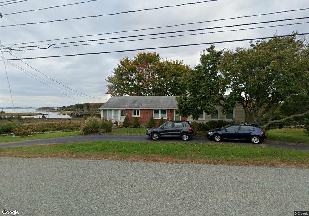
20 Wilcox Rd Unit first floor Stonington, CT 06378
Mystic NeighborhoodEstimated Value: $530,000 - $835,000
3
Beds
1
Bath
1,358
Sq Ft
$532/Sq Ft
Est. Value
About This Home
This home is located at 20 Wilcox Rd Unit first floor, Stonington, CT 06378 and is currently estimated at $722,062, approximately $531 per square foot. 20 Wilcox Rd Unit first floor is a home located in New London County with nearby schools including Stonington Middle School, Stonington High School, and Pine Point School.
Ownership History
Date
Name
Owned For
Owner Type
Purchase Details
Closed on
Feb 10, 2025
Sold by
Tmc Keywest Llc
Bought by
Thompson Erik E
Current Estimated Value
Home Financials for this Owner
Home Financials are based on the most recent Mortgage that was taken out on this home.
Original Mortgage
$441,000
Outstanding Balance
$438,379
Interest Rate
6.91%
Mortgage Type
Stand Alone Refi Refinance Of Original Loan
Estimated Equity
$283,683
Purchase Details
Closed on
Oct 31, 2014
Sold by
Anne L Lamb T L and Anne Lamb
Bought by
Rooney Timothy C
Home Financials for this Owner
Home Financials are based on the most recent Mortgage that was taken out on this home.
Original Mortgage
$385,650
Interest Rate
4.21%
Create a Home Valuation Report for This Property
The Home Valuation Report is an in-depth analysis detailing your home's value as well as a comparison with similar homes in the area
Home Values in the Area
Average Home Value in this Area
Purchase History
| Date | Buyer | Sale Price | Title Company |
|---|---|---|---|
| Thompson Erik E | -- | None Available | |
| Thompson Erik E | -- | None Available | |
| Rooney Timothy C | $428,500 | -- | |
| Rooney Timothy C | $428,500 | -- |
Source: Public Records
Mortgage History
| Date | Status | Borrower | Loan Amount |
|---|---|---|---|
| Open | Thompson Erik E | $441,000 | |
| Closed | Thompson Erik E | $441,000 | |
| Previous Owner | Rooney Timothy C | $86,877 | |
| Previous Owner | Rooney Timothy C | $385,650 |
Source: Public Records
Tax History Compared to Growth
Tax History
| Year | Tax Paid | Tax Assessment Tax Assessment Total Assessment is a certain percentage of the fair market value that is determined by local assessors to be the total taxable value of land and additions on the property. | Land | Improvement |
|---|---|---|---|---|
| 2025 | $9,273 | $478,500 | $293,000 | $185,500 |
| 2024 | $8,900 | $478,500 | $293,000 | $185,500 |
| 2023 | $8,852 | $478,500 | $293,000 | $185,500 |
| 2022 | $8,502 | $341,300 | $244,200 | $97,100 |
| 2021 | $8,567 | $341,300 | $244,200 | $97,100 |
| 2020 | $8,367 | $340,000 | $244,200 | $95,800 |
| 2019 | $8,330 | $338,500 | $244,200 | $94,300 |
| 2018 | $8,007 | $336,000 | $244,200 | $91,800 |
| 2017 | $9,881 | $411,200 | $327,000 | $84,200 |
| 2016 | $9,606 | $411,200 | $327,000 | $84,200 |
| 2015 | $9,157 | $411,200 | $327,000 | $84,200 |
| 2014 | $8,730 | $411,200 | $327,000 | $84,200 |
Source: Public Records
Map
Nearby Homes
- 17 Old Stonington Rd
- 20 Lambs Way
- 30 Cove Rd
- 6 Rogers Dr
- 8 Joyce St
- 39 Gledhill Ave
- 0 Smail St Unit 24066473
- 9 Kingfisher Way
- 6 Kingfisher Way
- 17 Langworthy Ave
- 44 Williams Ave
- 50 Ashworth Ave
- 8 Osprey Ln
- 71 Wolcott Ave
- 16 Montauk Ave
- 1 Egret Rd
- 75 Montauk Ave
- 17 Roosevelt Ave
- 4 E Neck Rd
- 59 Montauk Ave