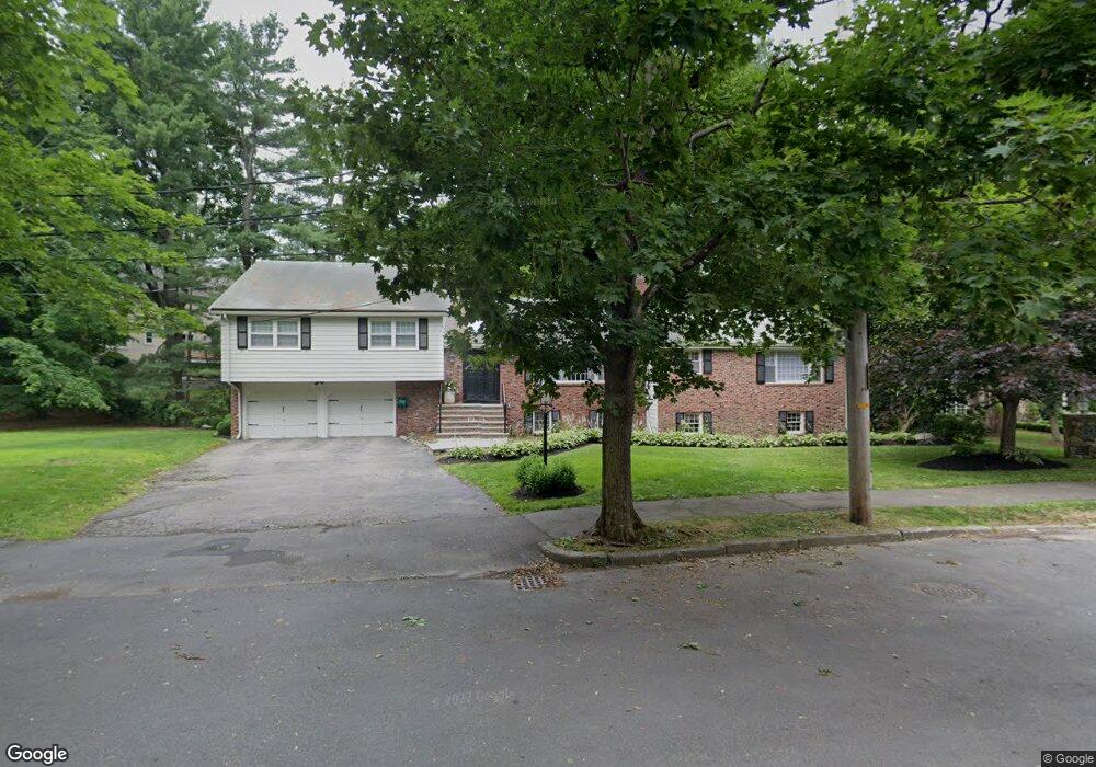
20 Winston Rd Newton Center, MA 02459
Oak Hill NeighborhoodEstimated Value: $1,881,000 - $2,349,000
4
Beds
4
Baths
2,395
Sq Ft
$898/Sq Ft
Est. Value
About This Home
This home is located at 20 Winston Rd, Newton Center, MA 02459 and is currently estimated at $2,149,998, approximately $897 per square foot. 20 Winston Rd is a home located in Middlesex County with nearby schools including Memorial Spaulding Elementary School, Charles E Brown Middle School, and Oak Hill Middle School.
Ownership History
Date
Name
Owned For
Owner Type
Purchase Details
Closed on
Apr 13, 2016
Sold by
Goodstein Mark K and Goodstein Sherri F
Bought by
Goodstein Sherri F
Current Estimated Value
Purchase Details
Closed on
Aug 30, 1996
Sold by
Kessler Robert R and Kessler Bette A
Bought by
Goodstein Mark K and Goodstein Sherri F
Home Financials for this Owner
Home Financials are based on the most recent Mortgage that was taken out on this home.
Original Mortgage
$100,000
Interest Rate
8.18%
Create a Home Valuation Report for This Property
The Home Valuation Report is an in-depth analysis detailing your home's value as well as a comparison with similar homes in the area
Home Values in the Area
Average Home Value in this Area
Purchase History
| Date | Buyer | Sale Price | Title Company |
|---|---|---|---|
| Goodstein Sherri F | -- | -- | |
| Goodstein Mark K | $560,000 | -- |
Source: Public Records
Mortgage History
| Date | Status | Borrower | Loan Amount |
|---|---|---|---|
| Previous Owner | Goodstein Mark K | $140,000 | |
| Previous Owner | Goodstein Mark K | $100,000 | |
| Previous Owner | Goodstein Mark K | $267,487 | |
| Previous Owner | Goodstein Mark K | $185,000 |
Source: Public Records
Tax History Compared to Growth
Tax History
| Year | Tax Paid | Tax Assessment Tax Assessment Total Assessment is a certain percentage of the fair market value that is determined by local assessors to be the total taxable value of land and additions on the property. | Land | Improvement |
|---|---|---|---|---|
| 2025 | $18,550 | $1,892,900 | $1,194,800 | $698,100 |
| 2024 | $17,937 | $1,837,800 | $1,160,000 | $677,800 |
| 2023 | $16,974 | $1,667,400 | $913,000 | $754,400 |
| 2022 | $16,242 | $1,543,900 | $845,400 | $698,500 |
| 2021 | $15,672 | $1,456,500 | $797,500 | $659,000 |
| 2020 | $14,532 | $1,392,000 | $797,500 | $594,500 |
| 2019 | $14,123 | $1,351,500 | $774,300 | $577,200 |
| 2018 | $13,705 | $1,266,600 | $702,300 | $564,300 |
| 2017 | $13,287 | $1,194,900 | $662,500 | $532,400 |
| 2016 | $12,708 | $1,116,700 | $619,200 | $497,500 |
| 2015 | $12,116 | $1,043,600 | $578,700 | $464,900 |
Source: Public Records
Map
Nearby Homes
- 65 Levbert Rd
- 45 Brandeis Rd
- 58 Country Club Rd
- 59 Deborah Rd
- 41 Juniper Ln
- 56 Cynthia Rd
- 35 Haynes Rd
- 135 Hartman Rd
- 136 Dudley Rd
- 85 Dudley Rd
- 19 Selwyn Rd
- 63 Drumlin Rd
- 21 Philbrick Rd
- 415 Dedham St Unit D
- 36 Cannon St
- 99 Baldpate Hill Rd
- 15 Buff Cir
- 250 Woodcliff Rd
- 79 Florence St Unit 600S
- 79 Florence St Unit 402S
- 83 Littlefield Rd
- 28 Winston Rd
- 75 Littlefield Rd
- 91 Littlefield Rd
- 30 Winston Rd
- 15 Winston Rd
- 99 Littlefield Rd
- 99 Littlefield Rd
- 38 Winston Rd
- 70 Burdean Rd
- 59 Littlefield Rd
- 84 Littlefield Rd
- 76 Littlefield Rd
- 92 Littlefield Rd
- 62 Littlefield Rd
- 60 Burdean Rd
- 68 Littlefield Rd
- 46 Winston Rd
- 100 Littlefield Rd
- 53 Littlefield Rd