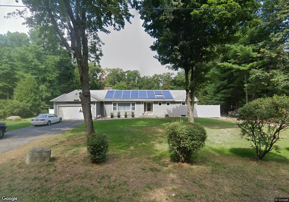
20 Woodside Cir Simsbury, CT 06070
Estimated Value: $421,000 - $508,000
3
Beds
4
Baths
1,842
Sq Ft
$252/Sq Ft
Est. Value
About This Home
This home is located at 20 Woodside Cir, Simsbury, CT 06070 and is currently estimated at $463,503, approximately $251 per square foot. 20 Woodside Cir is a home located in Hartford County with nearby schools including Central School, Henry James Memorial School, and Simsbury High School.
Ownership History
Date
Name
Owned For
Owner Type
Purchase Details
Closed on
Dec 28, 2017
Sold by
Gauvain David L
Bought by
Gauvain Thomas D and Gauvain Karen B
Current Estimated Value
Create a Home Valuation Report for This Property
The Home Valuation Report is an in-depth analysis detailing your home's value as well as a comparison with similar homes in the area
Home Values in the Area
Average Home Value in this Area
Purchase History
| Date | Buyer | Sale Price | Title Company |
|---|---|---|---|
| Gauvain Thomas D | -- | -- | |
| Gauvain Thomas D | -- | -- |
Source: Public Records
Mortgage History
| Date | Status | Borrower | Loan Amount |
|---|---|---|---|
| Previous Owner | Gauvain Thomas D | $200,000 |
Source: Public Records
Tax History Compared to Growth
Tax History
| Year | Tax Paid | Tax Assessment Tax Assessment Total Assessment is a certain percentage of the fair market value that is determined by local assessors to be the total taxable value of land and additions on the property. | Land | Improvement |
|---|---|---|---|---|
| 2025 | $8,066 | $236,110 | $74,900 | $161,210 |
| 2024 | $7,865 | $236,110 | $74,900 | $161,210 |
| 2023 | $7,513 | $236,110 | $74,900 | $161,210 |
| 2022 | $6,975 | $180,560 | $79,370 | $101,190 |
| 2021 | $6,975 | $180,560 | $79,370 | $101,190 |
| 2020 | $6,697 | $180,560 | $79,370 | $101,190 |
| 2019 | $6,738 | $180,560 | $79,370 | $101,190 |
| 2018 | $6,787 | $180,560 | $79,370 | $101,190 |
| 2017 | $6,701 | $172,890 | $79,380 | $93,510 |
| 2016 | $6,418 | $172,890 | $79,380 | $93,510 |
| 2015 | $6,418 | $172,890 | $79,380 | $93,510 |
| 2014 | $6,421 | $172,890 | $79,390 | $93,500 |
Source: Public Records
Map
Nearby Homes
- 16 Stratton Forest Way
- 5 Fox Den Rd
- 18 Meadowlark Rd
- 3 Stebbins Brook Ln
- 4 Stebbins Brook Ln
- 40 Firetown Rd Unit 39
- 1 West St Unit 206
- 15 Sand Hill Rd
- 48 Library Ln Unit 48
- 141 Firetown Rd
- 308 Hopmeadow St
- 302 Bushy Hill Rd
- 301 Bushy Hill Rd
- 10 Sachems Trail
- 25 Barry Ln
- 8 Quorn Hunt Rd
- 26 Red Stone Dr
- 3 Minister Brook Dr
- 9 Cobtail Way
- 15 Pinnacle Mountain Rd