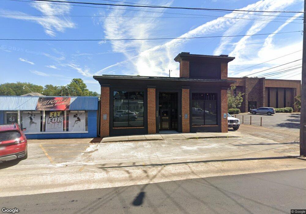
200 Andrew Jackson Way NE Huntsville, AL 35801
Five Points NeighborhoodEstimated Value: $714,197
--
Bed
1
Bath
3,396
Sq Ft
$210/Sq Ft
Est. Value
About This Home
This home is located at 200 Andrew Jackson Way NE, Huntsville, AL 35801 and is currently estimated at $714,197, approximately $210 per square foot. 200 Andrew Jackson Way NE is a home located in Madison County with nearby schools including Blossomwood Elementary School, Huntsville Junior High School, and Huntsville High School.
Ownership History
Date
Name
Owned For
Owner Type
Purchase Details
Closed on
Dec 6, 2019
Sold by
Garrett Family Properties Llc
Bought by
Miller Justin Ray and Miller Rebecca Erin
Current Estimated Value
Purchase Details
Closed on
Oct 25, 2013
Sold by
Stevens Kelly V and Gavitt Alison Stevens
Bought by
University Office Center Llc
Purchase Details
Closed on
Oct 31, 2008
Sold by
Dow Llc
Bought by
Garrett Family Properties Llc
Home Financials for this Owner
Home Financials are based on the most recent Mortgage that was taken out on this home.
Original Mortgage
$300,000
Interest Rate
6.11%
Mortgage Type
Future Advance Clause Open End Mortgage
Create a Home Valuation Report for This Property
The Home Valuation Report is an in-depth analysis detailing your home's value as well as a comparison with similar homes in the area
Home Values in the Area
Average Home Value in this Area
Purchase History
| Date | Buyer | Sale Price | Title Company |
|---|---|---|---|
| Miller Justin Ray | $470,000 | Jacob Title Llc | |
| University Office Center Llc | $100,000 | None Available | |
| Garrett Family Properties Llc | -- | -- |
Source: Public Records
Mortgage History
| Date | Status | Borrower | Loan Amount |
|---|---|---|---|
| Previous Owner | Garrett Family Properties Llc | $300,000 |
Source: Public Records
Tax History Compared to Growth
Tax History
| Year | Tax Paid | Tax Assessment Tax Assessment Total Assessment is a certain percentage of the fair market value that is determined by local assessors to be the total taxable value of land and additions on the property. | Land | Improvement |
|---|---|---|---|---|
| 2025 | $4,247 | $73,220 | $13,460 | $59,760 |
| 2024 | $4,247 | $73,220 | $13,460 | $59,760 |
| 2023 | $4,247 | $73,220 | $13,460 | $59,760 |
| 2022 | $3,772 | $65,040 | $13,460 | $51,580 |
| 2021 | $3,772 | $65,040 | $13,460 | $51,580 |
| 2020 | $2,596 | $44,760 | $13,460 | $31,300 |
| 2019 | $2,368 | $40,820 | $9,140 | $31,680 |
| 2018 | $2,301 | $39,680 | $0 | $0 |
| 2017 | $2,301 | $39,680 | $0 | $0 |
| 2016 | $2,301 | $39,680 | $0 | $0 |
| 2015 | $2,301 | $39,680 | $0 | $0 |
| 2014 | $2,268 | $39,100 | $0 | $0 |
Source: Public Records
Map
Nearby Homes
- 205 Dement St NE
- 721 Randolph Ave SE
- 610 3B Randolph Ave Unit 3B
- 610 3A Randolph Ave Unit 3A
- 610 1D Randolph Ave Unit 1D
- 610 2B Randolph Ave Unit 2B
- 610 2C Randolph Ave Unit 2C
- 610 3C Randolph Ave Unit 3C
- 1723 Ward Ave NE
- 610 1A Randolph Ave Unit 1A
- 717 Eustis Ave SE
- 500 Beirne Ave NE
- 508 Schiffman St NE
- 707 Mccullough Ave NE
- 803 Mccullough Ave NE
- 223 Ward Ave NE
- 417 Mccullough Ave NE
- 705 Eustis Ave SE
- 606 Schiffman St NE
- 214 Beirne Ave NE
- 201 Dement St NE
- 203 Dement St NE
- 719 Clinton Ave E
- 717 Clinton Ave E
- 805 Wellman Ave NE
- 715 Clinton Ave E
- 715 School St NE
- 813 Wellman Ave NE
- 713 School St NE
- 713 Clinton Ave E
- 720 Clinton Ave E
- 901 Clinton Ave E
- 720 Holmes Ave NE
- 718 Clinton Ave E
- 902 Wellman Ave NE
- 711 Clinton Ave E
- 800 Clinton Ave E
- 718 Holmes Ave NE
- 711 School St NE
- 716 Clinton Ave E