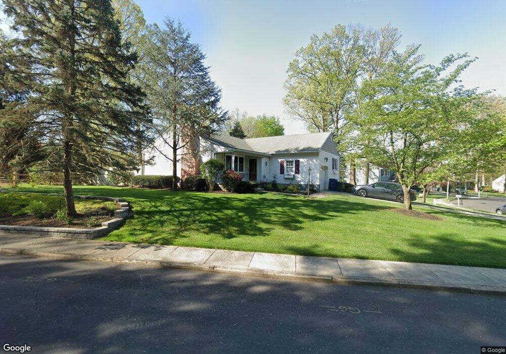
200 Andrews Ave Moorestown, NJ 08057
Estimated Value: $440,199 - $601,000
3
Beds
2
Baths
1,567
Sq Ft
$331/Sq Ft
Est. Value
About This Home
This home is located at 200 Andrews Ave, Moorestown, NJ 08057 and is currently estimated at $518,050, approximately $330 per square foot. 200 Andrews Ave is a home located in Burlington County with nearby schools including Mary E. Roberts Elementary School, Moorestown Upper Elementary School, and William Allen Middle School.
Ownership History
Date
Name
Owned For
Owner Type
Purchase Details
Closed on
Dec 16, 2009
Sold by
Victor Pides
Bought by
Victor Jeanne M
Current Estimated Value
Home Financials for this Owner
Home Financials are based on the most recent Mortgage that was taken out on this home.
Original Mortgage
$264,000
Outstanding Balance
$171,055
Interest Rate
4.85%
Mortgage Type
New Conventional
Estimated Equity
$346,995
Purchase Details
Closed on
Jun 25, 1999
Sold by
Cymbor John P and Hall Robert H
Bought by
Murphy Timothy P
Home Financials for this Owner
Home Financials are based on the most recent Mortgage that was taken out on this home.
Original Mortgage
$156,275
Interest Rate
7.39%
Purchase Details
Closed on
Apr 2, 1996
Sold by
Hall Robert H
Bought by
Hall Robert H and Cymbor John P
Create a Home Valuation Report for This Property
The Home Valuation Report is an in-depth analysis detailing your home's value as well as a comparison with similar homes in the area
Home Values in the Area
Average Home Value in this Area
Purchase History
| Date | Buyer | Sale Price | Title Company |
|---|---|---|---|
| Victor Jeanne M | -- | Stewart Title Guaranty Co | |
| Victor Jeanne M | $330,000 | Stewart Title Guaranty Co | |
| Murphy Timothy P | $164,500 | Congress Title Corp | |
| Hall Robert H | -- | Surety Title Corporation |
Source: Public Records
Mortgage History
| Date | Status | Borrower | Loan Amount |
|---|---|---|---|
| Open | Victor Jeanne M | $264,000 | |
| Previous Owner | Murphy Timothy P | $156,275 |
Source: Public Records
Tax History Compared to Growth
Tax History
| Year | Tax Paid | Tax Assessment Tax Assessment Total Assessment is a certain percentage of the fair market value that is determined by local assessors to be the total taxable value of land and additions on the property. | Land | Improvement |
|---|---|---|---|---|
| 2025 | $6,181 | $216,200 | $65,500 | $150,700 |
| 2024 | $5,995 | $216,200 | $65,500 | $150,700 |
| 2023 | $5,995 | $216,200 | $65,500 | $150,700 |
| 2022 | $5,965 | $216,200 | $65,500 | $150,700 |
| 2021 | $5,889 | $216,200 | $65,500 | $150,700 |
| 2020 | $5,850 | $216,200 | $65,500 | $150,700 |
| 2019 | $5,744 | $216,200 | $65,500 | $150,700 |
| 2018 | $5,576 | $216,200 | $65,500 | $150,700 |
| 2017 | $5,613 | $216,200 | $65,500 | $150,700 |
| 2016 | $5,587 | $216,200 | $65,500 | $150,700 |
| 2015 | $5,513 | $216,200 | $65,500 | $150,700 |
| 2014 | $5,243 | $216,200 | $65,500 | $150,700 |
Source: Public Records
Map
Nearby Homes
- 124 E Wilson Ave
- 7 Errickson Ave
- 709 Manor Terrace
- 801 E Camden Ave
- 5 Domenica Dr
- 14 Vincent Way
- 206 E Camden Ave
- 519 N Lincoln Ave
- 106 Pine St
- 531 Covington Terrace
- 112 Beacon St
- 99 Grant Ave
- 114 Grant Ave
- 423 Park Blvd
- 316 Farmdale Rd
- 31 S Boulevard Ave
- 403 S Lenola Rd
- 313 Fairview Ave
- 702 E Main St
- 15 S Pine Ave
- 202 Andrews Ave
- 229 New Albany Rd
- 227 New Albany Rd
- 204 Andrews Ave
- 205 Andrews Ave
- 215 New Albany Rd
- 213 New Albany Rd
- 206 Andrews Ave
- 210 Winstead Ave
- 207 Andrews Ave
- 211 New Albany Rd
- 208 Andrews Ave
- 209 New Albany Rd
- 302 New Albany Rd
- 208 Winstead Ave
- 230 New Albany Rd
- 224 New Albany Rd
- 209 Andrews Ave
- 207 New Albany Rd
- 318 Andrews Ln