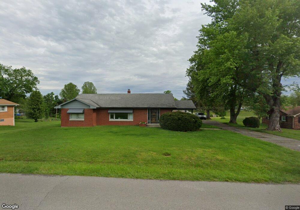
200 Ashton Dr Corydon, IN 47112
Estimated Value: $207,000 - $230,000
3
Beds
2
Baths
1,540
Sq Ft
$143/Sq Ft
Est. Value
About This Home
This home is located at 200 Ashton Dr, Corydon, IN 47112 and is currently estimated at $220,491, approximately $143 per square foot. 200 Ashton Dr is a home located in Harrison County with nearby schools including Corydon Elementary School, Corydon Intermediate School, and Corydon Central Junior High School.
Ownership History
Date
Name
Owned For
Owner Type
Purchase Details
Closed on
Jun 22, 2021
Sold by
Hauswald Beverly M
Bought by
Newton Susan P
Current Estimated Value
Home Financials for this Owner
Home Financials are based on the most recent Mortgage that was taken out on this home.
Interest Rate
2.93%
Purchase Details
Closed on
Jul 2, 2015
Sold by
Beverly M Hauswald
Bought by
Paul R Hauswald
Purchase Details
Closed on
Jun 3, 2015
Sold by
Melcom
Bought by
Hauswald and Beverly Trust
Create a Home Valuation Report for This Property
The Home Valuation Report is an in-depth analysis detailing your home's value as well as a comparison with similar homes in the area
Home Values in the Area
Average Home Value in this Area
Purchase History
| Date | Buyer | Sale Price | Title Company |
|---|---|---|---|
| Newton Susan P | $123,700 | -- | |
| Paul R Hauswald | $80,000 | Dillman, Chastain, Byrd, Llc | |
| Hauswald | -- | Dillman, Chastain, Byrd, Llc |
Source: Public Records
Mortgage History
| Date | Status | Borrower | Loan Amount |
|---|---|---|---|
| Closed | Newton Susan P | -- |
Source: Public Records
Tax History Compared to Growth
Tax History
| Year | Tax Paid | Tax Assessment Tax Assessment Total Assessment is a certain percentage of the fair market value that is determined by local assessors to be the total taxable value of land and additions on the property. | Land | Improvement |
|---|---|---|---|---|
| 2024 | $1,356 | $175,700 | $44,300 | $131,400 |
| 2023 | $1,306 | $171,100 | $43,400 | $127,700 |
| 2022 | $1,209 | $153,200 | $28,900 | $124,300 |
| 2021 | $1,160 | $142,700 | $28,900 | $113,800 |
| 2020 | $2,661 | $136,900 | $23,100 | $113,800 |
| 2019 | $2,756 | $137,800 | $23,100 | $114,700 |
| 2018 | $2,728 | $136,500 | $23,100 | $113,400 |
| 2017 | $2,675 | $135,800 | $23,100 | $112,700 |
| 2016 | $2,401 | $134,600 | $23,100 | $111,500 |
| 2014 | $2,283 | $135,000 | $23,100 | $111,900 |
| 2013 | $2,283 | $140,400 | $23,100 | $117,300 |
Source: Public Records
Map
Nearby Homes
- 0 N Highway 337 NE
- 0 N Highway 337
- 23 Indiana 337
- 104 Cook St
- 0 Atwood St Unit 2025012067
- 300 N Maple St
- 524 N Capitol Ave
- 601 Farquar Ave
- 609 Farquar Ave
- 807 Woodland Ave
- 0 Country Club Estates Dr SE
- 813 Woodland Ave
- 0 Muirfield Dr SE Unit Lot 39 2025010484
- 0 Muirfield Dr SE Unit Lot 38 2025010482
- 1335 Grace St NE
- 1475 Willow Creek Dr NE
- 895 Brigetta Dr NE
- 0 Creekstone St Unit MFRO6344197
- 1201 Owans Ln NE
- 1235 Highway 62 NW
- 180 Ashton Dr
- 224 Ashton Dr
- 219 S Harrison Dr
- 199 Ashton Dr
- 179 Ashton Dr
- 229 Ashton Dr
- 60 N Highway 337
- 159 Ashton Dr
- 100 N Highway 337
- 120 N Highway 337
- 221 S Harrison Dr
- 198 Williams St
- 218 Williams St
- 40 N Highway 337
- 190 Williams St
- 105 N Highway 337
- 150 N Highway 337
- 110 E Loweth Ave
- 30 S Highway 337
- 174 Williams St