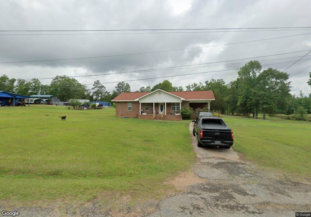
200 Aubrey Mays Rd Forsyth, GA 31029
Estimated Value: $201,974 - $279,000
2
Beds
2
Baths
1,314
Sq Ft
$189/Sq Ft
Est. Value
About This Home
This home is located at 200 Aubrey Mays Rd, Forsyth, GA 31029 and is currently estimated at $247,994, approximately $188 per square foot. 200 Aubrey Mays Rd is a home located in Monroe County with nearby schools including Samuel E. Hubbard Elementary School, Mary Persons High School, and Lighthouse Academy.
Ownership History
Date
Name
Owned For
Owner Type
Purchase Details
Closed on
May 1, 2014
Sold by
Mays Willie B
Bought by
Mays Willie B
Current Estimated Value
Purchase Details
Closed on
Feb 10, 2012
Sold by
Mays Charles
Bought by
Mays Willie B
Purchase Details
Closed on
Jul 21, 1989
Sold by
Mays Aubrey and Mays Lillie S
Bought by
Mays Lillie Mae Smith
Purchase Details
Closed on
Sep 16, 1975
Sold by
Mays Julia A Etal
Bought by
Mays Aubrey and Mays Lillie S
Create a Home Valuation Report for This Property
The Home Valuation Report is an in-depth analysis detailing your home's value as well as a comparison with similar homes in the area
Home Values in the Area
Average Home Value in this Area
Purchase History
| Date | Buyer | Sale Price | Title Company |
|---|---|---|---|
| Mays Willie B | -- | -- | |
| Mays Willie B | -- | -- | |
| Mays Lillie Mae Smith | -- | -- | |
| Mays Aubrey | -- | -- |
Source: Public Records
Tax History Compared to Growth
Tax History
| Year | Tax Paid | Tax Assessment Tax Assessment Total Assessment is a certain percentage of the fair market value that is determined by local assessors to be the total taxable value of land and additions on the property. | Land | Improvement |
|---|---|---|---|---|
| 2024 | $922 | $44,752 | $4,120 | $40,632 |
| 2023 | $227 | $38,032 | $4,120 | $33,912 |
| 2022 | $705 | $38,032 | $4,120 | $33,912 |
| 2021 | $730 | $38,032 | $4,120 | $33,912 |
| 2020 | $748 | $38,032 | $4,120 | $33,912 |
| 2019 | $754 | $38,032 | $4,120 | $33,912 |
| 2018 | $1,105 | $38,032 | $4,120 | $33,912 |
| 2017 | $1,105 | $38,032 | $4,120 | $33,912 |
| 2016 | $1,051 | $38,032 | $4,120 | $33,912 |
| 2015 | $996 | $38,032 | $4,120 | $33,912 |
| 2014 | $961 | $38,032 | $4,120 | $33,912 |
Source: Public Records
Map
Nearby Homes
- 3138 Collier Rd
- 0 Zellner Rd Unit 10572316
- 0 Zellner Rd Unit 180679
- 325 Parks Rd
- 301 Parks Rd
- 507 W Main St
- 397 Ensign Rd
- 84 Hillsdale Rd
- 81 Langston Ave
- 394 Brookwood Dr
- 333 W Main St
- 47 Ensign Rd
- 263 Martin Luther King jr Dr
- 3474 Old Atlanta Hwy
- 120 Willis Wilder Dr
- 60 Dew Place
- 200 Indian Springs Dr
- 299 Willis Wilder Dr
- 225 N Indian Springs Dr
- 289 Willis Wilder Dr
- 180 Aubrey Mays Rd
- 203 Aubrey Mays Rd
- 135 Aubrey Mays Rd
- 148 Aubrey Mays Rd
- 1981 Us Highway 41
- 1985 Us Highway 41
- 0 Highway 41 Tract 9
- 2309 Old Atlanta Hwy
- 8 Old Atlanta Hwy
- 0 Highway 41 N Tract 10
- 2337 Old Atlanta Hwy
- 2334 Old Atlanta Hwy
- 2455 Old Atlanta Hwy
- 2461 Old Atlanta Hwy
- 2537 Old Atlanta Hwy
- 2473 Old Atlanta Hwy
- 2553 Old Atlanta Hwy
- 2525 Highway 41 S
- 2532 Old Atlanta Hwy
- 41 N Old Atlanta Highway at Vaughn Rd