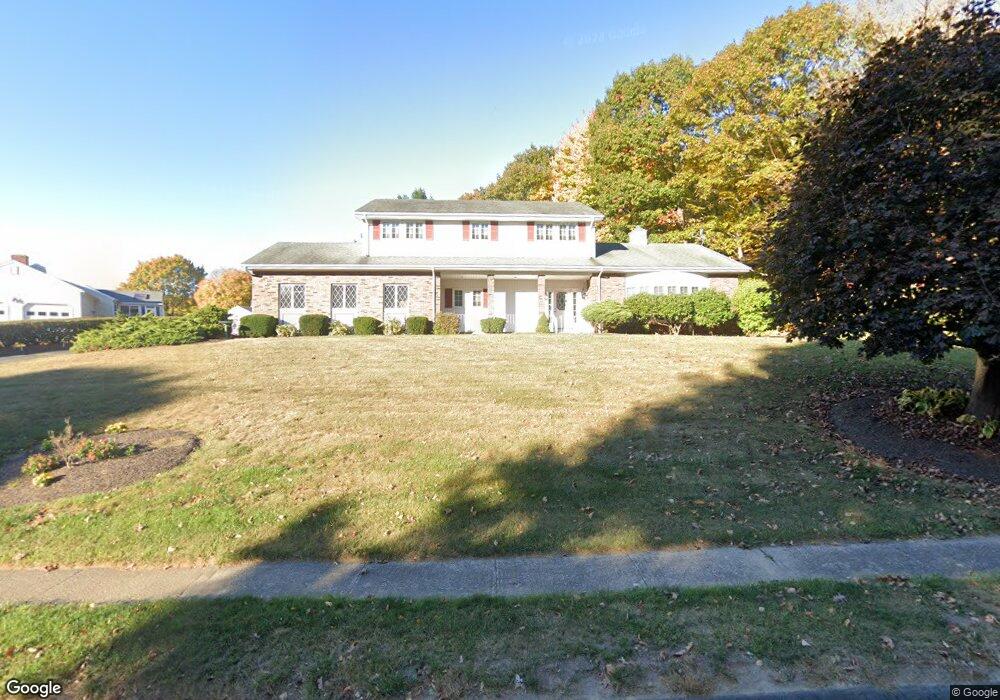
200 Baldwin Dr Bristol, CT 06010
North Bristol NeighborhoodEstimated Value: $514,492 - $621,000
4
Beds
3
Baths
2,566
Sq Ft
$220/Sq Ft
Est. Value
About This Home
This home is located at 200 Baldwin Dr, Bristol, CT 06010 and is currently estimated at $564,373, approximately $219 per square foot. 200 Baldwin Dr is a home located in Hartford County with nearby schools including West Bristol Sch, Bristol Central High School, and St. Joseph School.
Ownership History
Date
Name
Owned For
Owner Type
Purchase Details
Closed on
Jul 22, 2002
Sold by
Barlas George and Barlas Anne
Bought by
Reid Lester C
Current Estimated Value
Purchase Details
Closed on
May 3, 2002
Sold by
Nelson Dev Llc
Bought by
Barlas George and Barlas Anne
Create a Home Valuation Report for This Property
The Home Valuation Report is an in-depth analysis detailing your home's value as well as a comparison with similar homes in the area
Home Values in the Area
Average Home Value in this Area
Purchase History
| Date | Buyer | Sale Price | Title Company |
|---|---|---|---|
| Reid Lester C | $280,000 | -- | |
| Barlas George | $61,000 | -- |
Source: Public Records
Mortgage History
| Date | Status | Borrower | Loan Amount |
|---|---|---|---|
| Open | Barlas George | $68,691 | |
| Open | Barlas George | $1,975,000 |
Source: Public Records
Tax History
| Year | Tax Paid | Tax Assessment Tax Assessment Total Assessment is a certain percentage of the fair market value that is determined by local assessors to be the total taxable value of land and additions on the property. | Land | Improvement |
|---|---|---|---|---|
| 2025 | $9,750 | $288,890 | $49,700 | $239,190 |
| 2024 | $9,337 | $293,160 | $49,700 | $243,460 |
| 2023 | $8,897 | $293,160 | $49,700 | $243,460 |
| 2022 | $8,011 | $208,880 | $38,850 | $170,030 |
| 2021 | $8,011 | $208,880 | $38,850 | $170,030 |
| 2020 | $8,011 | $208,880 | $38,850 | $170,030 |
| 2019 | $7,948 | $208,880 | $38,850 | $170,030 |
| 2018 | $7,703 | $208,880 | $38,850 | $170,030 |
| 2017 | $7,206 | $199,990 | $52,850 | $147,140 |
| 2016 | $7,206 | $199,990 | $52,850 | $147,140 |
| 2015 | $6,922 | $199,990 | $52,850 | $147,140 |
| 2014 | $6,922 | $199,990 | $52,850 | $147,140 |
Source: Public Records
Map
Nearby Homes
- 351 Glendale Dr
- 62 (Lot 13-1) James P Casey Rd
- 0 Hart St Unit 170255530
- 114 El Toro Dr
- 83 Robin St
- 32 Lardner Rd
- 380 Burlington Ave
- 88 N Pond St
- 454 Maple Ave
- 439 James P Casey Rd
- 205 Perkins St
- 395 Fern Hill Rd
- 35 James P Casey Rd
- 276 Hart St
- 127 Curtiss St
- 354 Maple Ave
- 40 Matthews St Unit 30
- 41 Pardee St
- 6 Sand Hill Rd
- 0 Fairlawn St